
Canso in Guysborough County, Nova Scotia — The Atlantic Provinces (North America)
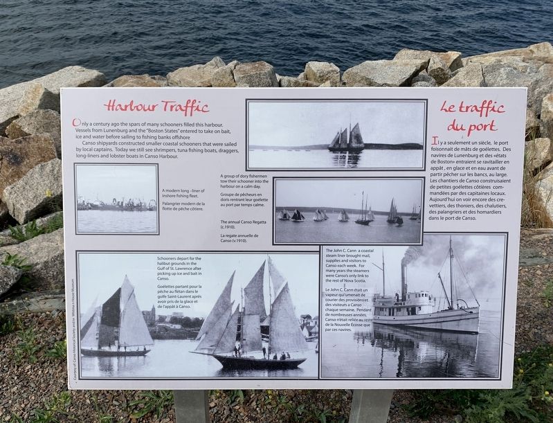
Harbour Traffic/Le traffic du port
Photographed by Steve Stoessel, August 25, 2019
1. Harbour Traffic/Le traffic du port Marker
Canso shipyards constructed smaller coastal schooners that were sailed by local captains. Today we see still shrimpers, tuna fishing boats, draggers, long-liners and lobster boats in Canso Harbour.
this page online
Topics. This historical marker is listed in this topic list: Waterways & Vessels.
Location. 45° 20.259′ N, 60° 59.68′ W. Marker is in Canso, Nova Scotia, in Guysborough County. It can be reached from Water Street. Touch for map. Marker is in this post office area: Canso NS B0H 1H0, Canada. Touch for directions.

Regionally, this marker is on the marine drive. It is also in the Maritimes and in Atlantic Canada. Globally, it is in the North Atlantic Region, North America, the Western Hemisphere, the Western World, and the Anglosphere. Historically, it finds itself in what was once a British colony, the Viceroyalty of New France, and Acadia.
Other nearby markers. At least 8 other markers are within 19 kilometers of this marker, measured as the crow flies: Welcome to Canso Harbour/Bienvenue au Port de Canso (a few steps from this marker); Where Fishermen Meet / Lieu de rencontre des pêcheurs (about 90 meters away, measured in a direct line); The Canso Islands/ Les îles Canso (about 150 meters away); We Heard the News First/Nous étions les premiers à avoir les nouvelles (about 150 meters away); Canso (approx. 0.3 kilometers away); In Memory of Tusker 914 En mémoire de (approx. 0.4 kilometers away); Canso Soldiers Memorial (approx. 0.8 kilometers away); Folklore & Trivia (approx. 18.7 kilometers away). Touch for a list and map of all markers in Canso.
Credits. This page was last revised on October 7, 2019. It was originally submitted on October 3, 2019, by Steve Stoessel of Niskayuna, New York. This page has been viewed 247 times since then and 20 times this year. Photo 1. submitted on October 3, 2019, by Steve Stoessel of Niskayuna, New York. • Andrew Ruppenstein was the editor who published this page.
