St. Mary's City in St. Mary's County, Maryland — The American Northeast (Mid-Atlantic)
Welcome to St. John's
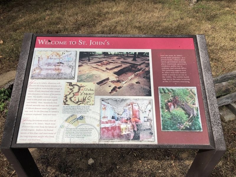
Surviving documents reveal a few of the stories of St. John's. Much more evidence has come from the labors of archaeologists. Explore the buried secrets of this place and meet some of the long-forgotten people who lived, worked, and died here.
[Captions:]
Exploring St. John's required many different skills. Historians, archaeologists, architectural historians, artifact specialists, and others contributed to understanding this site. The project became a model of interdisciplinary research into early American life.
The above detail is from a map of the Chesapeake region drawn in 1670 by Augustine Herrman. A visitor to the site, Herrman noted its location with the name and a symbol for the house.
Throughout the museum are exhibits that will help you understand how archaeology, historical documents, and oral traditions deciphered the role of St. John's played in the drama of Maryland's beginnings.
[Aside:]
Over the years, St. John's served many purposes—as a private home, tobacco plantation, government meeting place, courtroom, governor's residence, public inn or ordinary, and records office. This painting suggests how St. John's may have looked while it served as an inn in the 1680s. The exhibit buildings are in the same locations as the 17th-century structures.
Erected by Historic
this page online
Topics. This historical marker is listed in these topic lists: Colonial Era • Industry & Commerce • Settlements & Settlers. A significant historical year for this entry is 1638.
Location. 38° 11.386′ N, 76° 25.701′ W. Marker is in St. Mary's City, Maryland, in St. Mary's County. It is on Margeret Brent Way 0.1 miles west of Mathias De Sousa Drive, on the left when traveling west. Touch for map. Marker is at or near this postal address: 47645 Margaret Brent Way, Saint Marys City MD 20686, United States of America. Touch for directions.

Regionally, this marker is in Southern Maryland. It is also in the American South, specifically in the Upper South, in the Mid-Atlantic, in the Tidewater, in the Chesapeake Bay Region, and on the Eastern Seaboard. Globally, it is in the North Atlantic Region, North America, the Western Hemisphere, the Western World, and the Anglosphere. Historically, it finds itself in what was once one of the original Thirteen Colonies and also the Antebellum South.
Other nearby markers. At least 8 other markers are within walking distance of this marker: Entrance to St. John's Museum
Credits. This page was last revised on October 5, 2019. It was originally submitted on October 5, 2019, by Devry Becker Jones of Washington, District of Columbia. This page has been viewed 300 times since then and 20 times this year. Photos: 1, 2. submitted on October 5, 2019, by Devry Becker Jones of Washington, District of Columbia.
