Cumberland Township near Gettysburg in Adams County, Pennsylvania — The American Northeast (Mid-Atlantic)
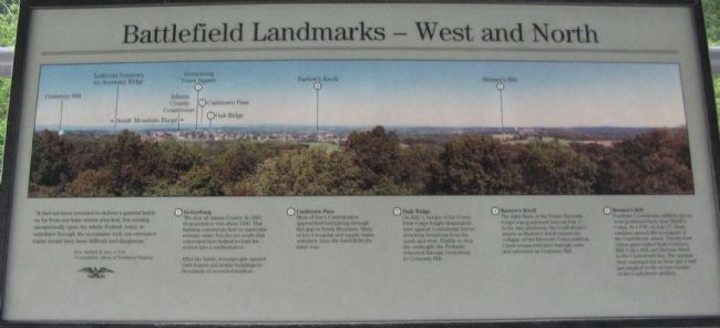
Battlefield Landmarks - North and West
Gen. Robert E. Lee, C.S.A.
Commander, Army of Northern Virginia
(1) Gettysburg
The seat of Adams County. In 1863 its population was about 2400. This farming community had no particular military value, but the ten roads that converged here helped to lead the armies into a confrontation.
After the battle, townspeople opened their homes and public buildings to thousands of wounded soldiers.
(2) Cashtown Pass
Most of Lee's Confederates approached Gettysburg through this gap in South Mountain. Many of Lee's hospital and supply trains withdrew from the battlefield the same way.
(3) Oak Ridge
On July 1, troops of the Union First Corps fought desperately here against Confederate forces attacking Gettysburg from the north and west. Unable to stop the onslaught, the Federals retreated through Gettysburg to Cemetery Hill.
(4) Barlow's Knoll
The right flank of the Union Eleventh Corps was positioned here on July 1st. In the late afternoon, the Confederate's attack on Barlow's Knoll caused the collapse of the Eleventh Corps position. Union troops retreated through town and reformed on Cemetery Hill.
(5) Benner's Hill
Fourteen Confederate artillery pieces were positioned here from Ewell's Corps. At 4 p.m. on July 2nd, these cannon opened fire in support of the Confederate attack. Twenty-four Union guns replied from Cemetery Hill, Culp's Hill, and Stevens' Knoll to the Confederate fire. The unequal duel continued for an hour and a half and resulted in the severe repulse of the Confederate artillery.
Topics. This historical marker is listed in this topic list: War, US Civil. A significant historical date for this entry is July 1, 1863.
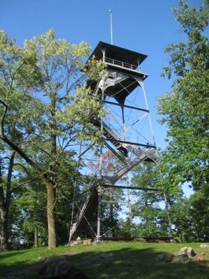
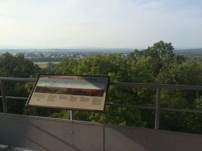
Location. 39° 49.207′ N, 77° 13.228′ W. Marker is near Gettysburg, Pennsylvania, in Adams County. It is in Cumberland Township. Marker is on Culp's Hill Loop, in the median. Located on the Observation Tower at the upper crest of Culp's Hill in Gettysburg National Military Park. Touch for map. Marker is in this post office area: Gettysburg PA 17325, United States of America. Touch for directions.
Other nearby markers. At least 8 other markers are within walking distance of this marker. Battlefield Landmarks - South and West (here, next to this marker); Battery K, Fifth U.S. Artillery (a few steps from this marker); 7th Indiana Infantry (a few steps from this marker); 76th New York Infantry (a few steps from this marker); 95th New York Infantry (within shouting distance of this marker); The Deadened Woods (within shouting distance of this marker); Defense of Culp's Hill (within shouting distance of this marker); Culp's Hill Rehabilitation (within shouting distance of this marker). Touch for a list and map of all markers in Gettysburg.
More about this marker. The upper section of the marker is a panoramic photo looking to the north and west of the tower.
Credits. This page was last revised on February 7, 2023. It was originally submitted on December 2, 2008, by Craig Swain of Leesburg, Virginia. This page has been viewed 1,021 times since then and 15 times this year. Photos: 1, 2. submitted on December 2, 2008, by Craig Swain of Leesburg, Virginia. 3. submitted on September 5, 2015, by J. Makali Bruton of Accra, Ghana. 4. submitted on December 2, 2008, by Craig Swain of Leesburg, Virginia.


