Near Syringa in Idaho County, Idaho — The American West (Mountains)
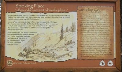
Smoking Place
"...those indians are most admirable pilots..."
Smoking Place is an important part of the mountain route to the Nimigpuu. The mountains are sacred to the Tittokan (Indian people) They have always been places to pray, reflect and feel closer to the Creator. The request to stop and smoke a pipe with Lewis and Clark showed the significance of this "ellevated point."
In September 2001, this Nimigpuu sacred site was desecrated by the removal of three rock cairns. A Nimigpuu man said, "My grandfather used to pray for the mountains." Today we need to continue to protect them.
Capt. William Clark, June 27, 1806
"...Short of the encampment we halted by the request of the Guides a few minits on an ellevated point and Smoked a pipe on this eminance the nativs have raised a conic mound of Stons of 6 to 8 feet high and erected a pine pole of 15 feet long... from this place we has an extencive view of these Stupendeous Montains principally Covered with Snow like that on which we Stood; we were entirely Serounded by those mountains from which to one unacquainted with them it would have Seemed impossible ever to have escaped, in short without the assistance of our guides, I doubt much whether we who had once passed them could find our way to Travellers rest...
those indians are most admirable pilots; we find the road where the Snow has disappeared tho' it be only for a few paces. after having Smoked the pipe and Contemplating this Scene Sufficient to have dampened the Spirits of any except Such hardy travellers as we have become, we continued our march..."
Erected by Forest Service, U.S. Department of Agriculture.
Topics and series. This historical marker is listed in these topic lists: Exploration • Native Americans. In addition, it is included in the Lewis & Clark Expedition series list. A significant historical date for this entry is June 27, 1806.
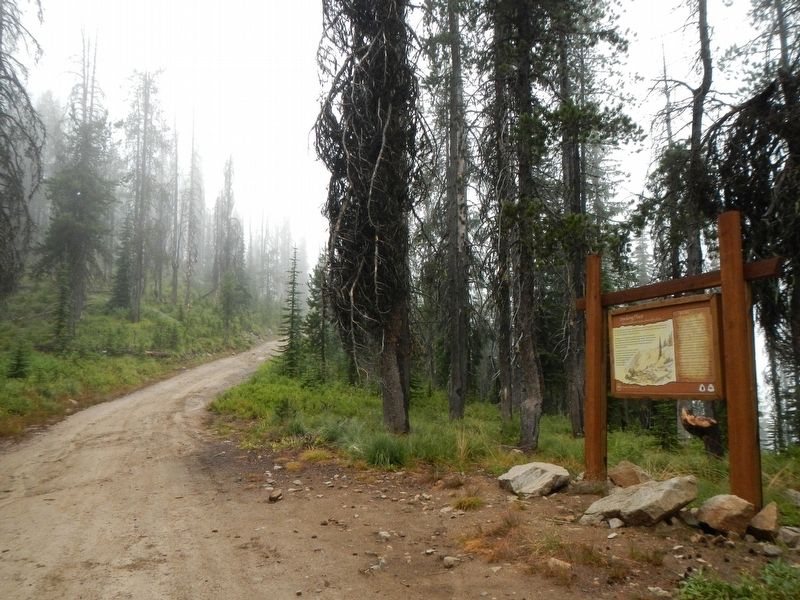
Location. 46° 29.015′ N, 115° 9.49′ W. Marker is near Syringa, Idaho, in Idaho County. Marker is on Lolo Motorway (Forest Road 500) near Gravey Creek Road (Forest Road 107), on the left when traveling west. Touch for map. Marker is in this post office area: Kooskia ID 83539, United States of America. Touch for directions.
Other nearby markers. At least 7 other markers are within 13 miles of this marker, measured as the crow flies. Nímíípuu and Selish (approx. 3.4 miles away); Nimiipuum Wetes (approx. 4.2 miles away); My Name is K'useynisskit (approx. 4.2 miles away); Green Swoard Camp (approx. 4½ miles away); Howard Camp (approx. 5½ miles away); Indian Post Office (approx. 9.2 miles away); The Lolo Trail (approx. 12.9 miles away).
More about this marker. The term motorway as applied to the Lolo Motorway should be understood as it was originally defined and not the expressway with think of today. The Lolo Motorway was built by the CCC in the 1930s over practically impassable terrain (for automobiles). In places the road is extremely rocky, steep and narrow with shear drop-offs. In short, the Lolo Motorway should only be driven by high clearance, 4WD vehicles and the like.
Credits. This page was last revised on June 15, 2020. It was originally submitted on October 9, 2019, by Barry Swackhamer of Brentwood, California. This page has been viewed 389 times since then and 68 times this year. Photos: 1, 2. submitted on October 9, 2019, by Barry Swackhamer of Brentwood, California.

