Gracemor-Randolph Corners in Kansas City in Clay County, Missouri — The American Midwest (Upper Plains)
Crowley Cemetery
Clay County Historic Landmark
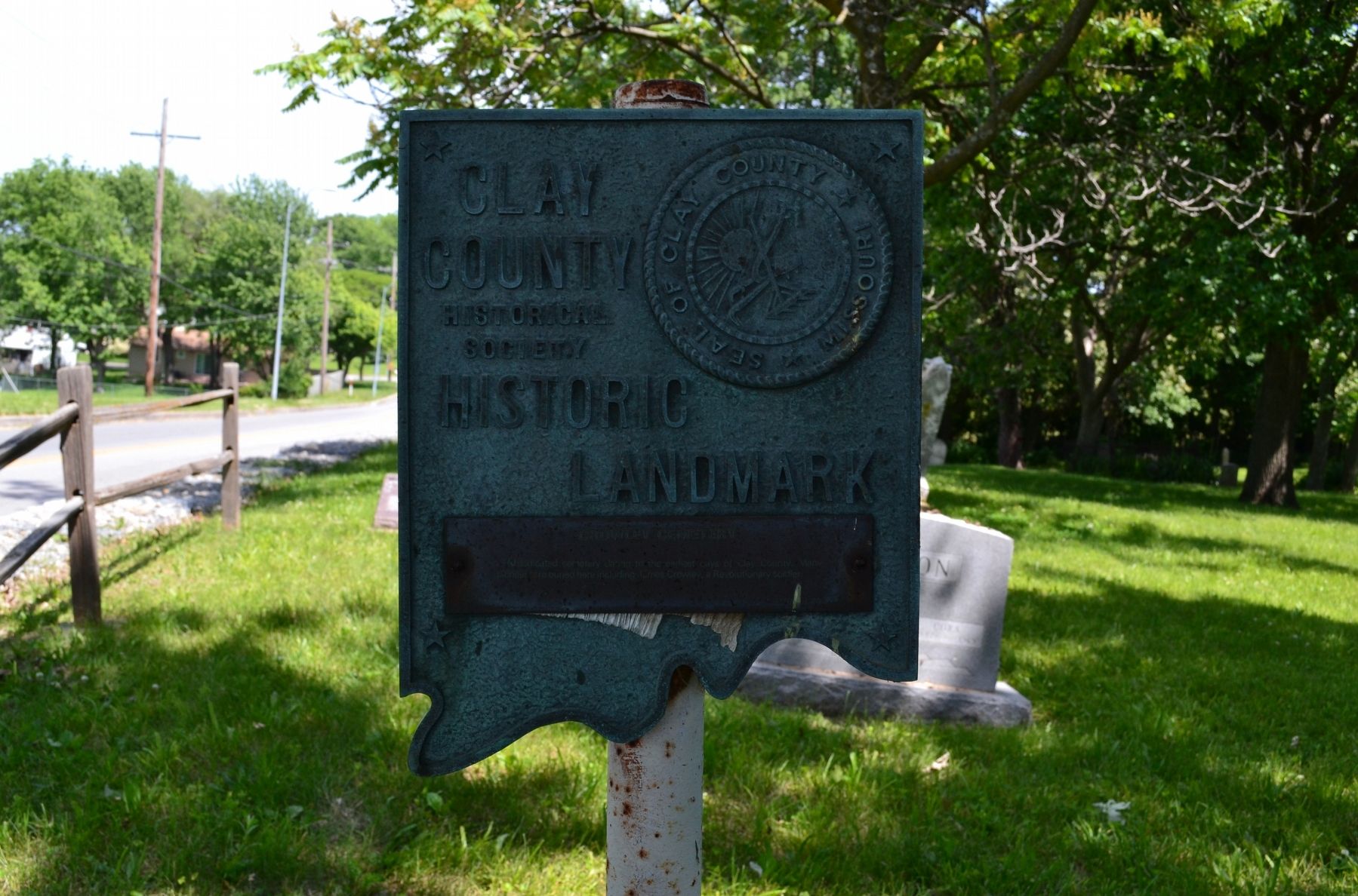
Photographed by Michael E Sanchez, Jr., May 17, 2012
1. Crowley Cemetery Marker
dedicated cemetery dating to the earliest days of Clay County. Many pioneers are buried here including James Crowley, a Revolutionary soldier.
Erected 1976 by Clay County Historical Society.
Topics and series. This historical marker is listed in these topic lists: Cemeteries & Burial Sites • War, US Revolutionary. In addition, it is included in the Missouri, Clay County Historic Landmarks series list.
Location. 39° 10.829′ N, 94° 29.416′ W. Marker is in Kansas City, Missouri, in Clay County. It is in Gracemor-Randolph Corners. It is on Northeast 48th Street 0.3 miles east of Worlds of Fun Avenue, on the right when traveling east. Interstate 435 passes over Northeast 48th Street North but there is not an exit. You must exit Interstate 435 at Northeast Parvin Road and travel north on Worlds of Fun Avenue to Northeast 48th Street North. Touch for map. Marker is at or near this postal address: 7534 Northeast 48th Street, Kansas City MO 64161, United States of America. Touch for directions.

Regionally, this marker is in the Missouri River Corridor. It is also
this page online
Other nearby markers. At least 8 other markers are within 5 miles of this marker, measured as the crow flies: Monument to the Eight Witnesses (approx. 2.9 miles away); Antioch Church (approx. 3.1 miles away); a different marker also named Antioch Church (approx. 3.1 miles away); Atkins-Johnson Farm (approx. 3.1 miles away); a different marker also named Antioch Church (approx. 3.1 miles away); Atkins-Johnson House (approx. 3.1 miles away); Atkins-Johnson Farmhouse (approx. 3.1 miles away); Interurban Railway Bridge (approx. 4.2 miles away). Touch for a list and map of all markers in Kansas City.
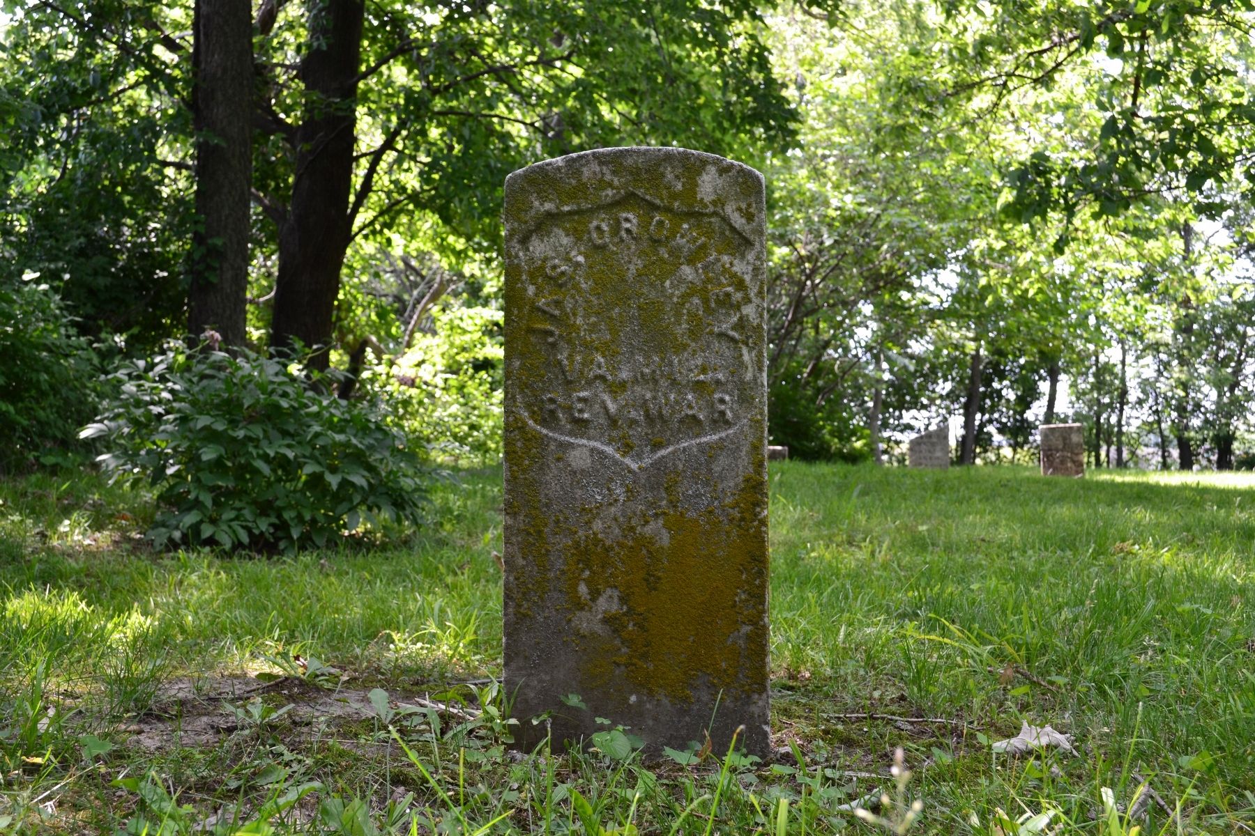
Photographed by Michael E Sanchez, Jr., May 17, 2012
2. Jas. Crowley
VA. MIL. [Virginia Military?]
REV. WAR
20 MAY 1764 - 4 SEP 1840
Credits. This page was last revised on February 10, 2023. It was originally submitted on October 10, 2019, by Michael E Sanchez, Jr. of Kansas City, Missouri. This page has been viewed 1,367 times since then and 127 times this year. Photos: 1, 2. submitted on October 10, 2019, by Michael E Sanchez, Jr. of Kansas City, Missouri. • Devry Becker Jones was the editor who published this page.
