Portage Des Sioux in St. Charles County, Missouri — The American Midwest (Upper Plains)
Forts and Blockhouses
1799 - 1812
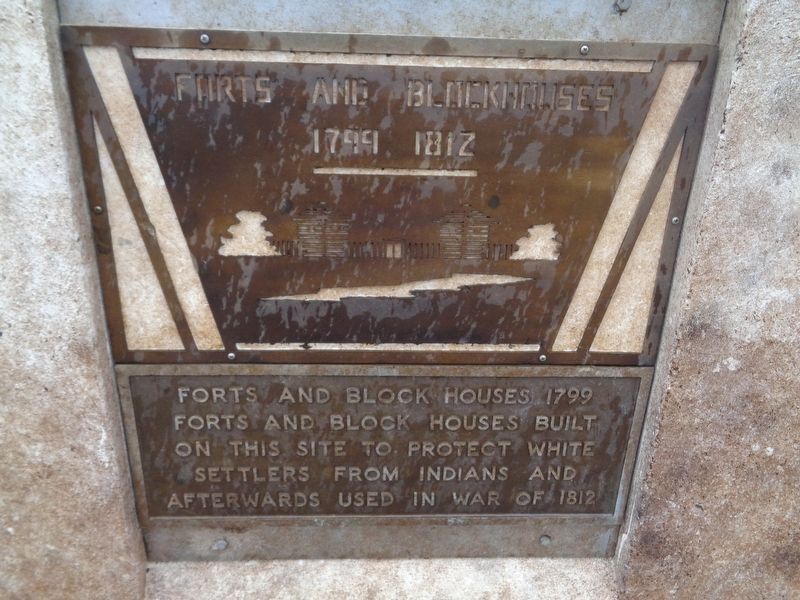
Photographed by Jason Voigt, September 22, 2019
1. Forts and Blockhouses Marker
Topics. This historical marker is listed in these topic lists: Forts and Castles • Indigenous Peoples and Communities • Settlements & Settlers • War of 1812 • Wars, US Indian. A significant historical year for this entry is 1799.
Location. 38° 55.8′ N, 90° 20.343′ W. Marker is in Portage Des Sioux, Missouri, in St. Charles County. It can be reached from River View Drive 0.1 miles north of Le Sieur Street, on the right when traveling north. Marker is located on a walkway towards the Our Lady of the Rivers Shrine statue. It is the second marker on the right, after walking past the entrance. Touch for map. Marker is at or near this postal address: 1665 River View Dr, Portage des Sioux MO 63373, United States of America. Touch for directions.

Regionally, this marker is in the Missouri River Corridor and in Greater St. Louis. It is also in the American Midwest, in the Lewis & Clark Corridor, in the Corn Belt, and in the Great River Road Region. Globally, it is in North America, the Western
this page online
Other nearby markers. At least 8 other markers are within walking distance of this marker: Lewis & Clark 1804 (here, next to this marker); Pere Marquette & Joliet 1673 (within shouting distance of this marker); Louisiana Territory (within shouting distance of this marker); Portage des Sioux 1798 (within shouting distance of this marker); 1815 Treaty (within shouting distance of this marker); St Rose Philippine Duchesne (within shouting distance of this marker); St. Francis of Assisi Church (within shouting distance of this marker); Our Lady of the Rivers (about 400 feet away, measured in a direct line). Touch for a list and map of all markers in Portage Des Sioux.
More about this marker. This is one of eight markers on the Our Lady of the Rivers Shrine walkway, which mostly cover Lewis & Clark and St. Charles County history.
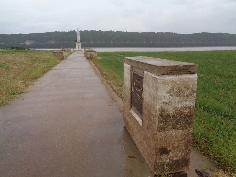
Photographed by Jason Voigt, September 22, 2019
2. Forts and Blockhouses Marker
The Our Lady of the Rivers Shrine statue is seen in the background.
Credits. This page was last revised on October 14, 2022. It was originally submitted on October 12, 2019, by Jason Voigt of Glen Carbon, Illinois. This page has been viewed 420 times since then and 32 times this year. Photos: 1, 2. submitted on October 12, 2019, by Jason Voigt of Glen Carbon, Illinois. • Devry Becker Jones was the editor who published this page.
