Mackinaw City in Cheboygan County, Michigan — The American Midwest (Great Lakes)
Anchors and their retrieval
Capstan for pulling up the anchor
| — | Mackinaw City Historical Pathway | — |
Photographed by Joel Seewald, August 19, 2019
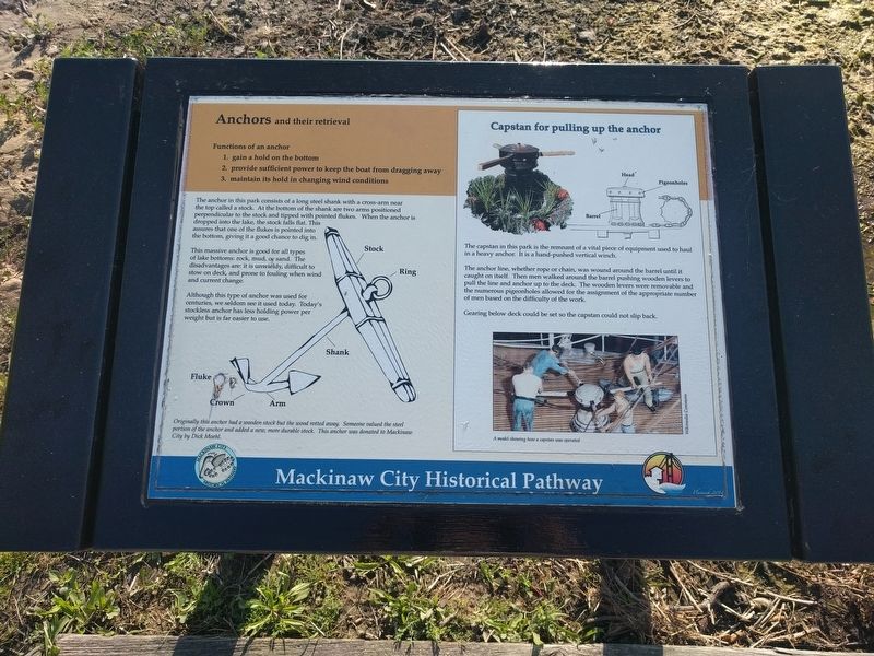
1. Anchors and their retrieval / Capstan for pulling up the anchor Marker
Anchors and their retrieval
Functions of an anchor
- gain a hold on the bottom
- provide sufficient power to keep the boat from dragging away
- maintain its hold in changing wind conditions
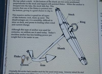
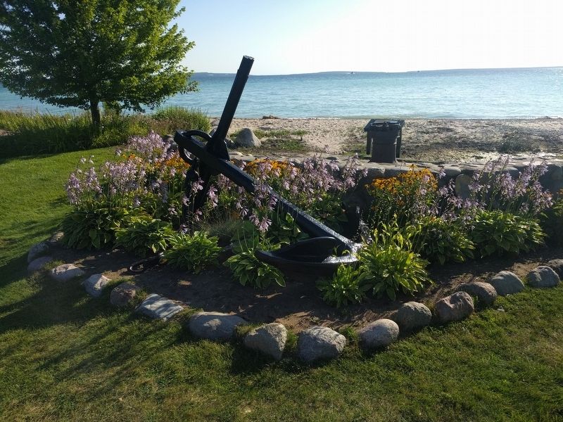
This massive anchor is good for all types of lake bottoms: rock, mud, or sand. The disadvantages are: it is unwieldy, difficult to stow on deck, and prone to fouling when wind and current change.
Although this type of anchor was used for centuries, we seldom see it used today. Today's stockless anchor has less holding power per weight but is far easier to use.
Originally this anchor had a wooden stock but the wood rotted away. Someone valued the steel portion of the anchor and added a new, more durable stock. This anchor was donated to Mackinaw City by Dick Moehl.
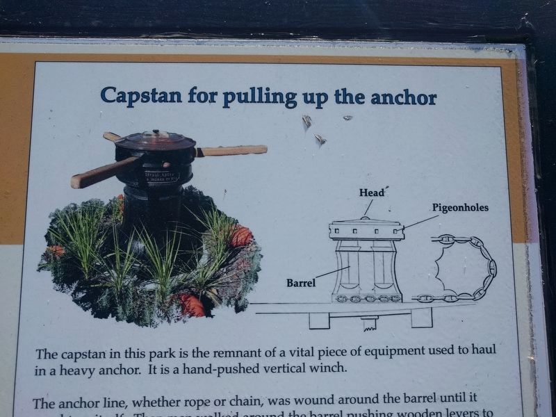
Capstan for pulling up the anchor
The
this page online
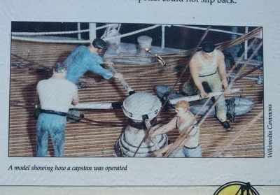
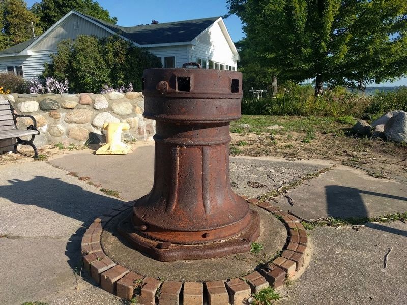
The anchor line, whether rope or chain, was wound around the barrel until it caught on itself. Then men walked around the barrel pushing wooden levers to pull the line and anchor up to the deck. The wooden levers were removable and the numerous pigeonholes allowed for the assignment of the appropriate number of men based on the difficulty of the work.
Gearing below deck could be set so the capstan could not slip back.
Erected 2014.
Topics. This historical marker is listed in this topic list: Waterways & Vessels.
Location. This marker has been replaced by another marker nearby. It was located near 45° 47.15′ N, 84° 43.556′ W. Marker was in Mackinaw City, Michigan, in Cheboygan County. It could be reached from the intersection of North Huron Avenue and East Depeyster Street, on the right when traveling north. Marker is in Maritime Park. Touch for map. Marker was at or near this postal address: 412 North Huron Avenue, Mackinaw City MI 49701,
2. Anchors and their retrieval / Capstan for pulling up the anchor Marker - left image

Regionally, this marker was in Northern Michigan Lower Peninsula, on the Straits of Mackinac, and in one of the Lake Huron Shore counties. It was also in the American Midwest. Globally, it was in North America, in the Great North Woods, on the Great Lakes, in the Western Hemisphere, in the Western World, and in the Anglosphere. Historically, it found itself in what was once the Northwest Territory.
Other nearby markers. At least 8 other markers are within walking distance of this location: Anchor (here, next to this marker); Marine and Weather Reporter (within shouting distance of this marker); The Lumbering Era (about 500 feet away, measured in a direct line); Alexander Henry Park Kiosk (about 600 feet away); Alexander Henry 1739 - 1834 (about 600 feet away); a different marker also named Graveyard of the Deep (about 700 feet away); Building the Mighty Mac (about 700 feet away); Perry B. Darrow 1939-1995 (about 700 feet away). Touch for a list and map of all markers in Mackinaw City.
Other markers no longer nearby. Marine & Weather Reporter (was within shouting distance
3. Anchors and their retrieval / Capstan for pulling up the anchor Marker - upper right image
Photographed by Wikimedia Commons
4. Anchors and their retrieval / Capstan for pulling up the anchor Marker - lower right image
A model showing how a capstan was operated.
Photographed by Joel Seewald, August 19, 2019
5. Anchors and their retrieval / Capstan for pulling up the anchor Marker
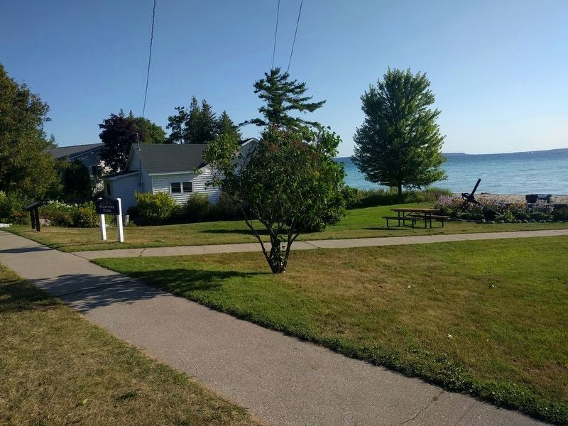
Marker is at the very right of the image, at the end of the sidewalk and next to the capstan.
Photographed by Joel Seewald, August 19, 2019
6. Anchor
Photographed by Joel Seewald, August 19, 2019
7. Capstan
Photographed by Joel Seewald, August 19, 2019
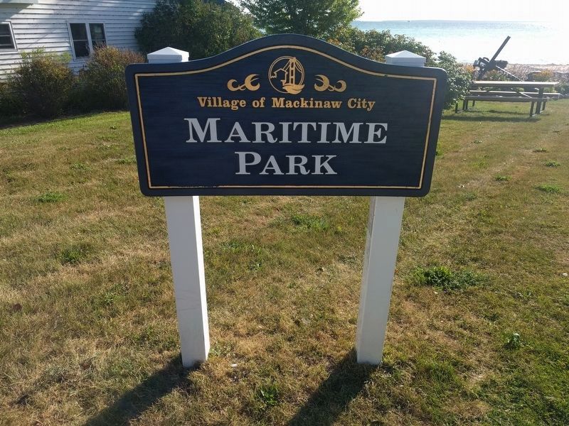
8. Maritime Park sign
Marker is in Maritime Park.
Credits. This page was last revised on August 24, 2024. It was originally submitted on October 16, 2019, by Joel Seewald of Madison Heights, Michigan. This page has been viewed 473 times since then and 21 times this year. Photos: 1, 2, 3, 4, 5, 6, 7, 8. submitted on October 16, 2019, by Joel Seewald of Madison Heights, Michigan.
