Near Ayelet HaShahar in Upper Galilee Regional Council, Northern District, Israel — West Asia (the Levant in the Middle East)
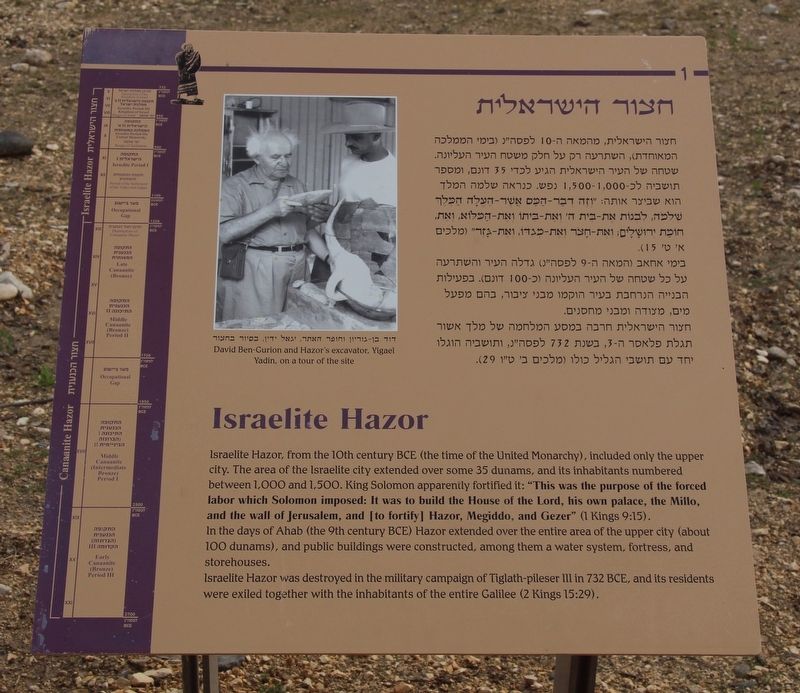
Israelite Hazor
Israelite Hazor, from the 10th century BCE (the time of the United Monarchy), included only the upper city. The area of the Israelite city extended over some 35 dunams, and its inhabitants numbered between 1,000 and 1,500. King Solomon apparently fortified it: "This was the purpose of the forced labor which Solomon imposed: It was to build the House of the Lord, his own palace, the Millo, and the wall of Jerusalem, and [to fortify] Hazor, Megiddo, and Gezer" (1 Kings 9:15).
In the days of Ahab (the 9th century BCE) Hazor extended over the entire area of the upper city (about 100 dunams), and public buildings were constructed, among them a water system, fortress, and storehouses.
Israelite Hazor was destroyed in the military campaign of Tiglath-pileser III in 732 BCE, and its residents were exiled together with the inhabitants of the entire Galilee (2 Kings 15:29).
English Text on Marker Timeline:
Canaanite Hazor (Greater Hazor) 1720-1100 BCE
• Middle Canaanite Period IIb
• Late Canaanite Period (to Destruction of Canaanite Hazor - 1250 BCE)
• Occupational Gap 1250-1100 BCE
Israelite Hazor 1100-732 BCE
• Israelite Period I (Period of the Settlement of the Tribes and Judges) 1100-950 BCE
• Israelite Period IIa (Reign of Solomon) 950-850 BCE
• Israelite Period IIb (Reign of Ahab to Destruction of the Kingdom of Israel) 850-732 BCE
Topics. This historical marker is listed in these topic lists: Anthropology & Archaeology • Forts and Castles • Parks & Recreational Areas • Settlements & Settlers. A significant historical year for this entry is 1250.
Location. 33° 1.059′ N, 35° 34.102′ E. Marker is near Ayelet HaShahar, Northern District, in Upper Galilee Regional Council. Marker can be reached from Rosh Pina - Metulla Road just east of Northern District Route 90, on the left when traveling east. This marker is located in the midst of the archaeological ruins at the Tel Hazor National Park. Touch for map. Touch for directions.
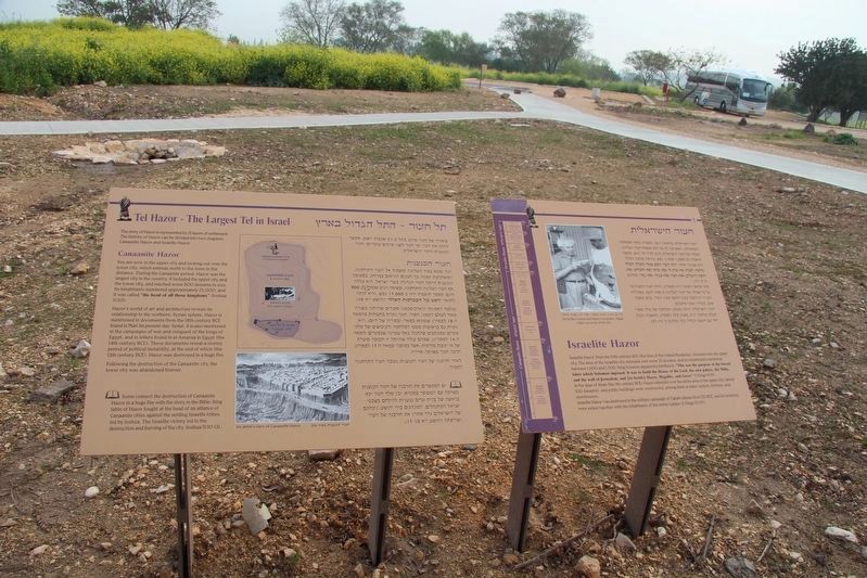
Other nearby markers. At least 8 other markers are within 13 kilometers of this marker, measured as the crow flies. Tel Hazor - The Largest Tel in Israel (here, next to this marker); "Solomonic Gate" (a few steps from this marker); Tel Hazor National Park (a few steps from this marker); Canaanite Temple (within shouting distance of this marker); a different marker also named Canaanite Temple (within shouting distance of this marker); Palace of the Canaanite Kings of Hazor (about 90 meters away, measured in a direct line); Water System (about 150 meters away); Chorazin in Christian Sources (approx. 11.8 kilometers away). Touch for a list and map of all markers in Ayelet HaShahar.
More about this marker. This marker is located in the Tel Hazor National Park, in midst of the ruins of the various layers of ancient cultures. It is my impression that these ancient ruins are very significant in both the historical and archaeological record of ancient Israel, because several of the artifacts and structural elements that were found in these particular ruins are now on display in the Israel Museum in Jerusalem.
Hazor is also part of the Biblical record, being referenced nineteen (19) times, in eight (8) different books of the Old Testament.
Credits. This page was last revised on October 22, 2019. It was originally submitted on October 22, 2019, by Dale K. Benington of Toledo, Ohio. This page has been viewed 100 times since then and 4 times this year. Photos: 1, 2, 3. submitted on October 22, 2019, by Dale K. Benington of Toledo, Ohio.


