Near Cameron in Madison County, Montana — The American West (Mountains)
Motoring Through Paradise: The Vigilante Trail
Inscription.
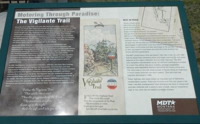
Motoring was an adventure in the early 20th century and people usually didn't travel very far from home. Most roads were choked with dust during the summers, knee-deep in mud in the rainy seasons, and blocked by snowdrifts in the winters. But as more people bought cars, they demanded better roads. Some banded together and formed organizations dedicated to the construction of good roads, which, they believed, increased commerce and made for prosperous communities. One way to prosperity was through tourism. Tourists stayed in local hotels or auto camps, ate in restaurants, and spent money in local businesses. For many communities, like West Yellowstone and Ennis, a good road was just as important as the railroad.
By the mid-1910s, many out-of-state and local promotors established road associations to designate roads that connected important tourist attractions, like Yellowstone and Glacier national parks. The auto associations gave the routes colorful and evocative names, like Yellowstone Trail, Park-to-Park Highway, Electric Highway and Theodore Roosevelt International Highway. In Montana, the roads mainly connected Yellowstone and Glacier national parks, with "laterals" to other important attractions like Little Bighorn Battlefield, By 1925, there were fourteen "named" highways crisscrossing the Treasure State, each with their own colorful symbols blazing the way.
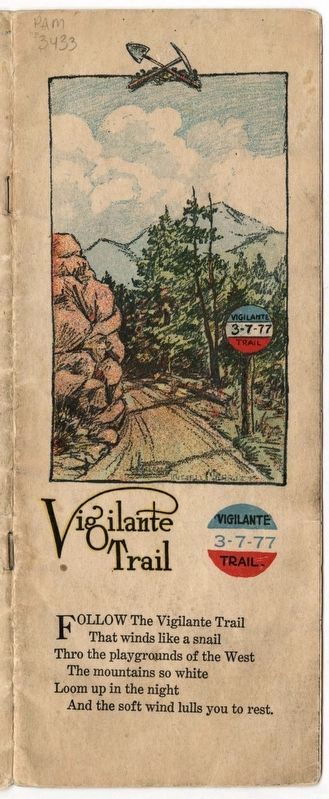
In 1923, businessmen and promoters in Madison, Jefferson, and Silver Bow counties banded together to form the Vigilante Trail Association, one of the last such road organizations formed in Montana. The trail, which conjured images of stalwart pioneers battling dastardly road agents in Montana's mining camps, provided a connection between West Yellowstone and Butte. The Vigilante Trail was marked with a round red, white and blue shield with the dreaded vigilante symbol 3-7-77 featured prominently in the middle. The route passed through country steeped in Montana's early history, including Virginia City and Alder Gulch. The 160-mile road also grazed some of Montana's best fisheries, including the Madison River, "the fisherman's paradise of the West."
Rest In Peace
Taking a break by the side of the road is as old as traveling itself. In the American West, rest areas consisted of wherever you stopped and got down off you horse. Sometimes it meant getting out of a stagecoach and stretching your legs for a bit at a stage station. But with the arrival of the automobile in the early twentieth century, things became a little more complicated. You could still pull over and do what you needed to do, but that practice was discouraged in many area. Local businesses encouraged motorists to stop in their communities
and take advantage of the services they had to offer, but stops in rural areas were still left to the whims of the driver and their passengers.
The MDT constructed it first rest area in 1934. But it was not until 1962 that the department adopted a policy and began planning for rest areas adjacent to the state's Interstate and two-lane highways. The MDT soon adopted a standardized design for restroom buildings surrounded by a park-like setting with picnic shelters, garbage receptacles, benches, and interpretive markers recounting the history of the area. The intent was to "provide small pockets of beauty along our highway in which weary motorists can rest in peace." This rest area was originally developed in 1966.
Today, highway rest areas remain an important part of Montana's transportation system. There are currently over fifty rest areas in the state. Like their predecessors, each Montana rest area is unique and provides motorists with a place to take a break, read an interpretive sign or two, and view the state's incredible scenery.
Erected by Montana Department of Transportation.
Topics. This historical marker is listed in this topic list: Roads & Vehicles.
Location. 44° 54.131′ N, 111° 35.604′ W. Marker is near Cameron,
Montana, in Madison County. Marker is on Forest Road 209 near U.S. 287. Touch for map. Marker is in this post office area: Cameron MT 59720, United States of America. Touch for directions.
Other nearby markers. At least 4 other markers are within 11 miles of this marker, measured as the crow flies. A Tough Business (here, next to this marker); Earthquakes! (a few steps from this marker); Raynolds' Pass (approx. 8 miles away); The Seismic Shake that Shaped this Lake (approx. 10.3 miles away).
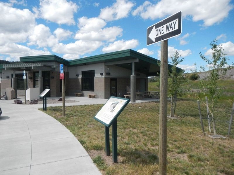
More about this marker. This marker is located at the Raynolds Pass Rest Area.
Also see . . . Rediscovering the Old Vigilante Trail 3-7-77 -- Montana Standard. As the old timers said, "just build a road and the tourists will find it." (Submitted on October 23, 2019, by Barry Swackhamer of Brentwood, California.)
Credits. This page was last revised on August 1, 2020. It was originally submitted on October 23, 2019, by Barry Swackhamer of Brentwood, California. This page has been viewed 203 times since then and 11 times this year. Photos: 1, 2, 3. submitted on October 23, 2019, by Barry Swackhamer of Brentwood, California.


