Near Arnoldsburg in Calhoun County, West Virginia — The American South (Appalachia)
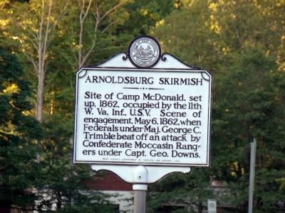
Arnoldsburg Skirmish
Erected 1973 by West Virginia Department of Archives and History.
Topics and series. This historical marker is listed in this topic list: War, US Civil. In addition, it is included in the West Virginia Archives and History series list. A significant historical date for this entry is May 6, 1919.
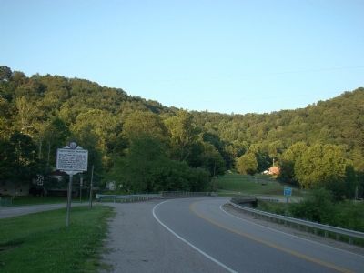
Location. 38° 47.643′ N, 81° 8.5′ W. Marker is near Arnoldsburg, West Virginia, in Calhoun County. Marker is at the intersection of U.S. 33 and Arnoldsburg-Rocksdale Road, on the left when traveling east on U.S. 33. Touch for map. Marker is in this post office area: Arnoldsburg WV 25234, United States of America. Touch for directions.
Other nearby markers. At least 8 other markers are within 10 miles of this marker, measured as the crow flies. Engagement at Arnoldsburg (here, next to this marker); Perry Hays & George Silcott / Louisa Hays & Amie Silcott (a few steps from this marker); Moccasin Rangers (a few steps from this marker); Honoring E. Dean Starcher (approx. 5.7 miles away); Grave of Mike Fink (approx. 5.9 miles away); Gilmer County / Calhoun County (approx. 7.7 miles away); Calhoun County Veterans Memorial (approx. 9.3 miles away); In Memoriam CSM Clovis Drexell Ice (approx. 9.3 miles away). Touch for a list and map of all markers in Arnoldsburg.
Also see . . . Skirmish at Arnoldsburg. Excerpt:
A heavy fog settled over the valley during the night, and when morning of May 6 came, visibility was limited to a few hundred feet. During the night, covered by darkness and the fog, the rangers had crept in and had taken strong positions on the hills overlooking the camp.(Submitted on December 6, 2008.)
Fortunately for the sleeping soldiers, a ranger scout ventured down the hill to get a better view of the lay of the land. In the dim half-light of the early morning he was detected by an alert sentry, who fired at him.
The shot aroused the camp. Drummers beat the long roll, the half-dressed soldiers turned out and formed in lines of battle. The partisans opened a heavy fire while the men were forming, but the blanket of fog prevented accurate shooting, and the partisans could only fire at the general location.
Credits. This page was last revised on August 17, 2019. It was originally submitted on December 6, 2008, by J. J. Prats of Powell, Ohio. This page has been viewed 1,943 times since then and 51 times this year. Photos: 1, 2. submitted on December 6, 2008, by J. J. Prats of Powell, Ohio.

