Downtown in St. Louis, Missouri — The American Midwest (Upper Plains)
Great Flood of 1993
August 1, 1993

Photographed by Jason Voigt, October 22, 2019
1. August 1, 1993 Marker
The bottom of this plaque indicates the high water mark of the Great Flood of 1993. On this date, the Mississippi River reached 49.58 feet, the highest level ever recorded in the City of St. Louis.
Topics. This historical marker is listed in these topic lists: Disasters • Waterways & Vessels. A significant historical date for this entry is August 1, 1993.
Location. 38° 37.494′ N, 90° 11.043′ W. Marker is in St. Louis, Missouri. It is in Downtown. It can be reached from North Leonor K Sullivan Boulevard 0.3 miles south of Lucas Street, on the right when traveling south. Marker is located between the Gateway Arch and the Mississippi River, on the north end of the grand steps between them, near the entrance of Gateway Arch National Park. Touch for map. Marker is at or near this postal address: 57 North Leonor K Sullivan Boulevard, Saint Louis MO 63102, United States of America. Touch for directions.

Regionally, this marker is in the American Midwest, in the Lewis & Clark Corridor, in the Corn Belt, and in the Great River Road Region. Globally, it is in North America, the Western Hemisphere, the Western World, and the Anglosphere.
this page online
Other nearby markers. At least 8 other markers are within walking distance of this marker: Rock Solid (a few steps from this marker); The Gateway Arch (within shouting distance of this marker); Miles of Steamboats (about 300 feet away, measured in a direct line); Pierre Laclede (about 300 feet away); In Memory of Robert E. Lee (about 400 feet away); Freedom Denied, Freedom Gained (about 400 feet away); Commercial Beginnings (about 600 feet away); Traders and Tribes (about 600 feet away). Touch for a list and map of all markers in St. Louis.
More about this marker. There is a duplicate marker at the south end of the steps, on the same level.

Photographed by Jason Voigt, October 22, 2019
2. August 1, 1993 Marker
Marker is located at the steps that lead to Gateway Arch National Park. The north leg of the Arch is seen in the background.
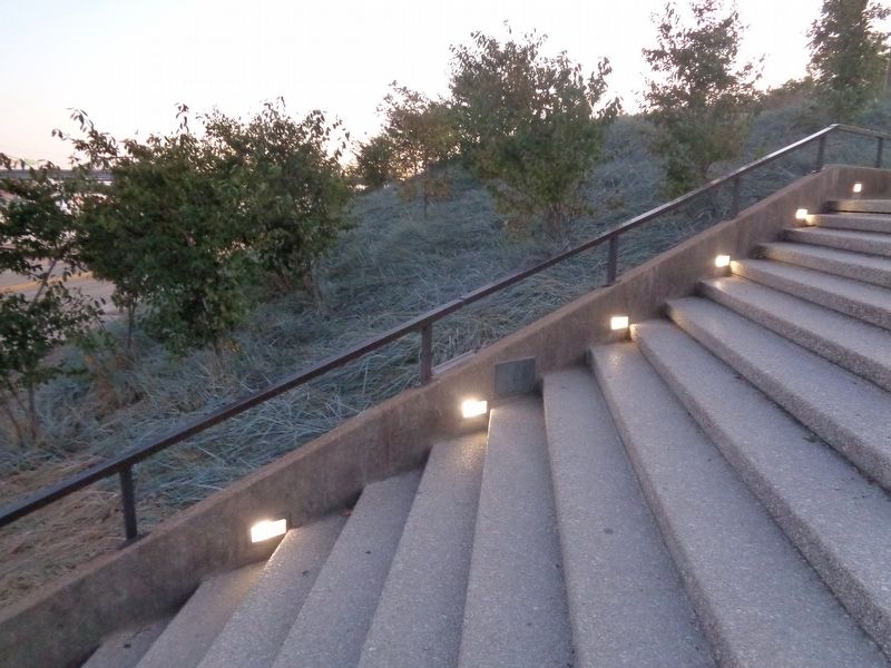
Photographed by Jason Voigt, October 22, 2019
3. August 1, 1993 Marker
Duplicate marker located at the South end of the steps
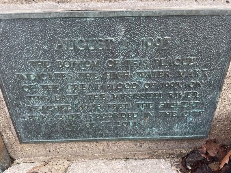
Photographed by Garrett Koch, March 6, 2026
4. Great Flood of 1993 Marker - alternate on south side of riverfront steps
Credits. This page was last revised on August 26, 2026. It was originally submitted on October 24, 2019, by Jason Voigt of Glen Carbon, Illinois. This page has been viewed 689 times since then and 79 times this year. Photos: 1, 2, 3. submitted on October 25, 2019, by Jason Voigt of Glen Carbon, Illinois. 4. submitted on August 20, 2026, by Garrett Koch of Saint Louis, Missouri. • Devry Becker Jones was the editor who published this page.
