Hofportal mit Bacchusrelief
⎯⎯⎯
Courtyard Entry with Bacchus Carving
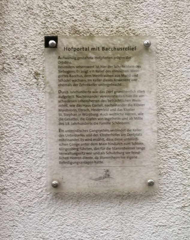
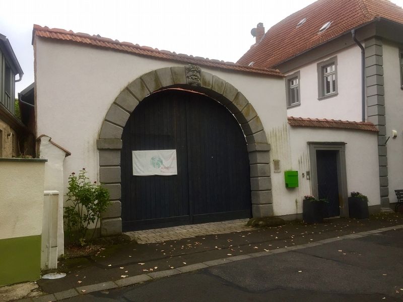
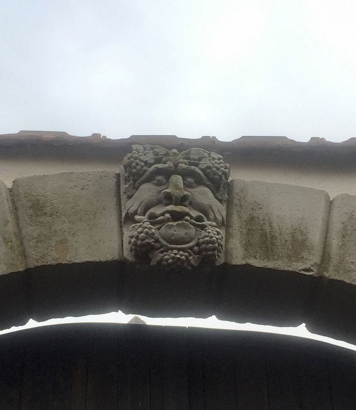
Besonders sehenswert ist hier der Scheitelstein des Torbogens Er zeigt ein Relief des römischen Weingottes Bacchus, dem Weintrauben aus Mund und Schädel wachsen. Im Keller dieses Anwesens war ehemals der Zehntkeller untergebracht.
Durch Jahrhunderte war das Dorf grundherrlich stark aufgeteilt. Nacheinander vereinnahmten hier die verschiedenen Lehensherren den beträchtlichen Weinzehnt, wie das Haus Castell, nacheinander die Klöster Maidbronn, Ebrach, Heidenfeld und das Kloster St.Stephan in Würzburg. Auch weltliche Herren, wie die Gesattel, die Grafen von Ingelheim und ab Mitte des 18. Jahrhunderts die Familie Schönborn.
Ein unterirdisches Gangsystem verbindet die Keller des Unterdorfes und des Klosterhofes am Dorfplatz miteinander. Es wird erzählt, dass diese unterirdi- schen Gänge unter dem Main hindurch zum Schloss Klingenberg führten, das für die Stammheimer lange Verwaltungssitz war und als Schutzburg vor feind- ichen Heeren diente, da Stammheim nie eigene Befestigungsanlagen hatte.
-
(English translation:)
Elaborately designed courtyard
this page online
Especially worth seeing here is the crest of the archway, displaying a relief of the Roman wine god, Bacchus, with grapes growing from his mouth and the top of his head. In the basement of this property was the titheing cellar.
For centuries, the village was under tight manorial control of various feudal lords, with the House of Castell, and then afterwards various monasteries such as those in Maidbronn, Ebrach, Heidenfeld and the monastery St. Stephan in Würzburg collecting considerable tithes. Later, non-ecclesiastic tithes were collected by the Counts of Ingelheim, and then from the middle of 18th century, the Schönborn Family.
An underground passage system connects together the cellars
of the lower village and the Klosterhof on the village square. It is said that these underground passages led under the Main River to Castle
Klingenberg, as Stammheim was an administrative seat for a long time but never had its own fortifications.
Topics. This historical marker is listed in these topic lists: Architecture • Arts, Letters, Music • Man-Made Features.
Location. 49° 54.277′ N,

Regionally, it is in Europe, the European Union, Atlantic Europe, Central Europe, the Schengen Area, Western Europe, and the Western World. Historically, it finds itself in what was once the Holy Roman Empire.
Other nearby markers. At least 8 other markers are within 3 kilometers of this marker, measured as the crow flies: Das Historisches Rathaus / The Historic Town Hall (within shouting distance of this marker); Wein-Kult Tour bei Stammheim / Wine Cult-Tour in Stammheim (within shouting distance of this marker); Weinbauchronik von Stammheim / Stammheim Viniculture Timeline (within shouting distance of this marker); Ehemaliger Klosterhof mit historischer Weinkelter / Former Monastery Building and Historic Winepress (within shouting distance of this marker); Barockes Zehnthaus mit Zehntkeller / Baroque Tithing House with Tithe Cellar (within shouting distance of
Credits. This page was last revised on January 28, 2022. It was originally submitted on October 26, 2019, by Andrew Ruppenstein of Lamorinda, California. This page has been viewed 147 times since then and 6 times this year. Photos: 1, 2, 3. submitted on October 26, 2019, by Andrew Ruppenstein of Lamorinda, California.
