Near Hanksville in Emery County, Utah — The American Mountains (Southwest)
Henry Mountains
Goblin Valley State Park
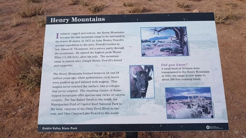
Henry Mountains
Isolated, rugged and remote, the Henry Mountains became the last mountain range to be surveyed in the lower 48 states. In 1872 on John Wesley Powell's second expedition to the area, Powell's bother-in-law, Almon H. Thompson, led a survey party through the mountains. He named the highest peak Mount Ellen (11,506 feet), after his wife. The mountain range is named after Joseph Henry, Powell's friend and supporter.
The Henry Mountains formed between 24 and 28 million years ago, when sedimentary rock layers were pushed up and infused with magma. This magma never reached the surface, like a volcano that never erupted. The resulting cluster of dome-topped mountains offer spectacular views of canyon country. The San Rafael Swell to the north, the Waterpocket Fold of Capitol Reef National Park to the west, canyons of the Dirty Devil River to the east, and Glen Canyon/Lake Powell to the south.
Did you know?
A small herd of 18 bison were transplanted to the Henry Mountains in 1941; the range is now home to about 200 free roaming bison.
Goblin Valley State Park
Erected by State of Utah Natural Resources, Division of Parks and Recreation.
Topics. This historical marker is listed in these topic lists: Environment • Exploration. A significant historical year for this entry is 1872.
Location. 38° 33.837′ N, 110° 42.217′ W. Marker is near Hanksville, Utah, in Emery County. Marker can be reached from Goblin Valley Road. The marker is at Goblin Valley State Park, most likely on the Carmel Canyon Trail, south of the Three Sisters rock formation. Touch for map. Marker is in this post office area: Hanksville UT 84734, United States of America. Touch for directions.
Other nearby markers. At least 1 other marker is within walking distance of this marker. John C. Fremont Expedition of 1853-54 (approx. 0.8 miles away).
Credits. This page was last revised on October 27, 2019. It was originally submitted on October 27, 2019, by J. Makali Bruton of Accra, Ghana. This page has been viewed 189 times since then and 23 times this year. Photos: 1, 2. submitted on October 27, 2019, by J. Makali Bruton of Accra, Ghana.
Editor’s want-list for this marker. More accurate GPS coordinates of the marker location. • Can you help?

