Near Kyburz in El Dorado County, California — The American West (Pacific Coastal)
Webster’s
(Sugar Loaf House)
Photographed by Syd Whittle, November 1, 2005
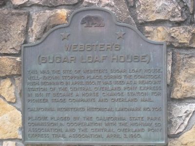
1. Webster’s Marker
This was the site of Webster's Sugar Loaf House, well-known stopping place during the Comstock rush. Beginning in April 1860, it was used as a remount station of the Central Overland Pony Express. In 1861 it became a horse change station for pioneer stage companies and the Overland Mail.
Erected 1960 by The California State Park Commission in cooperation with the Highway 50 Association and the Central Overland Pony Express Trail Association, April 3, 1960. (Marker Number 706.)
Topics and series. This historical marker is listed in these topic lists: Industry & Commerce • Roads & Vehicles • Settlements & Settlers. In addition, it is included in the California Historical Landmarks, and the Pony Express National Historic Trail series lists. A significant historical month for this entry is April 1860.
Location. 38° 46.204′ N, 120° 18.754′ W. Marker is near Kyburz, California, in El Dorado County. It is on Interstate 50, on the left when traveling east. Marker is located on Interstate 50, 1.0 miles west of Kyburz. Touch for map. Marker is in this post office area: Kyburz CA 95720, United States of America. Touch for directions.

Regionally,
this page online
Other nearby markers. At least 8 other markers are within 13 miles of this marker, measured as the crow flies: Johnson Cutoff - Peavine Hill (approx. 2.2 miles away); Johnson Cutoff - Sear's Post (approx. 5.1 miles away); Johnson Cutoff - Ascent to the Summit (approx. 5.7 miles away); Johnson Cutoff - Peavine Ridge (approx. 7.4 miles away); Riverton Bridge (approx. 7.4 miles away); Strawberry Valley House (approx. 9 miles away); Carson Trail - Leek Springs (approx. 9.9 miles away); Maiden's Grave (approx. 12.2 miles away). Touch for a list and map of all markers in Kyburz.
Another marker is no longer nearby. Moore’s (Riverton) (was approx. 7.4 miles away but has been confirmed missing).
Related markers. Click here for a list of markers that are related to this marker. Follow the first Eastbound journey of the Pony Express through California to Genoa, Nevada....To better understand the
Photographed by Syd Whittle, November 1, 2005
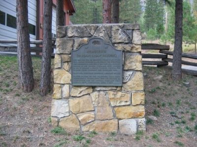
2. Webster’s Marker
Also see . . .
1. California Pony Express Stations. National Pony Express Association website entry (Submitted on December 6, 2008.)
2. The Pony Express. Gold Rush Chronicles website entry (Submitted on December 6, 2008.)
Credits. This page was last revised on February 13, 2022. It was originally submitted on December 6, 2008, by Syd Whittle of Mesa, Arizona. This page has been viewed 1,849 times since then and 33 times this year. Photos: 1, 2. submitted on December 6, 2008, by Syd Whittle of Mesa, Arizona.
