Porterville in Tulare County, California — The American West (Pacific Coastal)
Porterville's Badman
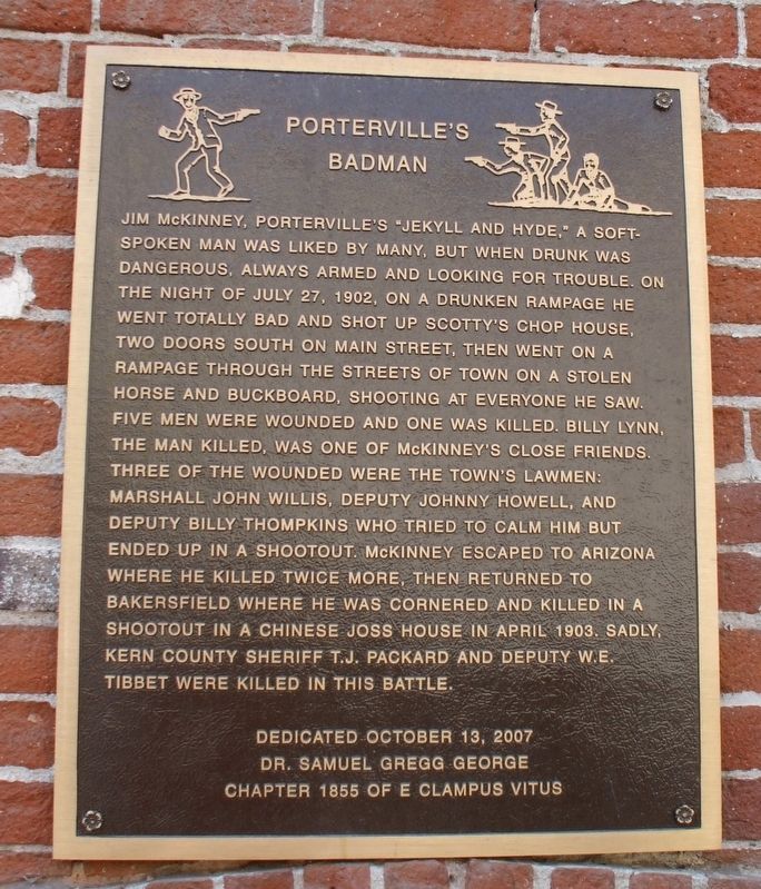
Photographed by Dr. Samuel Gregg George Chapter No. 1855 E Clampus Vitus, July 24, 2010
1. Porterville's Badman Marker
Erected 2007 by Dr. Samuel Gregg George Chapter 1855 E Clampus Vitus.
Topics and series. This historical marker is listed in this topic list: Law Enforcement. In addition,
this page online
Location. 36° 4.129′ N, 119° 0.986′ W. Marker is in Porterville, California, in Tulare County. It is at the intersection of West Mill Street and North Main Street, on the right when traveling east on West Mill Street. Marker is on the West Mill Street side of the building. Touch for map. Marker is at or near this postal address: 183 North Main Street, Porterville CA 93257, United States of America. Touch for directions.

Regionally, this marker is in California’s San Joaquin Valley, specifically in the Central Valley, and in the Sierra Nevada. It is also on the American Pacific Coast. Globally, it is in North America, on the Ring of Fire, on the Pacific Rim, in the Western Hemisphere, in the Western World, and in the Anglosphere. Historically, it finds itself in what was once New Spain and also Mexico’s Alta California.
Other nearby markers. At least 8 other markers are within 2 miles of this marker, measured as the crow flies: Time Marches On (about 700 feet away, measured in a direct line); Elisha Packwood (about 800 feet away); Nettie Smith's Place (approx. 0.2 miles away); Dr. Samuel Gregg George (approx. ¼ mile away); Tule River Stage Station (approx. 0.8 miles away); Gabriel Moraga (approx. 0.8 miles away); a different marker also named The Tule River Stage Station (approx. 1.2 miles away); Vandalia (approx. 1.4 miles away). Touch for a list and map of all markers in Porterville.
Also see . . . James "Jim" McKinney Grave. (Submitted on October 28, 2019, by Frank Gunshow Sanchez of Hollister, California.)
Credits. This page was last revised on August 5, 2021. It was originally submitted on October 28, 2019, by Frank Gunshow Sanchez of Hollister, California. This page has been viewed 1,087 times since then and 43 times this year. Photo 1. submitted on October 28, 2019, by Frank Gunshow Sanchez of Hollister, California. • Syd Whittle was the editor who published this page.
Editor’s want-list for this marker. Wide area view of the marker and its surroundings. • Can you help?
