Myrick Park Mounds
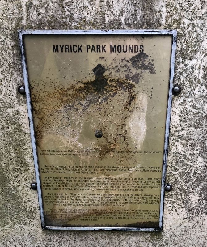
This reproduction of an 1883 map shows the relative location of four mounds at that time. The two mounds that have been destroyed are shown in the outline.
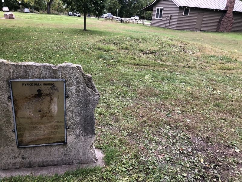
These two mounds a round mound and a mound in the shape (or effigy) of an animal, were built by the so-called Effigy Mound Culture. This Late Woodland Native American culture occupied southern Wisconsin from about 700-1100 A.D.
Many earthen mounds in the Midwest were constructed for burial purposes. Some effigy mounds, however, were not intended for human internment. The original meaning of the various shapes of the effigies is not known today. The most common interpretation is that the animals represent clan or totem symbols. Whatever the exact meaning, clearly these mounds represent sacred activity of Native Americans who gathered here about a thousand years ago.
The people of the Effigy Mound Culture were primarily hunters and gathers, moving on a seasonal schedule to available natural resources. Remains of corn at their sites shows that they were also the first in the Upper Mississippi Valley to experiment with agriculture. This site was probably occupied by a group of about 50 to 100 people during the warm season when the adjacent marsh would have offered abundant game and wild plant resources.
The two mounds that you now see are all that remains
of a group of five. One of the round mounds was located 250 feet to the west by (illegible) of St. Paul in 1885 and is not shown on the map. The mound group was first reported in 1883 when Frederick Putnam of Harvard University studied the mounds finding only a few fragments of pottery and bone. The findings (illegible) were found on Putnam's notes.Topics. This historical marker is listed in these topic lists: Cemeteries & Burial Sites • Native Americans. A significant historical year for this entry is 1883.
Location. 43° 49.314′ N, 91° 13.511′ W. Marker is in La Crosse, Wisconsin, in La Crosse County. Marker is on Myrick Park Road, 0.3 miles north of La Crosse Street. Touch for map. Marker is at or near this postal address: 2000 La Crosse Street, La Crosse WI 54601, United States of America. Touch for directions.
Other nearby markers. At least 8 other markers are within walking distance of this marker. Group of Indian Mounds (within shouting distance of this marker); Myrick Park Treewalk (approx. ¼ mile away); Losey Memorial (approx. 0.6 miles away); 16th and State (approx. 0.7 miles away); 12th and La Crosse (approx. 0.8 miles away); Concordia Hall (approx. 0.8 miles away); Red Cloud Park (approx. 0.8 miles away); La Crosse: "A Choice Town" (approx. one mile away). Touch for a list and map of all markers in La Crosse.
Credits. This page was last revised on October 31, 2019. It was originally submitted on October 30, 2019, by Ruth VanSteenwyk of Aberdeen, South Dakota. This page has been viewed 1,329 times since then and 202 times this year. Photos: 1, 2. submitted on October 30, 2019, by Ruth VanSteenwyk of Aberdeen, South Dakota. • Mark Hilton was the editor who published this page.

