Fort Benton in Chouteau County, Montana — The American West (Mountains)
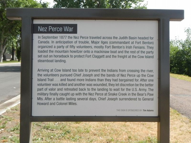
Nez Perce War
Photographed by Barry Swackhamer, August 14, 2019
1. Nez Perce War Marker
Arriving at Cow Island too late to prevent the Indians from crossing the river, the volunteers pursued Chief Joseph and the bands of Nez Perce up the Cow Island Trail ... and found more Indians than they had bargained for. After one volunteer was killed and another was wounded, they let discretion be the better part of valor and retreated back to the landing to wait for the U.S. Army. The military finally caught up with the Nez Perce at Snake Creek in the Bear's Paw Mts. After a battle lasting several days, Chief Joseph surrendered to General Howard and Colonel Miles.
Erected by Fort Benton Community Improvement Association.
Topics and series. This historical marker is listed in these topic lists: Indigenous Peoples and Communities
this page online
Location. 47° 49.269′ N, 110° 39.757′ W. Marker is in Fort Benton, Montana, in Chouteau County. It is on Front Street near 18th Street, on the right when traveling east. Touch for map. Marker is in this post office area: Fort Benton MT 59442, United States of America. Touch for directions.

Regionally, this marker is in Central Montana, in Missouri River Country, and specifically in Russell Country. It is also in the American Mountain West and in the Lewis & Clark Corridor. Globally, it is in North America, the Western Hemisphere, the Western World, and the Anglosphere. Historically, it finds itself in what was once Rupert’s Land and also the Louisiana Purchase.
Other nearby markers. At least 8 other markers are within walking distance of this marker: Buffalo Robe Fur Press (within shouting distance of this marker); The Engage's Quarters (within shouting distance of this marker); Old Fort Benton (about 300 feet away, measured in a direct line); Fort Benton Historic District (about 400 feet
Photographed by Barry Swackhamer, August 14, 2019
2. 1877 Cow Island Fight, on back
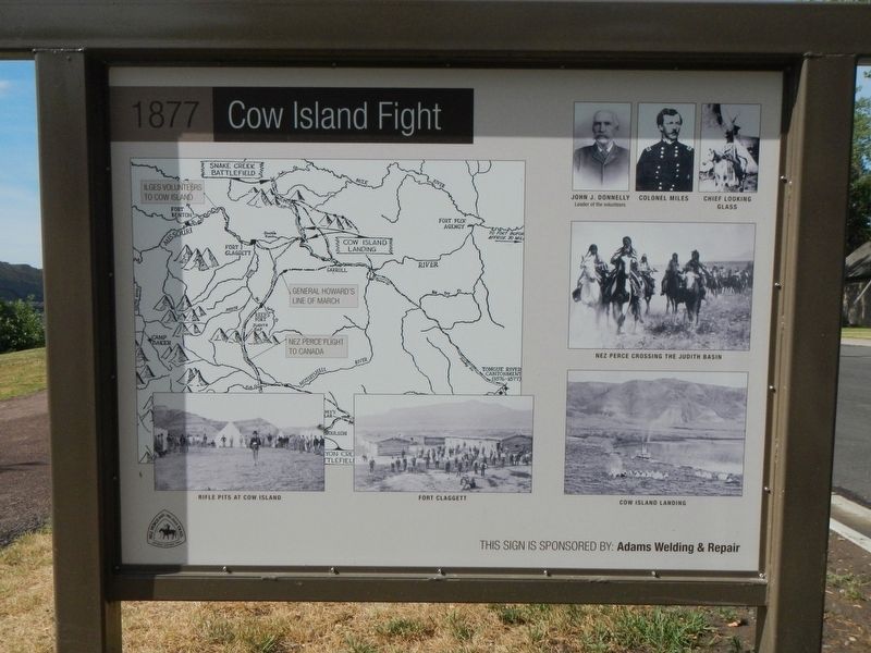
Captions: (upper left) map of the Nez Perce flight and US Army line of march; (bottom left) Rifle Pits at Cow Island; (bottom center) Fort Claggett; (bottom right) Cow Island Landing; (middle right) Nez Perce Crossing the Judith Basin; (top right) John J. Donnelly, Colonel Miles, Chief Looking Glass.
More about this marker. This marker is in the riverside park opposite Old Fort Benton.
Also see . . . Cow Island, Montana. ...As darkness fell, Nez Perce warriors fired on the entrenched soldiers from the bluffs. While the army unit was thus pinned down behind their shallow entrenchments, the Nez Perce broke into the freight storage area under cover of night and took what they wanted.
The next day, the Nez Perce moved up Cow Creek, but on September 25, 1877, they again engaged in a rear guard action in what is sometimes referred to as the Battle of Cow Creek Canyon, repulsing a pursuing army unit under command of Major Igles. On the same day, they ransacked and then burned a freight wagon train they overtook on the Cow Creek trail. (Submitted on November 5, 2019, by Barry Swackhamer of Brentwood, California.)
Photographed by Barry Swackhamer, August 14, 2019
3. Nez Perce War Marker
Credits. This page was last revised on November 7, 2019. It was originally submitted on November 5, 2019, by Barry Swackhamer of Brentwood, California. This page has been viewed 455 times since then and 51 times this year. Photos: 1, 2, 3. submitted on November 5, 2019, by Barry Swackhamer of Brentwood, California.
