Sandston in Henrico County, Virginia — The American South (Mid-Atlantic)
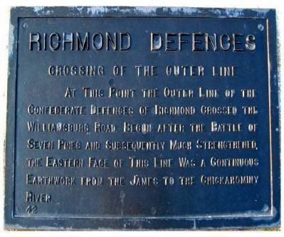
Richmond Defences
Crossing of the Outer Line
Erected by Battlefield Markers Association. (Marker Number 42.)
Topics and series. This historical marker is listed in this topic list: War, US Civil. In addition, it is included in the Freeman Markers (Richmond Battlefields) series list.
Location. 37° 31.135′ N, 77° 20.104′ W. Marker is in Sandston, Virginia, in Henrico County. Marker is on West Williamsburg Road (Route 60) 0.1 miles west of Sandburne Parkway, on the right. Touch for map. Marker is in this post office area: Sandston VA 23150, United States of America. Touch for directions.
Other nearby markers. At least 8 other markers are within 2 miles of this marker, measured as the crow flies. Virginia Air National Guard (about 700 feet away, measured in a direct line); Civil War Balloonists (about 800 feet away); Civil War Artillery (approx. 0.3 miles away); McClellan’s Picket Line (approx. 0.8 miles away); Battlefield of Seven Pines (approx. 0.9 miles away); Sandston (approx. one mile away); a different marker also named Battlefield of Seven Pines (approx. 1.1 miles away); McClellan’s First Line (approx. 1.1 miles away). Touch for a list and map of all markers in Sandston.
Also see . . . Virtual Tour by Markers of the Battle of Seven Pines. This is one of several markers describing the actions of May 31 - June 1, 1862. (Submitted on May 1, 2009, by Bernard Fisher of Richmond, Virginia.)
Additional keywords. Freeman Markers, Richmond Battlefield Parks Corporation, Douglas Southall Freeman
Credits. This page was last revised on June 16, 2016. It was originally submitted on December 8, 2008, by Bernard Fisher of Richmond, Virginia. This page has been viewed 1,331 times since then and 16 times this year. Photos: 1, 2. submitted on December 8, 2008, by Bernard Fisher of Richmond, Virginia. • Craig Swain was the editor who published this page.

