Bath Springs in Decatur County, Tennessee — The American South (East South Central)
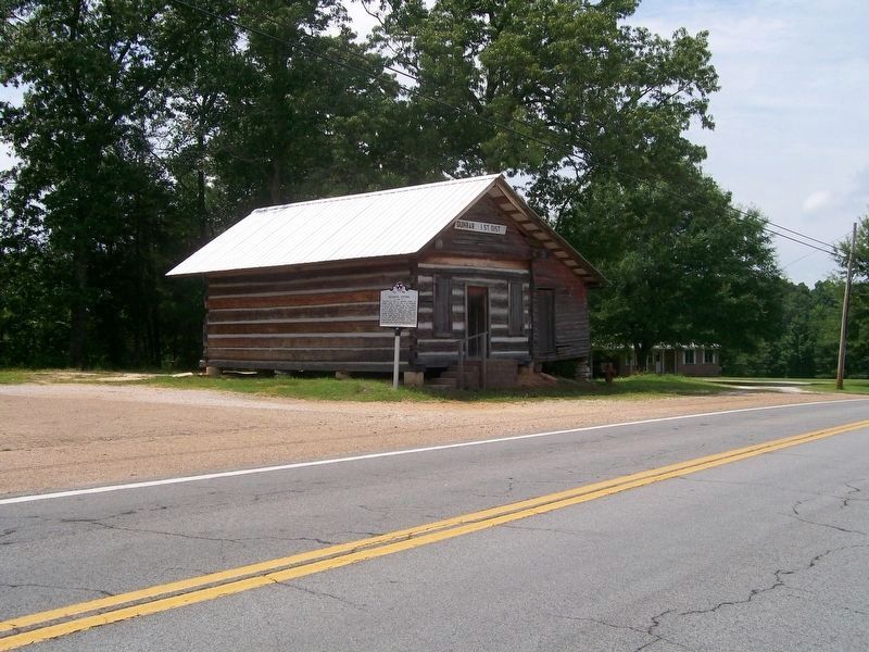
Dunbar Store
(side 1)
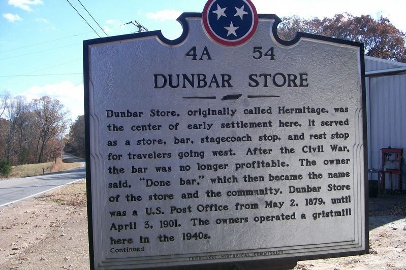
Dunbar Store, originally called Hermitage, was the center of early settlement here. It served as a store, bar, stagecoach stop, and rest stop for travelers going west. After the Civil War, the bar was no longer profitable. The owner said, "Done bar," which then became the name of the store and the community. Dunbar Store was a U.S. Post Office from May 2, 1879, until April 3, 1901. The owners operated a gristmill here in the 1940s.
Continued
(side 2)
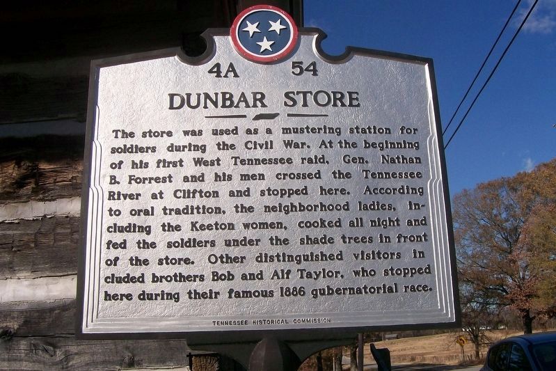
The store was used as a mustering station for soldiers during the Civil War. At the beginning of his first West Tennessee raid, Gen. Nathan B. Forrest and his men crossed the Tennessee River at Clifton and stopped here. According to oral tradition, the neighborhood ladles, including the Keeton women, cooked all night and fed the soldiers under the shade trees in front of the store. Other distinguished visitors included brothers Bob and Alf Taylor, who stopped here during their famous 1866 gubernatorial race.
Erected 2012 by Tennessee Historical Commission. (Marker Number 4A 54.)
Topics and series. This historical marker is listed in these topic lists: Industry & Commerce • Settlements & Settlers • War, US Civil. In addition, it is included in the Tennessee Historical Commission series list.
Location. 35° 27.532′ N, 88° 8.673′ W. Marker is in Bath Springs, Tennessee, in Decatur County. Marker is at the intersection of Tennessee Route 114 and Dunbar Road, on the left when traveling north on State Route 114. Touch for map. Marker is at or near this postal address: 2755 Highway 114 W, Bath Springs TN 38311, United States of America. Touch for directions.
Other nearby markers. At least 8 other markers are within 7 miles of this marker, measured as the crow flies. Dr. B.M. Brooks House (approx. 3.4 miles away); Doe Creek Church and School (approx. 5.8 miles away); Doe Creek Cemetery (approx. 5.9 miles away); Doe Creek School (approx. 5.9 miles away); The Temple (approx. 6 miles away); W.S. "Fluke" Holland (approx. 6.7 miles away); Veterans Marker (approx. 6.7 miles away); Prof. B.A. Tucker (approx. 6.8 miles away).
Also see . . . Keeton Store, Dunbar, Tennessee. Decatur County TNGenWeb (Submitted on November 19, 2019.)
Credits. This page was last revised on November 20, 2019. It was originally submitted on November 18, 2019, by David Austin of Scotts Hill, Tennessee. This page has been viewed 719 times since then and 35 times this year. Photos: 1, 2. submitted on November 19, 2019, by David Austin of Scotts Hill, Tennessee. 3. submitted on November 18, 2019, by David Austin of Scotts Hill, Tennessee. • Bernard Fisher was the editor who published this page.


