Near Chinook in Blaine County, Montana — The American West (Mountains)
Chief Joseph’s Surrender
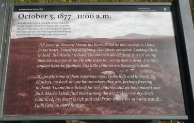
October 5, 1887 11:00 a.m.
Tell General Howard I know his heart. What he told me before I have in my heart. I an tired of fighting. Our chiefs are killed. Looking Glass is dead. Tukulxućúut is dead. The old men are all dead. It is the young men who say yes or no. He who leads the young men is dead. It is cold and we have no blankets. The little children are freezing to death.
My people some of them have run away to the hills and have no blankets, no food; no one knows where they are, perhaps freezing to death. I want to look for my children and see how many I can find. Maybe I shall find them among the dead. Hear me my chiefs, I am tired; my heart is sick and sad. From where the sun now stands, I will fight no more forever.
Erected by National Park Service, U.S. Department of the Interior.
Topics and series. This historical marker is listed in these topic lists: Native Americans • Wars, US Indian. In addition, it is included in the The Nez Perce Trail series list. A significant historical date for this entry is October 5, 1877.
Location. 48° 22.574′ N, 109° 12.659′ W. Marker is near Chinook, Montana, in Blaine County. Marker can be reached from Cleveland Road (County Road 240) near S-B Road. Touch for map. Marker is in this post office area: Chinook MT 59523, United States of America. Touch for directions.
Other nearby markers. At least 8 other markers are within walking distance of this marker. Soldier Burials (about 300 feet away, measured in a direct line); Bear Paw Battlefield (about 700 feet away); Nez Perce National Historical Park (about 700 feet away); ćáynim?a•lika?spe (about 700 feet away); Last Battle (about 700 feet away); Bear's Paw Battleground (about 700 feet away); Surrender of Chief Joseph (about 700 feet away); Nez Perce Encampment (approx. 0.2 miles away). Touch for a list and map of all markers in Chinook.
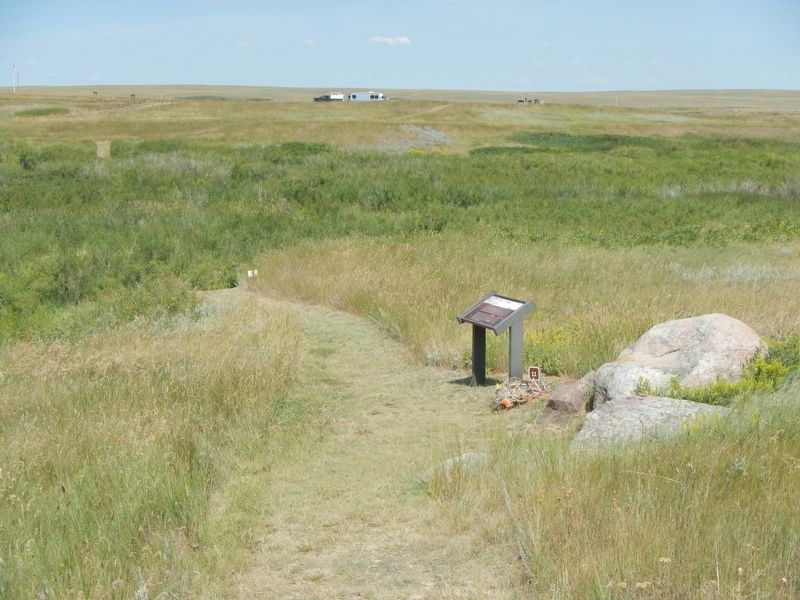
More about this marker. This marker is located on the Bear Paw Battlefield Trail. The trail is a loop, about 1 1/4 miles long, starting at the Bear Paw Battlefield parking lot.
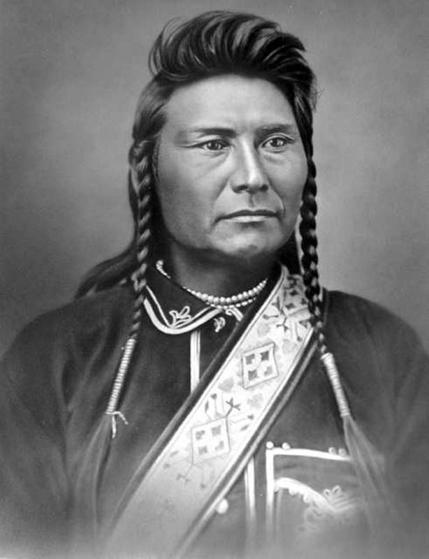
Also see . . . Wikipedia entry for Chief Joseph. Excerpt:
Chief Joseph led his band of Nez Perce during the most tumultuous period in their history, when they were forcibly removed by the United States federal government from their ancestral lands in the Wallowa Valley of northeastern Oregon onto a significantly reduced reservation in the Idaho Territory. A series of violent encounters with white settlers in the spring of 1877 culminated in those Nez Perce who resisted removal, including Joseph’s band and an allied band of the Palouse tribe, to flee the United States in an attempt to reach political asylum alongside the Lakota people, who had sought refuge in Canada under the leadership of Sitting Bull.(Submitted on September 26, 2020.)
At least 700 men, women, and children led by Joseph and other Nez Perce chiefs were pursued by the U.S. Army under General Oliver O. Howard in a 1,170-mile fighting retreat known as the Nez Perce War. The skill with which the Nez Perce fought and the manner in which they conducted themselves in the face of incredible adversity earned them widespread admiration from their military opponents and the American public, and coverage of the war in U.S. newspapers led to popular recognition of Chief Joseph and the Nez Perce.
In October 1877, after months of fugitive resistance, most of the surviving remnants of Joseph’s band were cornered in northern Montana Territory, just 40 miles (64 km) from the Canadian border. Unable to fight any longer, Chief Joseph surrendered to the Army with the understanding that he and his people would be allowed to return to the reservation in western Idaho. He was instead transported between various forts and reservations on the southern Great Plains before being moved to the Colville Indian Reservationin the state of Washington, where he died in 1904.
Chief Joseph’s life remains iconic of the American Indian Wars. For his passionate, principled resistance to his tribe’s forced removal, Joseph became renowned as a humanitarian and peacemaker.
Credits. This page was last revised on September 30, 2020. It was originally submitted on November 22, 2019, by Barry Swackhamer of Brentwood, California. This page has been viewed 1,360 times since then and 109 times this year. It was the Marker of the Week September 27, 2020. Photos: 1, 2. submitted on November 22, 2019, by Barry Swackhamer of Brentwood, California. 3. submitted on September 26, 2020, by J. J. Prats of Powell, Ohio.


