Near Williston in Williams County, North Dakota — The American Midwest (Upper Plains)
Missouri-Yellowstone Confluence
Missouri-Yellowstone Confluence Interpretive Center

Photographed By Barry Swackhamer, August 16, 2019
1. Missouri-Yellowstone Confluence Marker
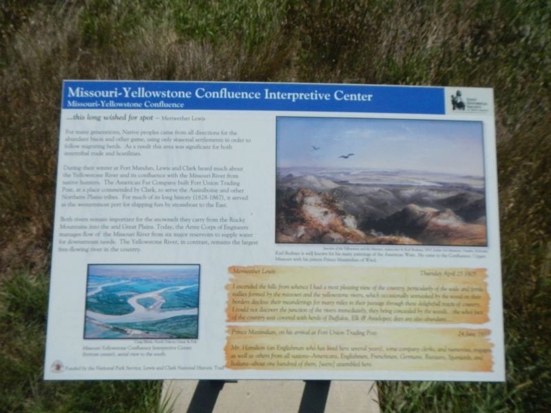
Captions: (bottom left) Missouri-Yellowstone Confluence Interpretive Center (bottom center), aerial view to the south.; (upper right) Junction of the Yellowstone and the Missouri by Karl Bodmer, 1833. Karl Bodmer is well known for his many paintings of the American West. He came to the Confluence / Upper Missouri with is patron Prince Maximilian of Wied.
For many generations, Native peoples came from all directions for the abundant bison and other game, using only seasonal settlements in order to follow migrating herds. As a result this area was significant for both intertribal trade and hostilities.
During their winter at Fort Mandan, Lewis and Clark heard much about the Yellowstone River and its confluence with the Missouri River from native hunters. The American Fur Company built Fort Union Trading Post, at a place commended by Clark, to serve the Assiniboine and other Northern Plains tribes. For much of its long history (1828-1867), it served as the westernmost port for shipping furs by steamboat to the East.
Both rivers remain important for the snowmelt they carry from the Rocky Mountains into the arid Great Plains. Today, the Army Corp of Engineers manages flow of the Missouri River from six major reservoirs to supply water for downstream needs. The Yellowstone River, in contrast, remains the largest free-flowing river in the country.
I ascended the hills from whence I had a most pleasing view of the country, perticularlly of the wide and fertile vallies formed by the missouri and the yellowstone rivers, which occasionally unmasked by the wood on their borders disclose their meandering for many miles in their passage through these delightfull tracts of country. I could not discover the junction of the rivers immediately, they being concealed by the woods....the whol face of the country was covered with herds of Buffaloe, Elk & Antelopes; deer are also abundant.... -- Meriwether Lewis, Thursday April 25 1805
Mr. Hamilton (an Englishman who has lived here several years), some company clerks, and numerous, engages as well as other from all nations - Americans, Englishmen, Frenchmen, Germans, Russians, Spaniards, and Italians - about one hundred of them, (were) assembled here. -- Prince Maximilian, on his arrival at Fort Union Trading Post, 24 June 1833
Erected by State Historical Society of North Dakota.
Topics and series. This historical marker is listed in this topic list: Waterways & Vessels. In addition, it is included in the Lewis & Clark Expedition series list. A significant historical date for this entry is August 24, 1805.
Location. 47° 59.087′ N, 103° 59.258′ W. Marker is near Williston, North Dakota, in Williams County. Marker can be reached from 39th Lane Northwest near 153rd Avenue Northwest. Touch for map. Marker is at or near this postal address: 15349 39th Lane Northwest, Williston ND 58801, United States of America. Touch for directions.
Other nearby markers. At least 8 other markers are within walking distance of this marker. A Beaver Boom (within shouting distance of this marker); Missouri-Yellowstone Confluence Area (within shouting distance of this marker); Mosquitoes (within shouting distance of this marker); Oxbow Wetland (about 400 feet away, measured in a direct line); Lesser Known Forts at the Confluence (about 400 feet away); Lewis & Clark's America (about 500 feet away); The Confluence (about 500 feet away); Fur Trade Forts (about 500 feet away). Touch for a list and map of all markers in Williston.
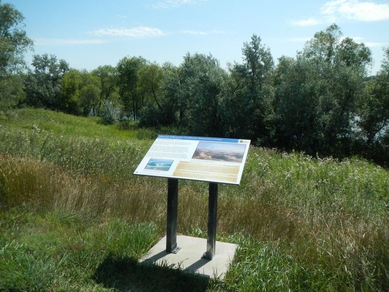
More about this marker. The marker is on the grounds of the Missouri-Yellowstone Confluence Interpretive Center.
Credits. This page was last revised on November 29, 2019. It was originally submitted on November 28, 2019, by Barry Swackhamer of Brentwood, California. This page has been viewed 269 times since then and 24 times this year. Photos: 1, 2. submitted on November 28, 2019, by Barry Swackhamer of Brentwood, California. 3. submitted on November 29, 2019, by Barry Swackhamer of Brentwood, California.

