Near Williston in Williams County, North Dakota — The American Midwest (Upper Plains)
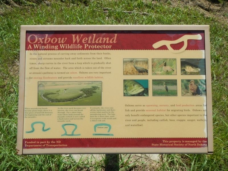
Oxbow Wetland
A Winding Wildlife Protector

Photographed By Barry Swackhamer, August 16, 2019
1. Oxbow Wetland Marker
Caption: (bottom left) When meandering bends become giant loops , there is a thin piece of land left between the beginning and the end of the meander.
As the river neck becomes very narrow, the river can break through. For a short time, water flows both around the meander (which is now called the backwater) and across the meander neck/
Eventually, the river cuts of the backwater and flows across what used to be the meander neck. The lake lasts for a short time, until it overgrows with weeds and is filled with soil.
Oxbows serve as spawning, nursery, and food production areas for fish and provide seasonal habitat for migrating birds. Oxbows not only benefit endangered species, but other species important to the river and people, including catfish, bass, crappie, sauger, walleye and waterfowl.
Erected by State Historical Society of North Dakota.
Topics. This historical marker is listed in this topic list: Natural Features.
Location. 47° 59.124′ N, 103° 59.167′ W. Marker is near Williston, North Dakota, in Williams County. Marker can be reached from 39th Lane Northwest near 153rd Avenue Northwest. Touch for map. Marker is at or near this postal address: 15349 39th Lane Northwest, Williston ND 58801, United States of America. Touch for directions.
Other nearby markers. At least 8 other markers are within walking distance of this marker. Lewis & Clark's America (within shouting distance of this marker); The Confluence (within shouting distance of this marker); Fur Trade Forts (within shouting distance of this marker); Buford-Trenton Project (within shouting distance of this marker); A Beaver Boom (about 300 feet away, measured in a direct line); Missouri-Yellowstone Confluence Area (about 300 feet away); Missouri-Yellowstone Confluence (about 400 feet away); Mosquitoes (about 600 feet away). Touch for a list and map of all markers in Williston.
More about this marker. The marker is on the grounds of the Missouri-Yellowstone Confluence Interpretive Center.
Credits. This page was last revised on November 28, 2019. It was originally submitted on November 28, 2019, by Barry Swackhamer of Brentwood, California. This page has been viewed 155 times since then and 7 times this year. Photo 1. submitted on November 28, 2019, by Barry Swackhamer of Brentwood, California.