Near Williston in Williams County, North Dakota — The American Midwest (Upper Plains)
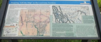
Stepping "Off the Map" in the Louisiana Territory

Photographed By Barry Swackhamer, August 16, 2019
1. Stepping "Off the Map" in the Louisiana Territory Marker
Captions: (bottom left) Lewis and Clark Geology Sign Sites; (center left) 1802 map by Aaron Arrowsmith which Lewis and Clark took on their expedition.; (upper right) A portion of William Clark's map, published by Biddle in 1814. Clark compiled the new map fro the Lewis and Clark Expedition records and information fro a few later explorers.
The Lewis and Clark Expedition was the first major scientific venture funded by the United States of America. Mapping rivers was the principle stated goal of the Expediton. Water transportation was key to exploring the new territory's resources. At the beginning of the 19th Century, natural lakes and rivers provided only practical routes for moving major trade goods across a developing nation with almost no roads.
What geography did the explorers already know?
The Expedition carried a recent map that included two well-defined destinations on their route. The first was the Mandan Villages, where the Expedition built Fort Mandan as headquarters for the winter of 1804-05. The second was the mouth of the Columbia River, near which the Expediton built its 1805-1806 winter headquarters, Fort Clatsop. The Rocky Mountains and Black Hills were named, but only vaguely located.
At Fort Mandan, Lewis and Clark used the long winter to gather much new geographic information from Native Americans of several tribes. From them, the explorers gathered details of the Missouri and its tributaries all the way to the Great Falls. They learned Native American names for the major tributaries and the order in which they would be encountered. Their knowledge of the Missouri River and its tributaries was very much improved, but still very incomplete.
Unknowns
The biggest question was the nature of the Continental Divide separating the Missouri River drainage from the rivers that went to the Pacific. There were incorrect predictions that the Divide was a single broken chain of mountains with easy passes or just a flat pyramid-shaped high plain. Maybe most of the major rivers were just a short portage from each other...or maybe not.
The Expedition's contribution
Compare the 1803 Arrowsmith map and the 1814 Clark map to see how much the "Voyage of Discovery" added to geographical knowledge of the American West.
Would President Jefferson have made the Louisiana Purchase if he had known that a razor-backed bulge of many high
mountain ranges, hundreds of miles wide in places, split the continent? As they passed the future site of Fort Union, that realization was still four months away for Lewis and Clark.
The Indians inform that the yellowstone river is navigable for perogues and canoes nearly to its source in the Rocky Mountains, and that in it's course near these mountains it passes within less than half a day's march to a navigable part of the Missouri. it's extreem sources are adjacent to those of the Missouri, river platte, and I think probably with some of the South branch of the Columbia river. -- Meriwether Lewis, April 26, 1805
Erected by National Park Service, Lewis and Clark National Historic Trail.
Topics and series. This historical marker is listed in these topic lists: Exploration • Waterways & Vessels. In addition, it is included in the Former U.S. Presidents: #03 Thomas Jefferson, and the Lewis & Clark Expedition series lists. A significant historical date for this entry is April 26, 1895.
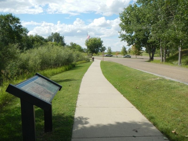
Location. 47° 59.972′ N, 104° 2.66′ W. Marker is near Williston, North Dakota, in Williams County. Marker is on Mondak Backroad 1 near 143rd Avenue Northwest (State Route 1804), on the right when traveling east. This marker is next to the entrance road for Fort Union Trading Post National Historic Site. Technically it is in Montana, but just by a few yards. It has been placed in North Dakota because of its proximity to and association with the Missouri-Yellowstone Confluence, Fort Union and other Lewis and Clark markers. Touch for map. Marker is at or near this postal address: 15550 North Dakota 1804, Williston ND 58801, United States of America. Touch for directions.
Other nearby markers. At least 8 other markers are within walking distance of this marker. River Interstates (within shouting distance of this marker); Gravel Pits (about 400 feet away, measured in a direct line); Lewis and Clark Trail (about 400 feet away); Dwelling Range (approx. 0.2 miles away); Bourgeois House (approx. 0.2 miles away); Riverboat Landing (approx. 0.2 miles away); Front Gate (approx. 0.2 miles away); Outpost on the Missouri (approx. 0.2 miles away). Touch for a list and map of all markers in Williston.
Credits. This page was last revised on December 6, 2019. It was originally submitted on December 5, 2019, by Barry Swackhamer of Brentwood, California. This page has been viewed 154 times since then and 16 times this year. Photos: 1, 2. submitted on December 5, 2019, by Barry Swackhamer of Brentwood, California.
