Kennesaw in Cobb County, Georgia — The American South (South Atlantic)
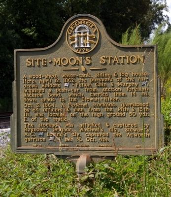
Site - Moon's Station
Photographed by David Seibert, October 20, 2008
1. Site - Moon's Station Marker
Oct. 3, 1864. A Federal stockade, garrisoned by 84 officers & men from the 14th & 15th Ill., was located on the high ground 50 yds. E. of the track.
The stockade was attacked & captured by Reynolds' brigade, Walthall's div., Stewart's A. C. [CS] Loring's div. captured the Acworth garrison [US], 4 mi. N., Oct. 4th.
Erected 1954 by Georgia Historical Commission. (Marker Number 033-45.)
Topics and series. This historical marker is listed in these topic lists: Railroads & Streetcars • War, US Civil. In addition, it is included in the Georgia Historical Society series list. A significant historical month for this entry is April 1865.
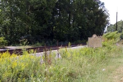
Location. 34° 3.1′ N, 84° 36.921′ W. Marker is in Kennesaw, Georgia, in Cobb County. It is on Baker Road NW 0 miles south of Dresden Green NW, on the left when traveling north. Touch for map. Marker is in this post office area: Kennesaw GA 30144, United
this page online

Regionally, this marker is in Georgia’s Piedmont and in Metro Atlanta. It is also in the American South and specifically in the Deep South. Globally, it is in North America, the Western Hemisphere, the Western World, and the Anglosphere. Historically, it finds itself in what was once the original Cherokee Nation, the territory of the Mississippian Culture, one of the original Thirteen Colonies, one of the Confederate States of America, and the Antebellum South.
Other nearby markers. At least 8 other markers are within 2 miles of this marker, measured as the crow flies: Veterans Memorial (approx. 1.9 miles away); William A. Fuller (approx. 1.9 miles away); Locomotive "General" (approx. 1.9 miles away); Federal Occupation of Big Shanty (approx. 1.9 miles away); Stewart's Corps at Big Shanty (approx. 1.9 miles away); Site - Lacy Hotel (approx. 1.9 miles away); The Andrews Raid (approx. 1.9 miles away); Big Shanty (approx. 1.9 miles away). Touch for a list and map of all markers in Kennesaw.
Photographed by David Seibert, October 20, 2008
2. Site - Moon's Station Marker
Credits. This page was last revised on May 27, 2020. It was originally submitted on December 10, 2008, by David Seibert of Sandy Springs, Georgia. This page has been viewed 2,514 times since then and 81 times this year. Photos: 1, 2. submitted on December 10, 2008, by David Seibert of Sandy Springs, Georgia. • Craig Swain was the editor who published this page.
