Near Blairsden-Graeagle in Plumas County, California — The American West (Pacific Coastal)
Pioneer Ski Area of America
Photographed by Barry Swackhamer, May 30, 2012
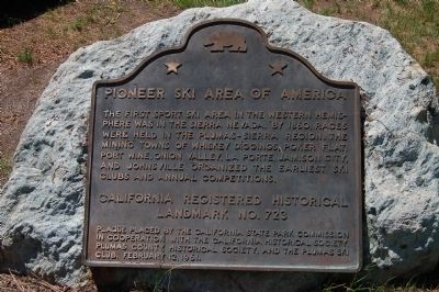
1. Pioneer Ski Area of America Marker
The first sport ski area in the western hemisphere was in the Sierra Nevada. By 1860, races were held in the Plumas-Sierra region. The mining towns of Whiskey Diggings, Poker Flat, Port Wine, Onion Valley, La Porte, Jamison City, and Johnsville organized the earliest ski clubs and annual competitions.
Erected 1961 by California State Park Commission, California Historical Society, Plumas County Historical Society, and the Plumas Ski Club. (Marker Number 723.)
Topics and series. This historical marker is listed in these topic lists: Notable Events • Sports. In addition, it is included in the California Historical Landmarks series list. A significant historical year for this entry is 1860.
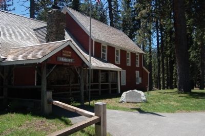
Location. 39° 45.397′ N, 120° 41.861′ W. Marker is near Blairsden-Graeagle, California, in Plumas County. It can be reached from Johnsville - McCrea Road, on the left when traveling north. The marker is mounted on a boulder in front of the Eureka-Plumas State Park Museum. Touch for map. Marker is in this post office area: Blairsden Graeagle CA 96103, United States of America. Touch for directions.

Regionally, this marker is in
this page online
Other nearby markers. At least 8 other markers are within 5 miles of this marker, measured as the crow flies: Emigrant Trail (about 400 feet away, measured in a direct line); Thar’s Gold in Them Hills! (about 600 feet away); Winter in the Sierra (about 600 feet away); Johnsville Firehouse (approx. ¼ mile away); Longboard Ski Races (approx. 0.7 miles away); Jamison City, Eureka Mine and Mill, Johnstown (approx. 4 miles away); Olympic Flagpole (approx. 4.3 miles away); a different marker also named Jamison City, Eureka Mine and Mill, Johnstown (approx. 4.6 miles away). Touch for a list and map of all markers in Blairsden-Graeagle.
Another marker is no longer nearby. Mohawk Hotel and Tavern (was approx. 3.7 miles away but has been confirmed missing).
Related marker.
Photographed by Barry Swackhamer, May 30, 2012
2. Pioneer Ski Area of America Marker
Also see . . . Eureka-Plumas State Park. California Parks and Recreation website entry:
Plumas-Eureka State Park was established in 1959, and provides visitors with a glimpse into a fascinating period of California history, as well as opportunities for quiet recreation in a beautiful high Sierra mountain setting. (Submitted on June 16, 2012, by Barry Swackhamer of Brentwood, California.)
Photographed by Barry Swackhamer, May 30, 2012
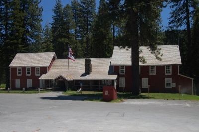
3. Eureka Plumas State Park Museum
Credits. This page was last revised on April 19, 2024. It was originally submitted on June 16, 2012, by Barry Swackhamer of Brentwood, California. This page has been viewed 928 times since then and 28 times this year. Last updated on December 11, 2019, by Craig Baker of Sylmar, California. Photos: 1, 2, 3. submitted on June 16, 2012, by Barry Swackhamer of Brentwood, California. • J. Makali Bruton was the editor who published this page.
