Southwest Jacksonville in Duval County, Florida — The American South (South Atlantic)
The Harvey Farm
Jacksonville On The Edge Of The Civil War
| — | Camp Milton Historic Preserve | — |

Photographed by Brandon D Cross, November 11, 2019
1. The Harvey Farm Marker
Historic Florida farm
In 1889 Mr. Harvey built his home near the Camp Milton site. When the State of Florida purchased property for the establishment of Whitehouse Field, the Harvey home was moved to the town of Whitehouse. In 2002, the original Harvey cabin was moved to Camp Milton, within a mile of the home’s original location. Construction of the Camp Milton Historic Preserved added the farm and farm yard fencing to show how a typical Florida homestead may have looked. Typical farm features including a livestock barn, sugar cane mill, storage shed , sweet potato cellar and outhouse may be added in the future.
Historic farm features
Although the Harvey cabin was built in 1889, the homestead would have likely resembled a Civil War era farm. Other than the cabin, the Harvey homestead included a detached kitchen building. The structures shown below are from a farm in South Georgia. Similar buildings may have been found on neighboring Northeast Florida homesteads.
Topics. This historical marker is listed in these topic lists: Agriculture • Settlements & Settlers.
Location. 30° 20.154′ N,
this page online

Regionally, this marker is in Florida’s First Coast. It is also in the American South and on the Eastern Seaboard. Globally, it is in the North Atlantic Region, North America, a Gulf of Mexico state, the Western Hemisphere, the Western World, and the Anglosphere. Historically, it finds itself in what was once New Spain, the territory of the Mississippian Culture, one of the Confederate States of America, and the Antebellum South.
Other nearby markers. At least 8 other markers are within walking distance of this marker: Stonewall Jackson Prayer Oak (within shouting distance of this marker); Jefferson Davis Live Oak (within shouting distance of this marker); Fort Fisher Live Oak (within shouting

Photographed by Brandon D Cross, November 11, 2019
2. The Harvey Farm Marker

Photographed by Brandon D Cross, November 11, 2019
3. Photo Insert Left
Conceptual artistic rendering of a typical 1800’s farm

Photographed by Brandon D Cross, November 11, 2019
4. Photo Insert Center Top
Livestock barn: The livestock barn sheltered a variety of farm animals including sheep, cattle, chickens and horses.

Photographed by Brandon D Cross, November 11, 2019
5. Photo Insert Center Middle
Sugar Cane Mill: The cane mill was a grinder powered by hitching a mule in a circular direction. Sugar cane was fed into the grinder and juice was produced from the crushed cane for making syrup.
Photographed by Brandon D Cross, November 11, 2019
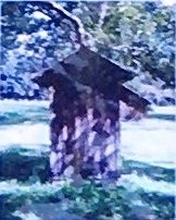
6. Photo Insert Center Bottom
Outhouse: The outhouse was a common form of sanitation on the historic farm. Dried corn cobs were the common form of bathroom tissue.

Photographed by Brandon D Cross, November 11, 2019
7. Photo Insert Right Bottom
Sweet Potato Cellar: Low sheds with sunken floors were used to store sweet potatoes. The yearly crop of potatoes was stored below ground and layered in pine straw, which held the lower underground temperature and kept the sweet potatoes cool.

Photographed by Brandon D Cross, November 11, 2019
8. The Harvey cabin located within the Camp Milton Preserve
Credits. This page was last revised on February 3, 2023. It was originally submitted on December 20, 2019, by Brandon D Cross of Flagler Beach, Florida. This page has been viewed 789 times since then and 39 times this year. Photos: 1, 2, 3, 4, 5, 6. submitted on December 20, 2019, by Brandon D Cross of Flagler Beach, Florida. 7, 8. submitted on December 21, 2019, by Brandon D Cross of Flagler Beach, Florida. • Bernard Fisher was the editor who published this page.
