St. Augustine in St. Johns County, Florida — The American South (South Atlantic)
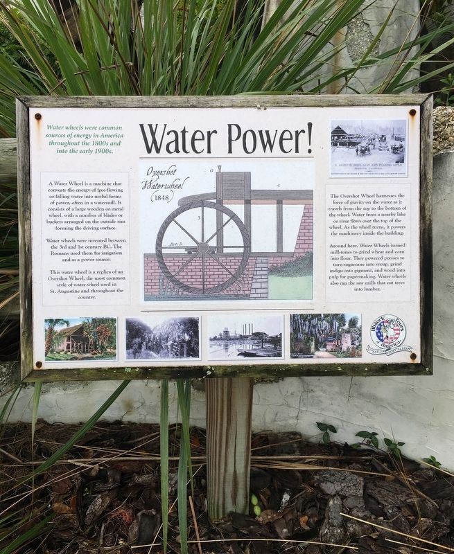
Water Power!
Photographed by Brandon D Cross, December 28, 2019
1. Water Power Marker
Water wheels were common sources of energy in America throughout the 1800s and into the early 1900s.
A Water Wheel is a machine that converts the energy of free-flowing water into useful forms of power, often in a watermill. It consists of a large wooden or metal wheel, with a number of blades or buckets arranged on the outside rim forming the driving surface.
Water wheels were invented between the 3rd and 1st century BC. The Romans used them for irrigation and as a power source.
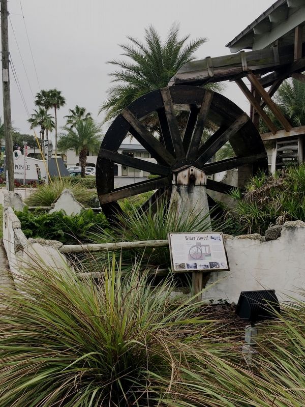
This water wheel is a replica of an Overshot Wheel, the most common style of water wheel used in St. Augustine and throughout the country.
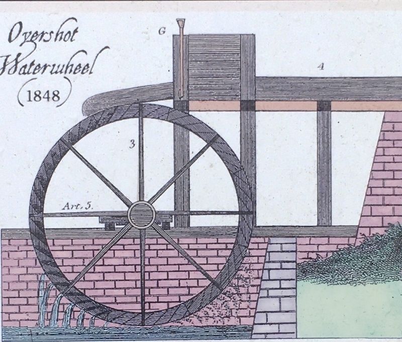
The Overshot Wheel harnesses the force of gravity on the water as it travels from the top to the bottom of the wheel. As the wheel turns, it powers the machinery inside the building.
Around here, Water Wheels turned millstones to grind wheat and corn into flour. They powered presses to turn sugar cane into syrup, grind indigo into pigment, and wood into pulp for papermaking. Water wheels also ran the saw mills that cut trees into lumber.
Erected by Historic Tours of America.
Topics.
this page online
Location. 29° 54.242′ N, 81° 19.261′ W. Marker is in St. Augustine, Florida, in St. Johns County. It is at the intersection of North Ponce De Leon Boulevard (U.S. 1) and Old Mission Avenue, on the left when traveling north on North Ponce De Leon Boulevard. Marker located in front of the Old Town Trolley Welcome Center. Touch for map. Marker is at or near this postal address: 1305 N Ponce De Leon Blvd, Saint Augustine FL 32084, United States of America. Touch for directions.

Regionally, this marker is in First Coast and in Greater Jacksonville. It is also in the American South and on the Eastern Seaboard. Globally, it is in the North Atlantic Region, North America, a Gulf of Mexico state, the Western Hemisphere, the Western World, and the Anglosphere. Historically, it finds itself in what was once New Spain, the territory of the Mississippian Culture, one of the Confederate States of America, and the Antebellum South.
Other nearby markers. At least 8 other markers are within walking
Photographed by Brandon D Cross, December 28, 2019
2. Water Power Marker
Photographed by Brandon D Cross, December 28, 2019
3. Photo Insert: Center
Overshot Waterwheel (1848)
Credits. This page was last revised on February 5, 2020. It was originally submitted on December 28, 2019, by Brandon D Cross of Flagler Beach, Florida. This page has been viewed 868 times since then and 103 times this year. Photos: 1, 2, 3. submitted on December 28, 2019, by Brandon D Cross of Flagler Beach, Florida. • Bernard Fisher was the editor who published this page.
