Eastham in Barnstable County, Massachusetts — The American Northeast (New England)
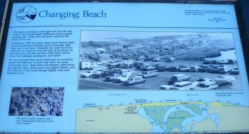
Changing Beach
Photographed by Alan M. Perrie, September 14, 2016
1. Changing Beach Marker
In February 1978, the same winter storm that brought a famous blizzard to Boston caused unusually high tides and waves here. Gradually the water level rose until all you could see were the tops of the dunes. In just 48 hours, the ebb and flow of the tides carried away the buildings, parking lot, and dunes.
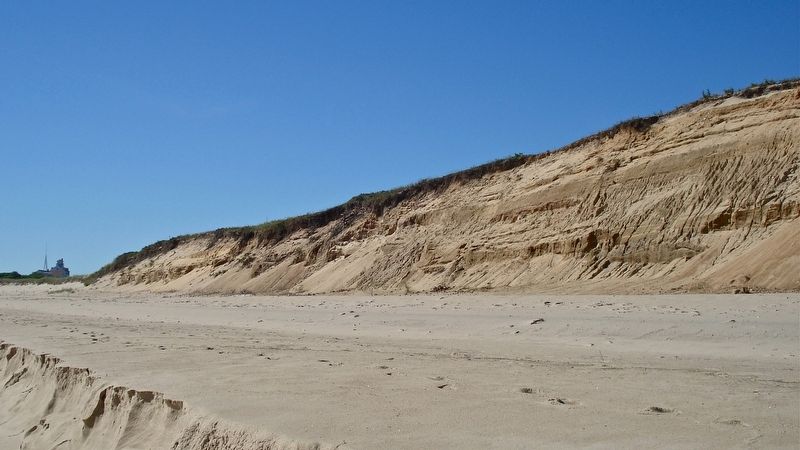
We are reminded that the ocean landscapes are transitory. Under the influence of water and wind, the sands continually move. Spits form and elongate, inlets break through the spits, dunes grow and migrate inland, and the contours of the beach change slightly with each breaking wave.
Erected by Cape Cod National Seashore.
Topics. This historical marker is listed in these topic lists: Disasters • Environment. A significant historical month for this entry is February 1978.
Location. Marker has been reported missing. It was located near 41° 50.604′ N, 69° 56.817′ W. Marker was in Eastham, Massachusetts, in Barnstable County. It could be reached from Ocean
this page online

Regionally, this marker was on Massachusetts’ Cape Cod. It was also in the American Northeast, in New England, and on the Eastern Seaboard. Globally, it was in the North Atlantic Region, North America, the Western Hemisphere, the Western World, and the Anglosphere. Historically, it found itself in what was once one of the original Thirteen Colonies.
Other nearby markers. At least 8 other markers are within 2 miles of this location, measured as the crow flies: Coast Guard Beach: (here, next to this marker); Journey of the Mayflower (a few steps from this marker); The Outermost House (a few steps from this marker); Outermost cliff and solitary dune… (about 400 feet away, measured in a direct line); Doane Rock (approx. 0.6 miles away); Adapting to Nature (approx. 1.1 miles away); The Long, Black Cable
Photographed by Alan M. Perrie, September 14, 2016
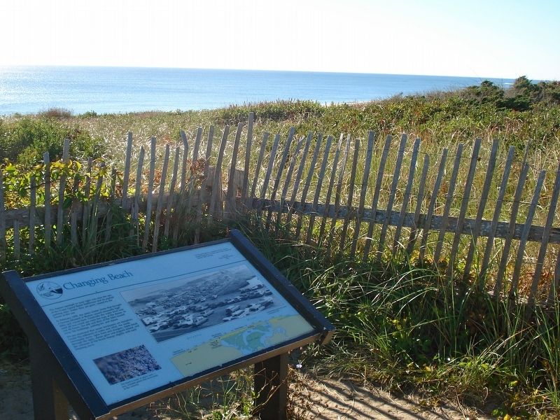
2. In 1977 you would be able to see the bathhouse and parking lot from here.
Another marker is no longer nearby. The Life Savers (was a few steps from this marker but has been confirmed missing).
Also see . . .
1. Blizzard of 1978. (Submitted on December 17, 2017, by Alan M. Perrie of Unionville, Connecticut.)
2. The bathhouse before the Blizzard. (Submitted on December 17, 2017, by Alan M. Perrie of Unionville, Connecticut.)
Photographed by Alan M. Perrie, September 14, 2016
3. A view toward Coast Guard Beach shows the influence of wind and water.
Photographed by Alan M. Perrie, September 14, 2016
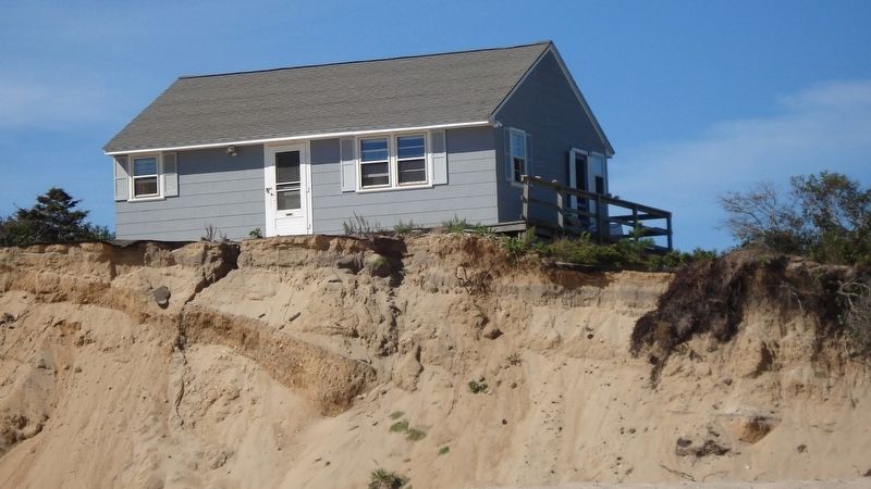
4. This house located 1 mile down the beach has so far survived.
It was completely washed away in the winter storm of January 2019.
Credits. This page was last revised on January 3, 2020. It was originally submitted on December 17, 2017, by Alan M. Perrie of Unionville, Connecticut. This page has been viewed 447 times since then and 40 times this year. Last updated on January 3, 2020, by Alan M. Perrie of Unionville, Connecticut. Photos: 1, 2, 3, 4. submitted on December 17, 2017, by Alan M. Perrie of Unionville, Connecticut. • Michael Herrick was the editor who published this page.
