Highland in Madison County, Illinois — The American Midwest (Great Lakes)
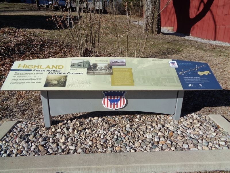
Highland
Fresh Horses and New Courses
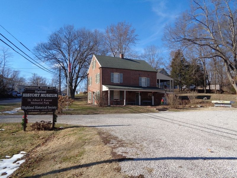
During the era of stagecoach travel, the building before you played an important role. It anchored a relay station.
Coach journeys were broken into stages of about 10 miles. At the end of each stage, drivers stopped at a relay station like this one. Here, fresh teams were hitched to the coach, and tired horses were fed, watered, and rested. Relay stations helped stagecoach companies maintain schedules challenged by weather and difficult roads.
Paving the Way
Highland resident C.J. Hug shaped the National Road - literally. In the early 1920s, Hug was contracted to pave the National Road, from Pocahontas, Ill., to Troy, Ill. When existing commercial vehicles didn't meet his needs, Hug designed a new truck better suited for roadwork.
In 1922, Hug began manufacturing his trucks. In the years that followed, Hug trucks were shipped worldwide.
Rerouting the National Road
When Joseph Shriver surveyed the National Road in 1828, Highland wasn't on the route.
Highland residents knew National Road access could secure their community's future. With aid from a soon-to-be U.S. senator named James Semple, they lobbied to reroute the National Road through Highland. The city's appeal was granted—at a price. Highland would have to construct the new route. The community rallied, providing funds, labor, and equipment. Area residents felled trees, graded earth, built bridges, and spanned the Silver Creek flood plain with a timber or "corduroy" road. By late 1843, stagecoaches were following the National Road through Highland.
Photo captions:
The Columbia Hotel provided lodging for early travelers on the National Road. The building stands today on the 800 block of Main Street.
A road crew paves the streets.
The Tavern offered food and gasoline to travelers following the National Road through Highland. The building still stands on the 400 block of Broadway.
Originally built to accommodate a rail line, Broadway ultimately became part of the National Road.
(aside:)
A Road of Dirt, Rock, And Dreams
In 1806, President Thomas Jefferson signed legislation to provide federal funding for a National Road. Surveyed from Cumberland, Md., to the Mississippi River, the National Road was a highway for pioneers eager to settle the West.
Today, as US 40, the National Road in Illinois spans 164 miles. From Indiana to East St. Louis, you can still see how the ambitions and accomplishments of early Illinois immigrants shaped our communities. You'll find their influence in our art and architecture, our industry and agriculture, and in our
way of life. Enjoy your time on the Road.
Erected 2015 by National Road Association of Illinois.
Topics and series. This historical marker is listed in these topic lists: Industry & Commerce • Roads & Vehicles • Settlements & Settlers. In addition, it is included in the The Historic National Road series list.
Location. 38° 44.337′ N, 89° 40.037′ W. Marker is in Highland, Illinois, in Madison County. Marker is on Broadway, 0.1 miles west of Swallow Lane, on the right when traveling west. Marker is located in front of Highland History Museum, which is part of Kaeser Park. Touch for map. Marker is at or near this postal address: 1739 Broadway, Highland IL 62249, United States of America. Touch for directions.
Other nearby markers. At least 8 other markers are within 2 miles of this marker, measured as the crow flies. Corporal Richard A. Hoffmann (approx. 0.9 miles away); Sergeant Junior Floyd Roniger (approx. 0.9 miles away); Sergeant 1st Class Gary J. Vasquez (approx. one mile away); Highland POWs (approx. one mile away); War Memorial (approx. one mile away); Corporal Aaron Joel Ripperda (approx. one mile away); Dennis H. Rinderer (approx. one mile away); Schiller Chapel (approx. 2 miles away). Touch for a list and map of all markers in Highland.
Also see . . .
1. Highland. From the Illinois National Road's YouTube channel, this is a short video that talks about the history of Highland, as well as recommend historical places to visit while there.
(Submitted on January 3, 2020, by Jason Voigt of Glen Carbon, Illinois.)
2. Highland Historical Society. Society homepage (Submitted on January 3, 2020, by Jason Voigt of Glen Carbon, Illinois.)
Credits. This page was last revised on July 14, 2021. It was originally submitted on January 3, 2020, by Jason Voigt of Glen Carbon, Illinois. This page has been viewed 351 times since then and 37 times this year. Photos: 1, 2. submitted on January 3, 2020, by Jason Voigt of Glen Carbon, Illinois. • Devry Becker Jones was the editor who published this page.

