Pocahontas in Bond County, Illinois — The American Midwest (Great Lakes)
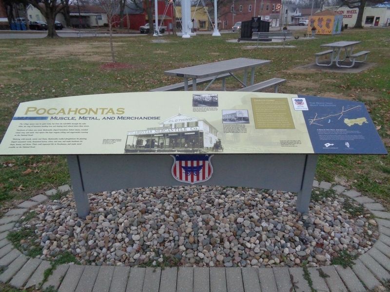
Pocahontas
Muscle, Metal, and Merchandise
Photographed by Jason Voigt, January 3, 2020
1. Pocahontas Marker
Northwest of where you stand, blacksmiths shaped horseshoes, linked chains, rounded wheel rims, and made vital repairs that kept wagons rolling and stagecoaches running on the National Road.
Working with muscle, metal, and flame, blacksmiths readied ploughshares for planting, forged carpenters' tools, sharpened knives, adzes, and axes, and made hardware for shops, homes, and farms. Their craft improved life in Pocahontas, and made travel possible on the National Road.
From Kettles to Carbide
What do cookware, clothing, and carbide lamps have in common? You could buy them at the general store.
General stores were all-purpose retail shops. Everyday items such as groceries and hand tools were always in demand. They appeared in general stores along the length of the National Road.
But a general store's merchandise also reflected the character of its community. In the early 1900s, Pocahontas' economy broadened to include coal production. General
this page online
Photo captions:
Simon Brown purchased Pocahontas Mercantile Co. in 1905. He operated the business for 20 years.
Shown here circa 1920, John and Mary DeLaurenti's general store offered a wide variety of goods, including groceries, patent medicines, clothes, ammunition, and miner's tools and accessories.
As mass-produced goods eliminated the need for blacksmiths, some found new trades, while others used their skills and shops in a related field: automobile sales and repair. In Pocahontas, the J.W. Long, Blacksmith & Wagon Repair Shop became Long's Garage. Shown here circa 1920, the building still stands northwest of the square.
Constructed south of the village in 1906, Pocahontas Mine operated until 1942. At the height of production, about 500 coal miners worked in the mine.
(aside:)
A Road of Dirt, Rock, And Dreams
In 1806, President Thomas Jefferson signed legislation to provide
Photographed by Jason Voigt, January 3, 2020
2. Pocahontas Marker
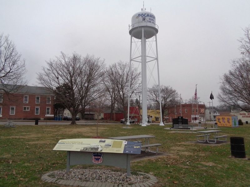
Located in the town square
Today, as US 40, the National Road in Illinois spans 164 miles. From Indiana to East St. Louis, you can still see how the ambitions and accomplishments of early Illinois immigrants shaped our communities. You'll find their influence in our art and architecture, our industry and agriculture, and in our way of life. Enjoy your time on the Road.
Erected 2015 by National Road Association of Illinois.
Topics and series. This historical marker is listed in these topic lists: Industry & Commerce • Roads & Vehicles • Settlements & Settlers. In addition, it is included in the The Historic National Road series list. A significant historical year for this entry is 1905.
Location. 38° 49.683′ N, 89° 32.452′ W. Marker is in Pocahontas, Illinois, in Bond County. It is at the intersection of State Street and Park Street, on the right when traveling east on State Street. Marker is located at the northwest corner of the town square. Touch for map. Marker is at or near this postal address: 108 East State Street, Pocahontas IL 62275, United States of America. Touch for directions.

Regionally, this marker is in Greater St. Louis. It is also in the American Midwest and in the Corn Belt. Globally, it is in North America, the Western Hemisphere, the Western World, and the Anglosphere. Historically, it finds itself in what was once the territory of the Mississippian Culture and also the Northwest Territory.
Other nearby markers. At least 8 other markers are within 9 miles of this marker, measured as the crow flies: Dedicated in Memory and Honor of Those from our Community Who so Valiantly Served our Country (here, next to this marker); Elijah Cox (approx. 2.1 miles away); Hills Fort (approx. 4.2 miles away); Vandalia Railroad Depot (approx. 7.9 miles away); Greenville Public Library (approx. 8.1 miles away); Greenville (approx. 8.1 miles away); Third Street Jail (approx. 8.1 miles away); Dennis H. Rinderer (approx. 8.2 miles away). Touch for a list and map of all markers in Pocahontas.
Another marker is no longer nearby. Kendall Morse Town House (was approx. 8.1 miles away but has been confirmed missing).
Also see . . . Pocahontas. From the Illinois National Road's YouTube channel, this is a short video that talks about the history of the small town. (Submitted on January 4, 2020, by Jason Voigt of Glen Carbon, Illinois.)
Credits. This page was last revised on January 4, 2020. It was originally submitted on January 3, 2020, by Jason Voigt of Glen Carbon, Illinois. This page has been viewed 1,406 times since then and 132 times this year. Photos: 1, 2. submitted on January 4, 2020, by Jason Voigt of Glen Carbon, Illinois. • Devry Becker Jones was the editor who published this page.
