Vandalia in Fayette County, Illinois — The American Midwest (Great Lakes)
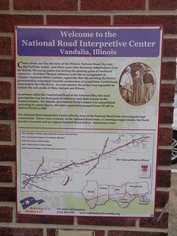
Welcome to the National Road Interpretive Center
Vandalia, Illinois
Inscription.
Come inside and live the story of the Historic National Road, the road that built the nation. Just thirty years after declaring independence from the British, the young nation was feeling the growing pains of westward expansion. President Thomas Jefferson, with the encouragement of Treasury Secretary Albert Gallatin, signed the first bill allowing the federal government to completely fund the construction of a road from Cumberland, Maryland to the Ohio River. As years passed, the project was expanded to include the new states of Ohio, Indiana and Illinois.
Sometimes called the Cumberland Road or the National Pike, this road provided the way for thousands of settlers to seek their fortune in the western frontier. For Illinois, the National Road's impact was unparalleled. According to census figures, the state's population jumped from 157,445 in 1830 to 476,183 in 1840.
The National Road Interpretive Center tells the story of the National Road from surveying through construction. There's also a Lincoln on the National Road room, a Conestoga wagon model, first hand traveler's accounts and an original National Road timber. Admission is free.
1806---President Jefferson signs legislation creating a National Road
1811---Construction begins at Cumberland, Maryland
1828---Surveying in Illinois begins
1830---Construction in Illinois begins
1838---Federal funding for National Road discontinued
Topics and series. This historical marker is listed in these topic lists: Roads & Vehicles • Settlements & Settlers. In addition, it is included in the Former U.S. Presidents: #03 Thomas Jefferson, the Former U.S. Presidents: #16 Abraham Lincoln, and the The Historic National Road series lists.
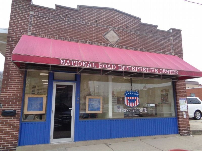
Location. 38° 57.687′ N, 89° 5.756′ W. Marker is in Vandalia, Illinois, in Fayette County. Marker is on South 5th Street just north of West Gallatin Street, on the right when traveling north. Marker is mounted on the National Road Interpretive Center building. Touch for map. Marker is at or near this postal address: 106 S 5th Street, Vandalia IL 62471, United States of America. Touch for directions.
Other nearby markers. At least 8 other markers are within walking distance of this marker. Vandalia (about 300 feet away, measured in a direct line); First Elective Office (about 300 feet away); Second State Capitol (about 300 feet away); The Charters Hotel (about 400 feet away); Ebenezer Capps' Store (about 400 feet away); Public Printer (about 400 feet away); Lincoln and the "Long Nine" (about 400 feet away); First Protest Against Slavery (about 400 feet away). Touch for a list and map of all markers in Vandalia.
Regarding Welcome to the National Road Interpretive Center.
The National Road Interpretive Center in Illinois opened its doors in Vandalia (next to City Hall) on February 12, 2009, in conjunction with the 200th anniversary of Abraham Lincoln's birth.
Also see . . . National Road Interpretive Center. Official website (the link is on the marker) (Submitted on January 6, 2020, by Jason Voigt of Glen Carbon, Illinois.)
Credits. This page was last revised on January 7, 2020. It was originally submitted on January 6, 2020, by Jason Voigt of Glen Carbon, Illinois. This page has been viewed 261 times since then and 28 times this year. Photos: 1, 2. submitted on January 6, 2020, by Jason Voigt of Glen Carbon, Illinois. • Devry Becker Jones was the editor who published this page.

