Washington in Washington County, Utah — The American Mountains (Southwest)
Washington City 1857
Photographed by Dawn Bowen, June 21, 2007
1. Washington City 1857 Marker
this page online
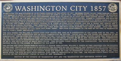
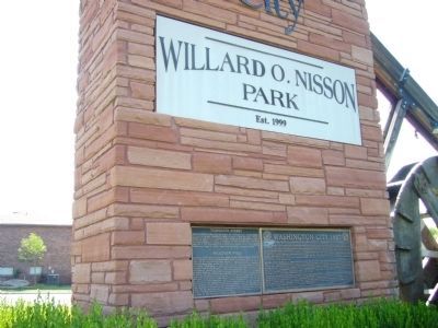
The area where the Willard O. Nisson park now stands was used as a campground in the latter part of the 1800’s. It was known as camp Washington and as Hall’s campground or pasture. Calvin Hall was the owner and operator of the campground. This provided for a place where visitors could come and stay in the small wooden cabins that were located on the property He also had a store located on the southeast corner of 200 W. and Telegraph St. This campground was the first place on Washington that had drinking water delivered in a pipe. A pipe was run from the northeast corner of 200 N. and 200 E. known as Hal’s Head House. This provided clean water to the campground. The water system to provide water to the homes in Washington was built in 1931.
The Antone and Leroy Nisson Families wanted to honor their father, Willard O. Nisson so they arranged for the building of this park. Through an exchange of properties, this property became available to that Washington City could construct this facility. Willard was known as a great schoolteacher, school principal, city mayor,
Photographed by Bill Kirchner, August 30, 2012
2. Washington City 1857 Marker
Erected 2000 by Washington City Historical Society.
Topics. This historical marker is listed in these topic lists: Notable Events • Settlements & Settlers. A significant historical year for this entry is 1857.
Location. 37° 7.805′ N, 113° 30.806′ W. Marker is in Washington, Utah, in Washington County. It is on Telegraph Street, on the right when traveling east. Touch for map. Marker is at or near this postal address: 151 W Telegraph, Washington UT 84780, United States of America. Touch for directions.

Regionally, this marker is in Utah’s Color Country. It is also in the American Southwest, in the Mountain West, and on the Colorado Plateau. Globally, it is in North America, the Rocky Mountains, the Western Hemisphere, the Western World, and the Anglosphere. Historically, it finds itself in what was once New Spain and also Mexico’s Alta California.
Other nearby markers. At least 8 other markers
Photographed by Dawn Bowen, June 21, 2007
3. Entrance to the Nisson Park
Credits. This page was last revised on June 16, 2016. It was originally submitted on June 28, 2007, by Dawn Bowen of Fredericksburg, Virginia. This page has been viewed 1,753 times since then and 40 times this year. Photos: 1. submitted on June 28, 2007, by Dawn Bowen of Fredericksburg, Virginia. 2. submitted on September 20, 2012, by Bill Kirchner of Tucson, Arizona. 3. submitted on June 28, 2007, by Dawn Bowen of Fredericksburg, Virginia. • J. J. Prats was the editor who published this page.
