
Cherry Valley in Otsego County, New York — The American Northeast (Mid-Atlantic)
Cherry Valley Museum
Revolutionary War Heritage Trail
Photographed by Steve Stoessel
1. Cherry Valley Museum Marker
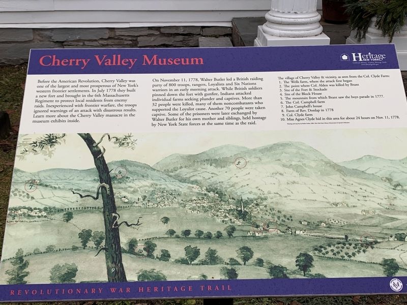
Before the American Revolution, Cherry Valley was one of the largest and most prosperous of New York's western frontier settlements. In July 1778 they built a new fort and brought in the 6th Massachusetts Regiment to protect local residents from enemy raids. Inexperienced with frontier warfare, the troops ignored warnings of an attack with disastrous results. Learn more about the Cherry Valley massacre in the museum exhibits inside.
On November 11, 1778, Walter Butler led a British raiding party of 800 troops, rangers, Loyalists and Six Nations warriors in an early morning attack. While British soldiers pinned down the fort with gunfire, Indians attacked individual farms seeking plunder and captives. More than 32 people were killed, many of them noncombatants who supported the Loyalist cause. Another 70 people were taken captive. Some of the prisoners were later exchanged by Walter Butler for his own mother and siblings, held hostage by New York State forces at the same time as the raid.
The village of Cherry Valley & vicinity, as seen from the Col. Clyde Farm:
1. The Wells farm, where the attack
this page online
2. The point where Col. Alden was killed by Brant
3. Site of the Fort & Stockade
4. Site of the Block House
5. The mountain from which Brant saw the boys parade in 1777.
6. The Col. Campbell farm
7. John Campbell's house
8. Farm of Rev. Donlap in 1778
9. Col. Clyde farm
10. Miss Agnes Clyde hid in this area for about 24 hours on Nov. 11, 1778.
Erected by Heritage New York.
Topics. This historical marker is listed in these topic lists: Indigenous Peoples and Communities • Settlements & Settlers • War, US Revolutionary. A significant historical month for this entry is July 1778.
Location. 42° 47.849′ N, 74° 45.072′ W. Marker is in Cherry Valley, New York, in Otsego County. It is at the intersection of Main Street (New York State Route 166) and Wall Street, on the right when traveling south on Main Street. Touch for map. Marker is at or near this postal address: 49 Main Street, Cherry Valley NY 13320, United States of America. Touch for directions.

Regionally, this marker is in Upstate New York and in the Mohawk Valley. It is also in the American Northeast, in the Mid-Atlantic,

Photographed by Steve Stoessel, December 29, 2019
2. Cherry Valley Museum
Other nearby markers. At least 8 other markers are within walking distance of this marker: A different marker also named Cherry Valley Museum (here, next to this marker); a different marker also named Cherry Valley Museum (a few steps from this marker); Limestone Mansion (about 300 feet away, measured in a direct line); Civil War Monument (approx. 0.2 miles away); First Presbyterian Church (approx. ¼ mile away); Cherry Valley Massacre (approx. 0.3 miles away); Site of Rev. Samuel Dunlop's House (approx. half a mile away); Colonel Alden Felled (approx. 0.6 miles away). Touch for a list and map of all markers in Cherry Valley.
Also see . . . Cherry Valley Museum. (Submitted on January 11, 2020, by Michael Herrick of Southbury, Connecticut.)
Credits. This page was last revised on January 11, 2020. It was originally submitted on January 9, 2020, by Steve Stoessel of Niskayuna, New York. This page has been viewed 873 times since then and 62 times this year. Photos: 1, 2. submitted on January 9, 2020, by Steve Stoessel of Niskayuna, New York. • Michael Herrick was the editor who published this page.
