Central Oklahoma City in Oklahoma County, Oklahoma — The American South (West South Central)
Stockyards City
Est. 1910

Photographed by Jerome W Walker, January 8, 2020
1. Stockyards City Marker
The Stockyards City Business Improvement District serves as a home to the world's largest stocker-feeder cattle market, the state's oldest restaurant, library, pharmacy and western wear establishment. The bank was chartered in 1925 and has remained a constant fixture in the area. Stockyards City is truly a vitally important piece of Oklahoma history. Tourist and locals alike enjoy the opportunity to taste a bit of the Old West flavor provided by a district designed to make any cowboy or cowgirl feel right at home.
Erected by Oklahoma City Community Foundation.
Topics. This historical marker is listed in these topic lists: Animals • Entertainment • Industry & Commerce • Man-Made Features.
Location. 35° 27.114′ N, 97° 33.284′ W. Marker is in Oklahoma City, Oklahoma, in Oklahoma County. It is in Central Oklahoma City. It is at the intersection of South Agnew Avenue and Southwest 13th Street, on the left when traveling north on South Agnew Avenue. The marker is on the sidewalk north of 13th and east of Agnew. Touch for map. Marker is at or near this postal
this page online

Regionally, this marker is in Central Oklahoma—Frontier Country. It is also in the American South, specifically on the prairies, and on the Southern Plains. Globally, it is in North America, the Western Hemisphere, the Western World, and the Anglosphere. Historically, it finds itself in what was once the territory of the Mississippian Culture and also the Louisiana Purchase.
Other nearby markers. At least 8 other markers are within 2 miles of this marker, measured as the crow flies: A different marker also named Stockyards City (within shouting distance of this marker); Delmar Garden (approx. 1.4 miles away); Lion's Head from Terminal Building and Arcade (approx. 1.7 miles away); Gristmill Bed Stone (approx. 1.7 miles away); Capitol of Oklahoma (approx. 1.7 miles away); Charles Gasham Jones (approx. 1.7 miles away); Columns from Lee-Huckins Hotel (approx. 1.7 miles away); Baum Building Cupola (approx. 1.7 miles away). Touch for a list and map of all markers in Oklahoma City.
Photographed by Jerome W Walker, January 8, 2020
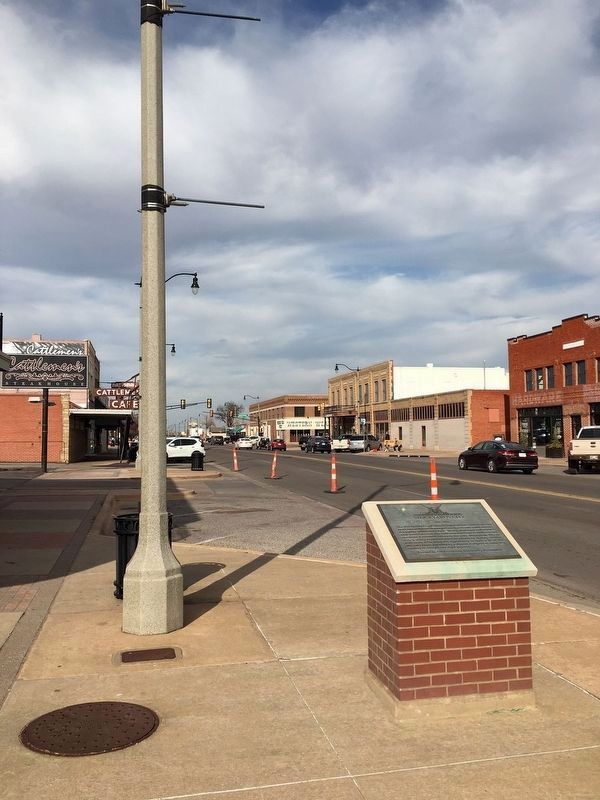
2. Looking north up Agnew Avenue from the Stockyards City Marker
Cattleman's Cafe is on the left side of the photo.
Credits. This page was last revised on February 16, 2023. It was originally submitted on January 9, 2020, by Jerome Walker of Moore, Oklahoma. This page has been viewed 351 times since then and 17 times this year. Photos: 1, 2. submitted on January 9, 2020, by Jerome Walker of Moore, Oklahoma. • J. Makali Bruton was the editor who published this page.
