
Chesapeake City in Cecil County, Maryland — The American Northeast (Mid-Atlantic)
“Bohemia Mannor”
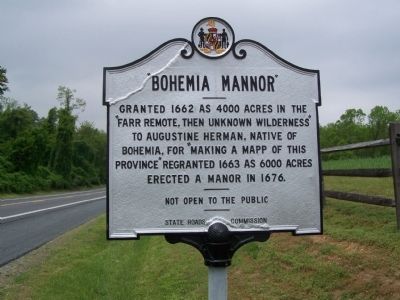
Photographed by William Pfingsten, May 5, 2008
1. "Bohemia Mannor" Marker
Erected 1956 by State Roads Commission.
Topics and series. This historical marker is listed in these topic lists: Colonial Era • Settlements & Settlers. In addition, it is included in the Maryland Historical Trust series list. A significant historical year for this entry is 1662.
Location. 39° 28.084′ N, 75° 51.54′ W. Marker is in Chesapeake City, Maryland, in Cecil County. It is on MD 213, on the right when traveling south. Marker is north of the Bohemia River. Touch for map. Marker is in this post office area: Chesapeake City MD 21915, United States of America. Touch for directions.

Regionally, this marker is in Greater Wilmington, on the Eastern Shore, and in Greater Philadelphia. It is also in the American Mid-Atlantic, on the Delmarva Peninsula, in the Tidewater, in the Chesapeake Bay Region, and on the Eastern Seaboard. Globally, it is in the North Atlantic Region, North
this page online
Other nearby markers. At least 8 other markers are within 4 miles of this marker, measured as the crow flies: Bohemia (approx. 1½ miles away); “Labadie Tract” (approx. 1½ miles away); St. Francis Xavier Church (approx. 2.4 miles away); Essex Lodge (approx. 2.8 miles away); The Anchorage (approx. 3.1 miles away); St. Augustine’s Church (approx. 3.2 miles away); St. Augustine Parish (approx. 3.2 miles away); Cherry Grove (approx. 3.6 miles away). Touch for a list and map of all markers in Chesapeake City.
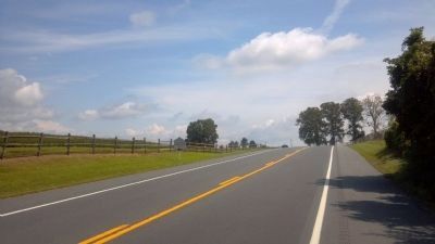
Photographed by Keith S Smith, August 22, 2013
2. “Bohemia Mannor” Marker Roadside
Credits. This page was last revised on December 25, 2024. It was originally submitted on May 8, 2008, by Bill Pfingsten of Bel Air, Maryland. This page has been viewed 3,226 times since then and 112 times this year. Last updated on January 9, 2020, by Carl Gordon Moore Jr. of North East, Maryland. Photos: 1. submitted on May 8, 2008, by Bill Pfingsten of Bel Air, Maryland. 2. submitted on August 23, 2013, by Keith S Smith of West Chester, Pennsylvania.
