Bayside in Charlotte County, New Brunswick — The Atlantic Provinces (North America)
A Place to Settle / Un endroit où s’établir
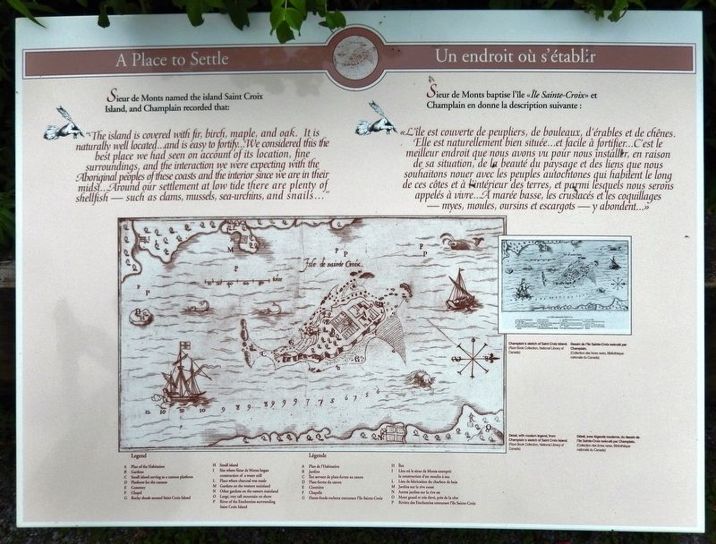
Sieur de Monts named the island Saint Croix Island, and Champlain recorded that:
"The island is covered with fir, birch, maple, and oak. It is naturally well located... and is easy to fortify... We considered this the best place we had seen on account of its location, fine surroundings, and the interaction we were expecting with the Aboriginal peoples of these coasts and the interior since we are in their midst... Around our settlement at low tide there are plenty of shellfish — such as clams, mussels, sea-urchins, and snails..."
Sieur de Monts baptise l'île «Île Sainte-Croix» et Champlain en donne la description suivante :
«L'île est couverte de peupliers, de bouleaux, d'érables et de chênes. Elle est naturellement bien située... et facile à fortifier... C'est te meilleur endroit que nous avons vu pour nous installer, en raison de sa situation, de la beauté du paysage et des liens que nous souhaitons nouer avec les peuples autochtones qui habitent le long de ces côtes et à l’intérieur des terres, et parmi lesquels nous serons appelés à vivre... À marée basse, les crustacés et les coquillages — myes, moules, oursins et escargots — y abondent...»
Erected by Parks Canada / Parcs Canada.
Topics and series. This historical marker is listed in these topic lists: Colonial Era • Exploration • Settlements & Settlers. In addition, it is included in the Acadian History series list.
Location. 45° 8.065′ N, 67° 6.769′ W. Marker is in Bayside, New Brunswick, in Charlotte County. Marker can be reached from New Brunswick Route 127, 9 kilometers south of New Brunswick Route 1, on the right when traveling south. Marker is located at the Saint Croix Island National Historic Site, along the interpretive trail. Touch for map. Marker is at or near this postal address: 3509 New Brunswick Highway 127, Bayside NB E5B 2V2, Canada. Touch for directions.
Other nearby markers. At least 8 other markers are within walking distance of this marker. A French Colony in Acadie / Une colonie française en Acadie (here, next to this marker); Where Two Worlds Met / Rencontre de deux mondes (here, next to this marker); A Winter of Despair / Un hiver de désespoir (within shouting distance of this marker); Moving on / Le déménagement (within shouting distance of this marker); The River Flows On... / La rivière poursuit son cours... (within

Courtesy Rare Book Collection, National Library of Canada
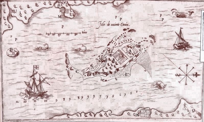
2. Champlain’s sketch of Saint Croix Island /
Dessin de l’île Saint-Croix exécuté par Champlain
Dessin de l’île Saint-Croix exécuté par Champlain
F: Chapel • G: Rocky shoals around Saint Croix Island •
H: Small island • I: Site where Sieur de Monts began construction of a water mill • L: Place where charcoal was made •
M: Gardens on the western mainland • N: Other gardens on the eastern mainland • O: Large; very tall mountain on shore •
P: River of the Etechemins surrounding Saint Croix Island
F: Chapelle • G: Hauts-fonds rocheux entourant l'île Sainte-Croix •
H: Îlot • I: Lieu où le sieur de Monts entreprit la construction d'un moulin à eau • L: Lieu de fabrication du charbon de bois •
M: Jardins sur la rive ouest • N: Autres jardins sur la rive est •
O: Mont grand et très élevé, près de la côte •
P: Rivière des Etechemins entourant l'île Sainte-Croix
Related markers. Click here for a list of markers that are related to this marker. Saint Croix Island International Historic Site / Île Sainte-Croix Lieu historique international
Also see . . . Saint Croix Island International Historic Site: A Place to Settle. (Submitted on January 18, 2020, by Cosmos Mariner of Cape Canaveral, Florida.)
Credits. This page was last revised on January 19, 2020. It was originally submitted on January 15, 2020, by Cosmos Mariner of Cape Canaveral, Florida. This page has been viewed 102 times since then and 6 times this year. Photos: 1. submitted on January 15, 2020, by Cosmos Mariner of Cape Canaveral, Florida. 2, 3. submitted on January 17, 2020, by Cosmos Mariner of Cape Canaveral, Florida.

