Bayside in Charlotte County, New Brunswick — The Atlantic Provinces (North America)
Moving on / Le déménagement
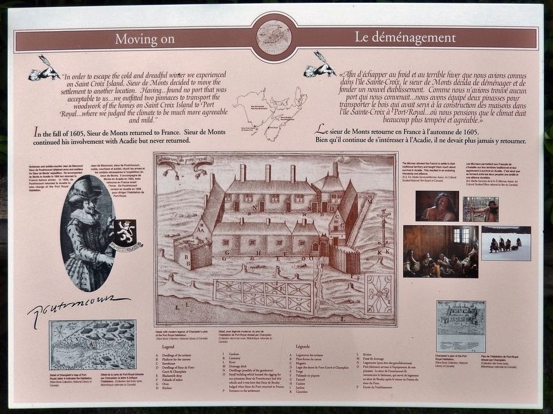
"In order to escape the cold and dreadful winter we experienced on Saint Croix Island, Sieur de Monts decided to move the settlement to another location. Having… found no port that was acceptable to us... we outfitted two pinnaces to transport the woodwork of the homes on Saint Croix Island to Port Royal... where we judged the climate to be much more agreeable and mild."
In the fall of 1605, Sieur de Monts returned to France. Sieur de Monts continued his involvement with Acadie but never returned.
«Afin d'échapper au froid et au terrible hiver que nous avions connus dans l'île Sainte-Croix, le sieur de Monts décida de déménager et de fonder un nouvel établissement. Comme nous n'avions trouvé aucun port qui nous convenait... nous avons équipé deux pinasses pour transporter le bois qui avait servi à la construction des maisons dans l'île Sainte-Croix à Port-Royal… où nous pensions que le climat était beaucoup plus tempéré et agréable.»
Le sieur de Monts retourne en France à l'automne de 1605. Bien qu'il continue de s'intéresser à l'Acadie, il ne devait plus jamais y retourner. .
Erected by Parks Canada / Parcs Canada.
Topics and series. This historical marker is listed in these topic lists: Colonial Era • Exploration • Settlements & Settlers. In addition, it is included in the Acadian History series list. A significant historical year for this entry is 1605.
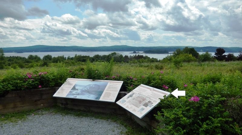
Location. 45° 8.076′ N, 67° 6.788′ W. Marker is in Bayside, New Brunswick, in Charlotte County. Marker can be reached from New Brunswick Route 127, 9 kilometers south of New Brunswick Route 1, on the right when traveling south. Marker is located at the Saint Croix Island National Historic Site, along the interpretive trail. Touch for map. Marker is at or near this postal address: 3509 New Brunswick Highway 127, Bayside NB E5B 2V2, Canada. Touch for directions.
Other nearby markers. At least 8 other markers are within walking distance of this marker. A Winter of Despair / Un hiver de désespoir (here, next to this marker); In Champlain’s Footsteps / Sur les traces de Champlain (within shouting distance of this marker); A French Colony in Acadie / Une colonie française en Acadie (within shouting distance of this marker); A Place to Settle / Un endroit où s’établir (within shouting distance of this marker); Where Two Worlds Met / Rencontre de deux mondes (within shouting distance of this marker); A Checkered History / Une historie mouvementée
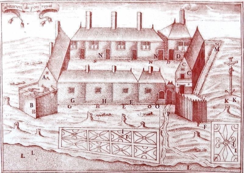
Rare Book Collection, National Library of Canada
2. Marker detail: Plan of the Port Royal Habitation
Modern Legend
C: Storehouse • D: Dwellings of Sieur de Pont-Grave & Champlain • E: Blacksmith shop • F: Palisade of stakes • G: Oven •
H: Kitchen • I: Gardens • K: Cemetery • L:River • M: Drainage ditch • N: Dwellings (possibly of the gentlemen) • O: Small building which housed the rigging for our pinnaces; Sieur de Poutrincourt had this rebuilt and it was here that Sieur de Boulay lodged when Sieur du Pont returned to France. • P: Entrance to the settlement
Légende Moderne
C: Magasin • D: Logis des sieurs de Pont-Gravé et Champlain •
E: Forge • F: Palissade en piquets • G: Fournil • H: Cuisine •
I: Jardins • K: Cimetière • L: Rivière • M Fossé de drainage •
N: Logements (peut-être des gentilshommes) • O: Petit bâtiment servant àJ'équipement de nos pinasses. Le sieur de Poutrincourt fit reconstruire le bâtiment, qui servit de logement au sieur de Boulay après le retour en France du sieur du Pont. • P: Entrée de l'établissement
Related markers. Click here for a list of markers that are related to this marker. Saint Croix Island International Historic Site / Île Sainte-Croix Lieu historique international
Also see . . .
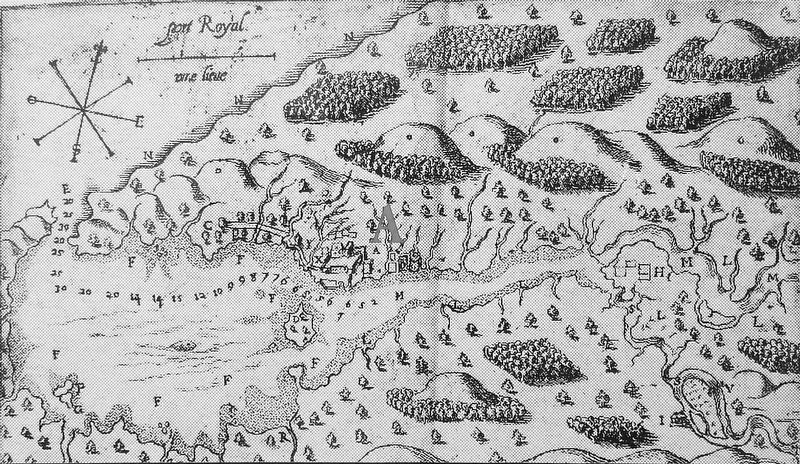
1. Original settlement of Port-Royal (Wikipedia). Port-Royal was founded after the French nobleman Pierre Du Gua de Monts spent a disastrous winter in Île-Saint-Croix. He was accompanied by Samuel de Champlain, Louis Hébert and Jean de Biencourt de Poutrincourt et de Saint-Just. They decided to move their settlement to the sheltered bay on the south shore of the Bay of Fundy which had been recorded by Champlain earlier in the spring of 1605 during a coastal reconnaissance. (Submitted on January 18, 2020, by Cosmos Mariner of Cape Canaveral, Florida.)
2. Port-Royal National Historic Site. Port-Royal was established in the summer of 1605 on the north shore
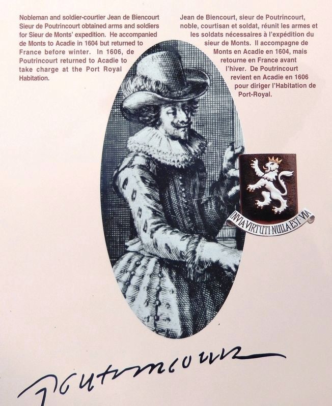
3. Marker detail: Jean de Biencourt Sieur de Poutrincourt
Nobleman and soldier-courtier Jean de Biencourt Sieur de Poutrincourt obtained arms and soldiers for Sieur de Monts' expedition. He accompanied de Monts to Acadie in 1604 but returned to France before winter. In 1606, de Poutrincourt returned to Acadie to take charge at the Port Royal Habitation.
Jean de Biencourt, sieur de Poutrincourt, noble, courtisan et soldat, réunit les armes et les soldats nécessaires à l'expédition du sieur de Monts. Il accompagne de Monts en Acadie en 1604, mais retourne en France avant l'hiver. De Poutrincourt revient en Acadie en 1606 pour diriger l'Habitation de Port-Royal.
Jean de Biencourt, sieur de Poutrincourt, noble, courtisan et soldat, réunit les armes et les soldats nécessaires à l'expédition du sieur de Monts. Il accompagne de Monts en Acadie en 1604, mais retourne en France avant l'hiver. De Poutrincourt revient en Acadie en 1606 pour diriger l'Habitation de Port-Royal.

Photographed By N.S. Ed. Media Services/Micmac Assoc. for Cultural Studies/National Film Board of Canada
5. Marker detail: The Micmac allowed the French to settle
The Micmac allowed the French to settle in their traditional territory and taught them much about survival in Acadie. This resulted in an enduring friendship and alliance.
Les Micmacs permettent aux Français de s'installer sur leur territoire traditionnel et leur apprennent à survivre en Acadie. C'est ainsi que se forment entre les deux peuples une amitié et une alliance durables.
Les Micmacs permettent aux Français de s'installer sur leur territoire traditionnel et leur apprennent à survivre en Acadie. C'est ainsi que se forment entre les deux peuples une amitié et une alliance durables.
Credits. This page was last revised on January 19, 2020. It was originally submitted on January 15, 2020, by Cosmos Mariner of Cape Canaveral, Florida. This page has been viewed 120 times since then and 10 times this year. Photos: 1. submitted on January 15, 2020, by Cosmos Mariner of Cape Canaveral, Florida. 2, 3, 4, 5, 6. submitted on January 18, 2020, by Cosmos Mariner of Cape Canaveral, Florida.
