Near Big Sur in Monterey County, California — The American West (Pacific Coastal)
Cooper Cabin
Andrew Molera State Park
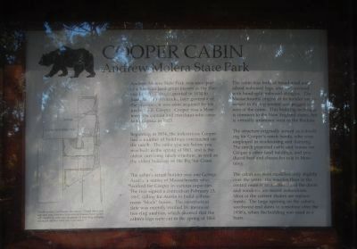
Inscription.
Andrew Molera State Park was once part of a Mexican land grant known as the Rancho El Sur. Though granted in 1834 to Juan Bautista Alvarado, later governor of the province, it was soon acquired by his uncle, J.B.R. Cooper, Cooper was a Monterey sea captain and merchant who came to California in 1823.
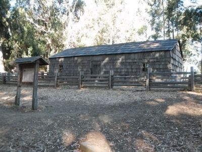
Beginning in 1834, the industrious Cooper had a number of buildings constructed on the ranch. The cabin you see before you was built in the spring of 1861, and is the oldest surviving ranch structure, as well as the oldest building on the Big Sur Coast.
The cabinís actual builder was one George Austin, a native of Massachusetts who worked for Cooper in various capacities. The two signed a contract on February 23, 1861, calling for Austin to build a three room “block” house. The construction date was recently verified by means of tree-ring analysis, which showed the cabinís logs were cut in the spring of 1861.
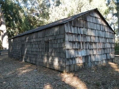
The cabin was built of broad-axed and adzed redwood logs, and was covered with hand-split redwood shingles. The Massachusetts origins of the builder are revealed in the lap-jointed and pegged corners of the cabin. This building technique is common to the New England states, but virtually unknown west of the Rockies.
The structure originally served as a dwelling for Cooperís ranch hands, who were employed in stockraising and dairying. The ranch provided cattle and horses for Cooperís other land holdings, and produced beef and cheese for sale in Monterey.
The cabin has been modified only slightly over the years. The wood floor in the central room is an addition, and the doors and windows are recent restorations. Most of the current shakes are replacements. The large opening on the cabinís southwest end dates to sometime after the 1930ís, when the building was used as a barn.
Topics. This historical marker is listed in these topic lists: Architecture • Parks & Recreational Areas. A significant historical month for this entry is February 1809.
Location. 36° 17.166′ N, 121° 51.174′ W. Marker is near Big Sur, California, in Monterey County. Marker can be reached from Cabrillo Highway (California Route 1), on the left when traveling south. Cooper Cabin is located in Andrew Molera State Park about 1/2 mile from the parking area along the Headlands Trail near the west end of the campground. Touch for map. Marker is in this post office area: Big Sur CA 93920, United States of America. Touch for directions.
Other nearby markers. At least 8 other markers are within 13 miles of this marker, measured as the crow flies. Point Sur Light Station (approx. 2.8 miles away); End of an Era (approx. 2.9 miles away); On Top of the Rock (approx. 3.1 miles away); Inspiration: A Wild Coast and Lonely (approx. 12.4 miles away); Pioneers: Homesteading the Sur (approx. 12.4 miles away); High Seas: The Ocean Highway (approx. 12.4 miles away); Daring: Dog-hole Ports (approx. 12.4 miles away); Esselen: We Are Still Here (approx. 12.4 miles away). Touch for a list and map of all markers in Big Sur.
Credits. This page was last revised on August 17, 2020. It was originally submitted on September 12, 2013, by Barry Swackhamer of Brentwood, California. This page has been viewed 902 times since then and 46 times this year. Last updated on January 18, 2020, by McGhiever of Minneapolis, Minnesota. Photos: 1, 2, 3. submitted on September 12, 2013, by Barry Swackhamer of Brentwood, California. • J. Makali Bruton was the editor who published this page.


