
Kayton/Frazier Area in Savannah in Chatham County, Georgia — The American South (South Atlantic)
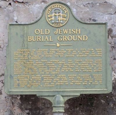
Old Jewish Burial Ground
Photographed by Mike Stroud, December 9, 2008
1. Old Jewish Burial Ground Marker
During the ill fated attempt of the French forces under Admiral Charles Henri, Comte d'Estaing, and the American forces under General Benjamin Lincoln, to recapture Savannah from the British, General Lincoln's Orders of the Day of October 8, 1779 stated that "The second place of rallying, or the first if the redoubt should not be carried, will be at the Jew's burying ground, where the reserve will be placed."
According to the account of Captain Antoine-Francoise Térance O'Connor, a military engineer serving with the French forces, on October 9, 1779, shortly after 4:00 AM, "The reserve corps, commanded by M. le Vicomte de Noailles, advanced as far as an old Jewish cemetery, and we placed on its right and a little to the rear the four 4-pounders."
Erected by Georgia Historical Marker.
Topics. This historical marker is listed in these topic lists: Cemeteries & Burial Sites
this page online
Location. 32° 4.342′ N, 81° 6.212′ W. Marker is in Savannah, Georgia, in Chatham County. It is in the Kayton/Frazier Area. It is at the intersection of Cohen Road and West Boundry Street, on the right when traveling south on Cohen Road. Touch for map. Marker is in this post office area: Savannah GA 31401, United States of America. Touch for directions.

Regionally, this marker is in the Coastal Plain and on the Georgia Coast and the Golden Isles. It is also in the American South, specifically in the Deep South, and on the Eastern Seaboard. Globally, it is in the North Atlantic Region, North America, the Western Hemisphere, the Western World, and the Anglosphere. Historically, it finds itself in what was once New Spain, the territory of the Mississippian Culture, one of the original Thirteen Colonies, one of the Confederate States of America, and the Antebellum South.
Other nearby markers. At least 8 other markers are within walking distance of this marker: De Lyon - De La Motta Cemetery (within shouting distance of this marker); Saint Philip A.M.E. Church
Photographed by Mike Stroud, December 9, 2008
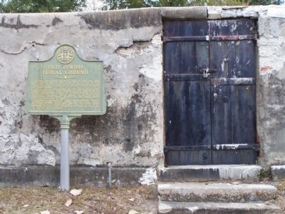
2. Old Jewish Burial Ground Marker
Photographed by Mike Stroud, December 9, 2008
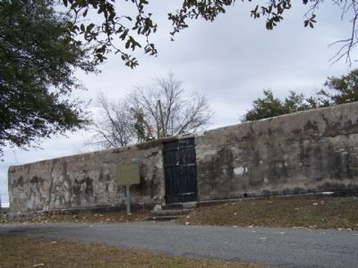
3. Old Jewish Burial Ground Marker
Photographed by Mike Stroud, December 9, 2008
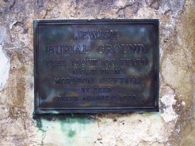
4. Old Jewish Burial Ground
The plaque on the wall reads:
"Jewish burial ground used about 100 years. A gift from Mordecai Sheftall by deed dated August 2, 1773"
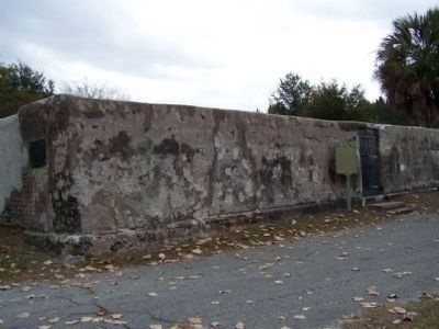
Photographed by Mike Stroud, December 9, 2008
5. Old Jewish Burial Ground Marker and the Mordecai Sheftall Plaque, at left
Photographed by Mike Stroud, September 18, 2008
6. Old Jewish Burial Ground Marker
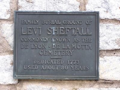
Across the street, still part of the Cemetery
Levi Sheftall Plaque
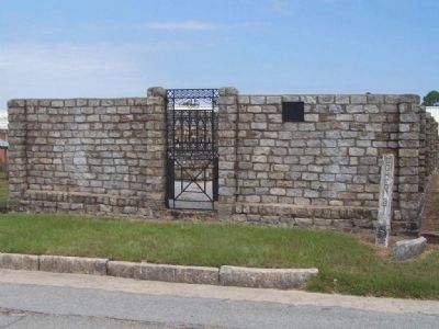
Photographed by Mike Stroud, September 18, 2008
7. Old Jewish Burial Ground Marker, Levi Sheftall Plaque
Credits. This page was last revised on February 8, 2023. It was originally submitted on December 16, 2008, by Mike Stroud of Bluffton, South Carolina. This page has been viewed 2,296 times since then and 36 times this year. Photos: 1. submitted on August 28, 2013, by Mike Stroud of Bluffton, South Carolina. 2, 3, 4, 5, 6, 7. submitted on December 16, 2008, by Mike Stroud of Bluffton, South Carolina. • Craig Swain was the editor who published this page.
