Marker Logo
THE HISTORICAL
MARKER DATABASE
“Bite-Size Bits of Local, National, and Global History”
Near Catonsville in Baltimore County, Maryland — The American Northeast (Mid-Atlantic)
 

20th Anniversary

[Benjamin Banneker Museum]
 
 
20th Anniversary Marker image. Click for full size.
Photographed by Devry Becker Jones (CC0), January 19, 2020
1. 20th Anniversary Marker
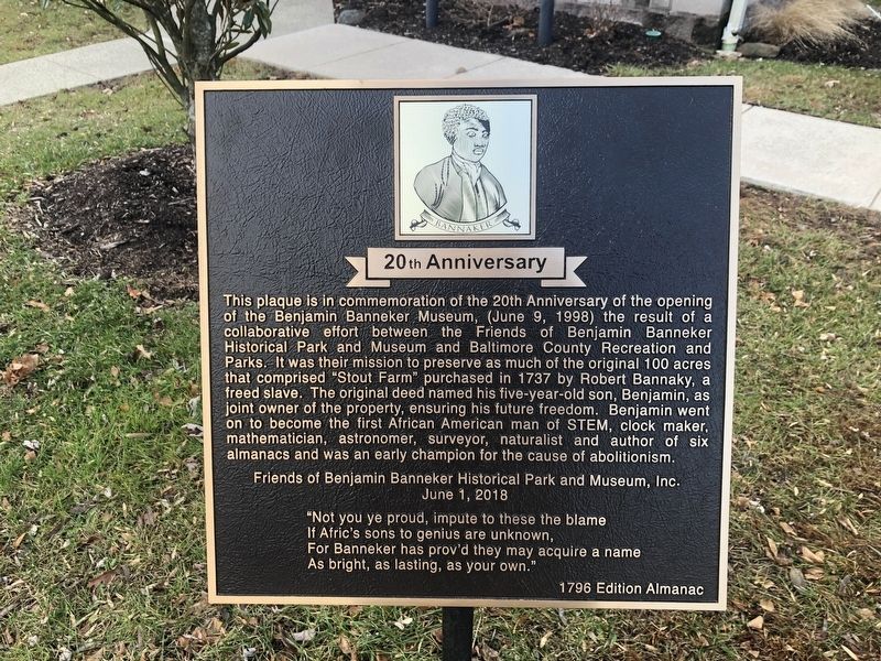
Inscription. This plaque is in commemoration of the 20th Anniversary of the opening of the Benjamin Banneker Museum. (June 9, 1998) the result of a collaborative effort between the Friends of Benjamin Banneker Historical Park and Museum and Baltimore County Recreation and Parks. It was their mission to preserve as much of the original 100 acres that comprised "Stout Farm" purchased in 1737 by Robert Bannaky, a freed slave. The original deed named his five-year-old son, Benjamin, as joint owner of the property, ensuring his future freedom. Benjamin went on to become the first African American man of STEM, clock maker, mathematician, astronomer, surveyor, naturalist and author of six almanacs and was an early champion for the cause of abolitionism.

Friends of Benjamin Banneker Historical Park and Museum, Inc.
June 1, 2018

"Not you ye proud, impute to these the blame
If Afric's sons to genius are unknown,
For Banneker has prov'd they may acquire a name
As bright, as lasting, as your own."
1796 Edition Almanac
 
Erected 2018 by Friends of Benjamin Banneker Historical Park and Museum, Inc.
 
Topics. This historical
Paid Advertisement
Click or scan to see
this page online
marker is listed in these topic lists: African AmericansColonial Era. A significant historical date for this entry is June 1, 2018.
 
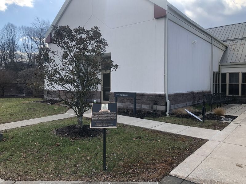
Location. 39° 16.147′ N, 76° 46.484′ W. Marker is near Catonsville, Maryland, in Baltimore County. It can be reached from Oella Avenue 0.2 miles north of Old Frederick Road, on the left when traveling north. Touch for map. Marker is at or near this postal address: 209 Oella Avenue, Catonsville MD 21228, United States of America. Touch for directions.

Regionally, this marker is in Central Maryland. It is also in the American Mid-Atlantic, in the Chesapeake Bay Region, and on the Eastern Seaboard. Globally, it is in the North Atlantic Region, North America, the Western Hemisphere, the Western World, and the Anglosphere. Historically, it finds itself in what was once one of the original Thirteen Colonies and also the Antebellum South.

Other nearby markers. At least 8 other markers are within walking distance of this marker: Benjamin Banneker (within shouting distance of this marker); The Banneker Rain Garden (within shouting distance of this marker); Robert Bannaky (about 300 feet away, measured in a
20th Anniversary Marker image. Click for full size.
Photographed by Devry Becker Jones (CC0), January 19, 2020
2. 20th Anniversary Marker
direct line); Banneker's Cabin (about 300 feet away); Banneker's Orchard (about 700 feet away); The Stone Farmhouse (about 700 feet away); a different marker also named Benjamin Banneker (approx. half a mile away); Edges of Earth's Crust Collided Here (approx. 0.9 miles away). Touch for a list and map of all markers in Catonsville.
 
Additional keywords. mathematics
 
 
Credits. This page was last revised on July 18, 2020. It was originally submitted on January 19, 2020, by Devry Becker Jones of Washington, District of Columbia. This page has been viewed 452 times since then and 18 times this year. Photos:   1, 2. submitted on January 19, 2020, by Devry Becker Jones of Washington, District of Columbia.

m=144731

CeraNet Cloud Computing sponsors the Historical Marker Database.
This website earns income from purchases you make after using our links to Amazon.com. We appreciate your support.
Paid Advertisement
Jul. 19, 2026