Wayne in McClain County, Oklahoma — The American South (West South Central)
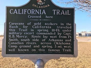
California Trail
Crossed here
Caravans of gold seekers in the Rush for California traveled this Trail in spring, 1849, under military escort commanded by Capt. R.B. Marcy. Route lay west from Ft. Smith, south side of Arkansas and Canadian rivers, across Oklahoma. Camp ground and spring. 3 mi. west, well known on this famous Trail.
Erected 1949 by Oklahoma Historical Society and State Highway Commission.
Topics and series. This historical marker is listed in these topic lists: Exploration • Industry & Commerce • Roads & Vehicles. In addition, it is included in the California Trail, and the Oklahoma Historical Society series lists. A significant historical year for this entry is 1849.
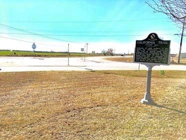
Location. 34° 54.809′ N, 97° 18.631′ W. Marker is in Wayne, Oklahoma, in McClain County. Marker is at the intersection of State Highway 59 and U.S. 77, on the right when traveling west on State Highway 59. The marker is located on the area northeast of the US77-OK59 intersection. Touch for map. Marker is in this post office area: Wayne OK 73095, United States of America. Touch for directions.
Other nearby markers. At least 8 other markers are within 8 miles of this marker, measured as the crow flies. Desert Storm Honor Roll (approx. 7.4 miles away); Confederate Memorial (approx. 7.4 miles away); 46th State (approx. 7.4 miles away); Hotel Love (approx. 7.4 miles away); Purcell (approx. 7˝ miles away); Col. John L. Smith (approx. 7˝ miles away); Run of '89 South Boundary (approx. 7˝ miles away); Camp Holmes Treaty (approx. 7.6 miles away).
Also see . . . California Road | The Encyclopedia of Oklahoma History and Culture. Describes the California Road as a number of trails that were established during the Gold Rush period. (Submitted on January 22, 2020, by Jerome Walker of Moore, Oklahoma.)
Credits. This page was last revised on January 24, 2020. It was originally submitted on January 21, 2020, by Jerome Walker of Moore, Oklahoma. This page has been viewed 271 times since then and 33 times this year. Photos: 1, 2. submitted on January 21, 2020, by Jerome Walker of Moore, Oklahoma. • J. Makali Bruton was the editor who published this page.

