Fernandina Beach in Nassau County, Florida — The American South (South Atlantic)
Shipwreck, Slavery and Survival
The Saga of the Slave Ship Guerrero
| — | Fernandina Plaza Historic State Park | — |
Photographed by Brandon D Cross, January 18, 2020
1. Shipwreck, Slavery and Survival Marker
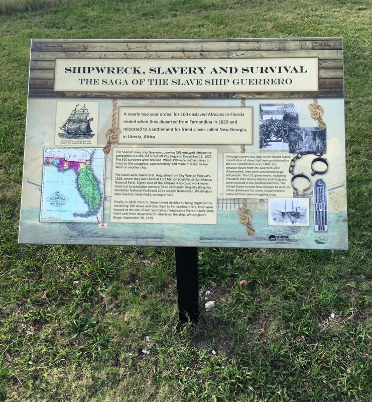
A nearly two year ordeal for 100 enslaved Africans in Florida ended when they departed from Fernandina in 1829 and relocated to a settlement for freed slaves called New Georgia, in Liberia, Africa.
The Spanish slave ship Guerrero, carrying 561 enslaved Africans to plantations in Cuba, hit a reef off Key Largo on December 19, 1827. The 520 survivors were rescued. While 398 were sold as slaves in Cuba by smugglers, approximately 120 made it safely to Key West on another ship.
The slaves were taken to St. Augustine from Key West in February, 1828, where they were held at Fort Marion (Castillo de San Marcos National Park). Eighty-nine of the Africans who could work were hired out to plantation owners; 36 to Zephaniah Kingsley (Kingsley Plantation National Park), among others.
Finally, in 1829, the U.S. Government decided to bring together the remaining 100 slaves and take them to Fernandina. Here, they were housed at the site of Fort San Carlos (Fernandina Plaza Historic State Park) until their departure for Liberia on the ship, Washington’s Barge, September 30, 1829.
Although slavery was legal in the United States,
this page online
Erected by Florida State Parks, Friends of Fort Clinch.
Topics and series. This historical marker is listed in these topic lists: African Americans • Forts and Castles • Settlements & Settlers • Waterways & Vessels. In addition, it is included in the Former U.S. Presidents: #06 John Quincy Adams series list. A significant historical date for this entry is December 19, 1827.
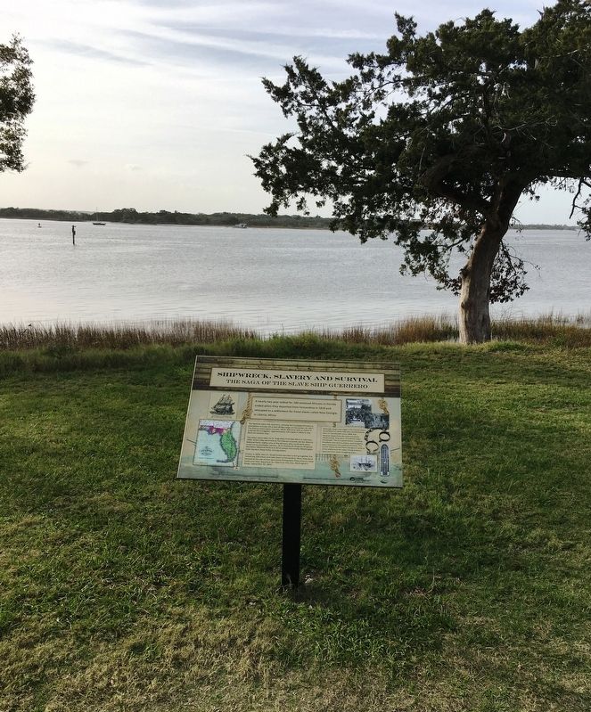
Location. 30° 41.323′ N, 81° 27.411′ W. Marker is in Fernandina Beach, Florida, in Nassau County. It is at the intersection of Estrada Street and White Street, on the right when traveling south on Estrada Street. Marker located within the Fernandina Plaza Historic State Park. Touch for map. Marker is at or near this postal address: 715 San Fernando
Photographed by Brandon D Cross, January 18, 2020
2. Shipwreck, Slavery and Survival Marker

Regionally, this marker is in First Coast, in Greater Jacksonville, and on the Sea Islands. It is also in the American South and on the Eastern Seaboard. Globally, it is in the North Atlantic Region, North America, a Gulf of Mexico state, the Western Hemisphere, the Western World, and the Anglosphere. Historically, it finds itself in what was once New Spain, the territory of the Mississippian Culture, one of the Confederate States of America, and the Antebellum South.
Other nearby markers. At least 8 other markers are within walking distance of this marker: Fort Clinch Military Road (here, next to this marker); 6-Pound Cannon (here, next to this marker); The Plaza (a few steps from this marker); The UNESCO Slave Route Project: Resistance, Liberty, Heritage / Amelia Island, Fl (a few steps from this marker); Fort San Carlos (within shouting distance of this marker); Plaza San Carlos (within shouting distance of this marker); Old Town (approx. ¼ mile away); McClure's Hill (approx. 0.6 miles away). Touch for a list and map of all markers in
Photographed by Brandon D Cross, January 18, 2020
3. Fernandina Plaza Historic State Park sign
Credits. This page was last revised on January 26, 2020. It was originally submitted on January 26, 2020, by Brandon D Cross of Flagler Beach, Florida. This page has been viewed 1,144 times since then and 78 times this year. Photos: 1, 2, 3. submitted on January 26, 2020, by Brandon D Cross of Flagler Beach, Florida. • Bernard Fisher was the editor who published this page.
