Godfrey in Madison County, Illinois — The American Midwest (Great Lakes)
Godfrey Cemetery
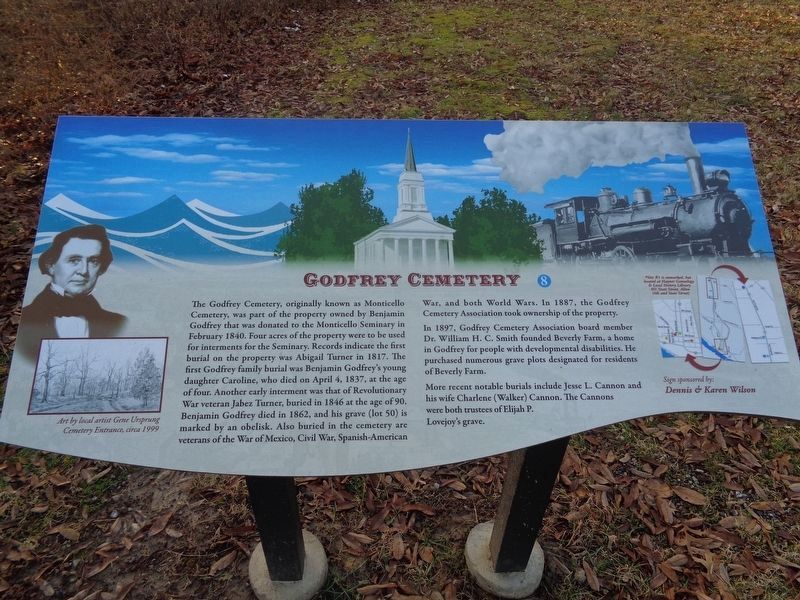
Photographed by Jason Voigt, January 14, 2020
1. Godfrey Cemetery Marker
This is one of two markers (#8) that are part of the Benjamin Godfrey Legacy Trail series in the cemetery.
In 1897, Godfrey Cemetery Association board member Dr. William H.C. Smith founded Beverly Farm, a home in Godfrey for people with developmental disabilities. He purchased numerous grave plots designated for residents of Beverly Farm.
More recent notable burials include Jesse L. Cannon and his
this page online
Erected 2019 by Benjamin Godfrey Legacy Trail Committee (sponsored by Dennis & Karen Wilson). (Marker Number 8.)
Topics. This historical marker is listed in these topic lists: Cemeteries & Burial Sites • Education • War, Mexican-American • War, Spanish-American • War, US Civil • War, US Revolutionary • War, World I • War, World II.
Location. 38° 57.37′ N, 90° 11.554′ W. Marker is in Godfrey, Illinois, in Madison County. It can be reached from Mulberry Street west of Godfrey Road (U.S. 67). Marker is at the southwest entrance of Godfrey City Cemetery, on a narrow road off of Mulberry Street. Touch for map. Marker is in this post office area: Godfrey IL 62035, United States of America. Touch for directions.

Regionally, this marker is in Greater St. Louis. It is also in the American Midwest, in the Lewis & Clark Corridor, in the Corn Belt, and in the Great River Road Region. Globally, it is in North America, the Western Hemisphere, the Western World,
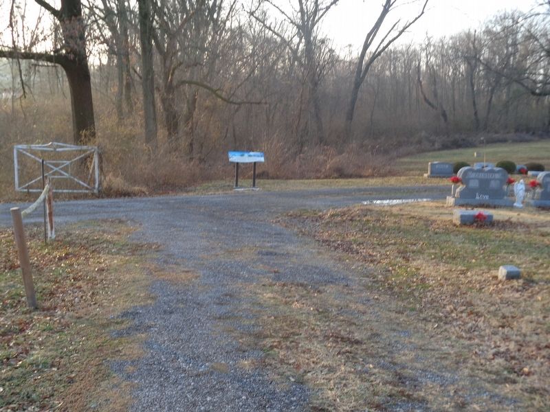
Photographed by Jason Voigt, January 14, 2020
2. Godfrey Cemetery Marker
At the southwest entrance of Godfrey City Cemetery
Other nearby markers. At least 8 other markers are within 3 miles of this marker, measured as the crow flies: Benjamin Godfrey (about 300 feet away, measured in a direct line); Monticello College (approx. 0.4 miles away); Benjamin Godfrey Memorial Chapel (approx. 0.4 miles away); Godfrey Mansion (approx. 0.8 miles away); Lindbergh Relay Station (approx. 0.9 miles away); Veterans Memorial (approx. 2.2 miles away); Plank Road (approx. 2.4 miles away); North Alton Confederate Cemetery (approx. 2.6 miles away). Touch for a list and map of all markers in Godfrey.
More about this marker. This is one of nine markers of the Benjamin Godfrey Legacy Trail series. Unlike all of the nine marked sites, this site (No. 8) has two markers, both different.
Also see . . . Godfrey Cemetery on Find-a-grave. Also known as Godfrey City Cemetery, this is the page that lists most of the interments here. (Submitted on January 29, 2020, by Jason Voigt of Glen Carbon, Illinois.)
Credits. This page was last revised on January 29, 2020. It was originally submitted on January 29, 2020, by Jason Voigt of Glen Carbon, Illinois. This page has been viewed 858 times since then and 66 times this year. Photos: 1, 2. submitted on January 29, 2020, by Jason Voigt of Glen Carbon, Illinois. • Devry Becker Jones was the editor who published this page.
