Bunger in Young County, Texas — The American South (West South Central)
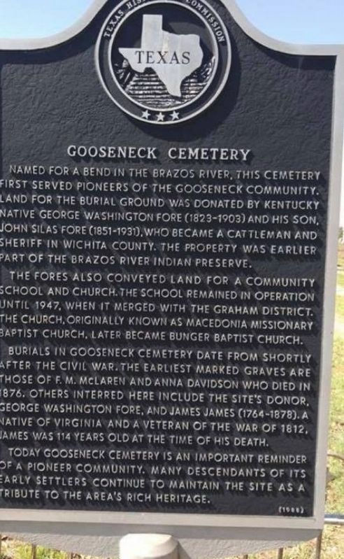
Gooseneck Cemetery
Named for a bend in the Brazos River, this cemetery first served pioneers of the Gooseneck community. Land for the burial ground was donated by Kentucky native George Washington Fore (1823-1903) and his son, John Silas Fore (1851-1931), who became a cattleman and sheriff in Wichita County. The property was earlier part of the Brazos River Indian Preserve.
The Fore's also conveyed land for a community school and church. The school remained in operation until 1947, when it merged with the Graham District. The church, originally known as Macedonia Missionary Baptist Church, later became Bunger Baptist Church.
Burials in Gooseneck Cemetery date from shortly after the Civil War. The earliest marked graves are those of F. M. McLaren and Anna Davidson who died in 1876. Others interred here include the site's donor, George Washington Fore, and James James (1764-1878). A native of Virginia and a veteran of the War of 1812, James was 114 years old at the time of his death.
Today Gooseneck Cemetery is an important reminder of a pioneer community. Many descendants of its early settlers continue to maintain the site as a tribute to the area's rich heritage.
Erected 1988 by Texas Historical Commission. (Marker Number 2228.)
Topics. This historical marker is listed in this topic list: Cemeteries & Burial Sites. A significant historical year for this entry is 1876.
Location. 33° 1.686′ N, 98° 34.866′ W. Marker is in Bunger, Texas, in Young County. Marker is on Gooseneck Cemetery Road west of Jeffrey Farm Road, on the right when traveling west. Touch for map. Marker is in this post office area: Graham TX 76450, United States of America. Touch for directions.
Other nearby markers. At least 8 other markers are within 6 miles of this marker, measured as the crow flies. Brazos Indian Reservation School (1858-1859) (approx. 4.7 miles away); Shawnee Springs (approx. 4.8 miles away); Brazos Indian Reservation School (approx. 4.9 miles away); Brazos River Indian Reservation (approx. 5 miles away); Morrison Funeral Home (approx. 5.3 miles away); Dr. & Mrs. J.W. Gallaher House (approx. 5.3 miles away); Early Church of Graham (approx. 5.3 miles away); First National Bank in Graham (approx. 5.3 miles away).
Credits. This page was last revised on April 2, 2023. It was originally submitted on January 29, 2020, by Dana S Ribble of Houston, Texas. This page has been viewed 254 times since then and 21 times this year. Photo 1. submitted on February 16, 2020, by Dana S Ribble of Houston, Texas. • J. Makali Bruton was the editor who published this page.
Editor’s want-list for this marker. A complete and straight photo of the marker. • A photo of the marker and the surrounding area together in context. • Can you help?
