Gapland in Washington County, Maryland — The American Northeast (Mid-Atlantic)
“Crampton Gap”
⬷
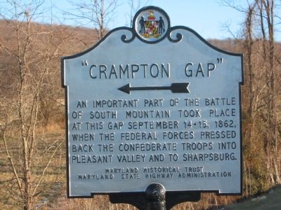
Photographed by F. Robby, January 12, 2003
1. "Crampton Gap" Marker
Erected by Maryland Historical Trust, Maryland State Highway Administration.
Topics and series. This historical marker is listed in this topic list: War, US Civil. In addition, it is included in the Maryland Historical Trust series list. A significant historical month for this entry is September 1714.
Location. 39° 23.999′ N, 77° 39.34′ W. Marker is in Gapland, Maryland, in Washington County. It is at the intersection of Rohrersville Road (Maryland Route 67) and Gapland Road, on the left when traveling south on Rohrersville Road. Touch for map. Marker is in this post office area: Rohrersville MD 21779, United States of America. Touch for directions.

Regionally, this marker is in Western Maryland. It is also in the American Mid-Atlantic, in Appalachia, and specifically in Northern Appalachia. Globally, it is in North America, the Western Hemisphere, the Western World, and the Anglosphere. Historically, it finds itself in what was once
this page online
Other nearby markers. At least 8 other markers are within walking distance of this marker: Confederate Retreat (about 300 feet away, measured in a direct line); Brownsville Pass: Semmes’ Gamble (approx. 0.9 miles away); The 15th North Carolina (approx. 0.9 miles away); GATH: The Man and His Mountain (approx. 0.9 miles away); Mell Rifles & Troup Light Artillery (approx. 0.9 miles away); Cobb’s Brigade McLaw’s Division C.S.A. (approx. 0.9 miles away); Maryland Campaign of 1862 / The Lost Orders (approx. 0.9 miles away); Troup Light Artillery (approx. 0.9 miles away).
More about this marker. Marker arrow points east toward the gap where several other markers are located.
Internet Archive
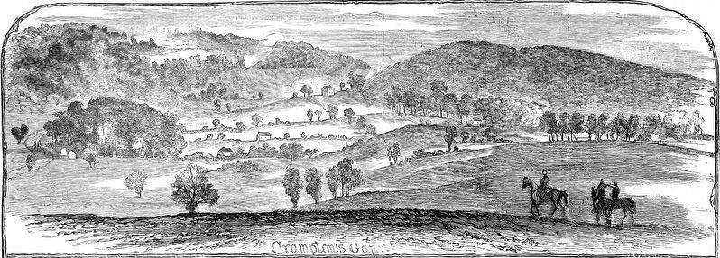
2. Crampton's Gap
from Harper's Weekly, October 4, 1862
Credits. This page was last revised on January 31, 2020. It was originally submitted on December 1, 2007, by F. Robby of Baltimore, Maryland. This page has been viewed 1,802 times since then and 56 times this year. Last updated on January 29, 2020, by Bradley Owen of Morgantown, West Virginia. Photos: 1. submitted on December 1, 2007, by F. Robby of Baltimore, Maryland. 2. submitted on August 28, 2018, by Allen C. Browne of Silver Spring, Maryland. • Bill Pfingsten was the editor who published this page.
Editor’s want-list for this marker. A wide shot of the marker and its surroundings. • Can you help?
