Colonia Vallejo in Ciudad de México, Mexico — The Valley of Mexico (The Central Highlands)
The Pilgrim's Route
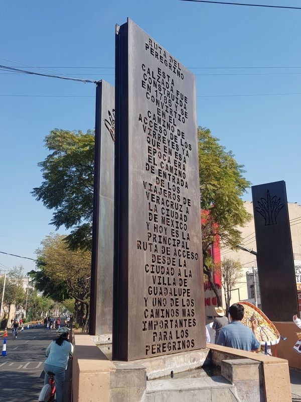
La Ruta del Peregrino
Esta calzada fue construida en 1786 y se convirtió en el camino de acceso de los virreyes ya que en esa época era el camino de entrada de los viajeros de Veracruz a la Ciudad de Mexico y hoy es la principal ruta de acceso desde la ciudad a la Villa de Guadalupe y uno de los caminos mas importantes para los peregrinos
The Pilgrim's Route
This road was built in 1786 and became the access road for the viceroys since at that time it was the entry way for travelers from Veracruz to Mexico City. Today it is the main path from the city to the Villa de Guadalupe and one of the most important roads for pilgrims
Topics. This historical marker is listed in these topic lists: Churches & Religion • Colonial Era • Roads & Vehicles. A significant historical year for this entry is 1786.
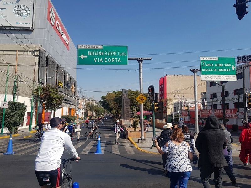
Location. 19° 27.694′ N, 99° 7.578′ W. Marker is in Ciudad de México. It is in Colonia Vallejo. Marker is at the intersection of Calzada de Guadalupe and Avenida Río Consulado, in the median on Calzada de Guadalupe. Touch for map. Marker is in this post office area: Ciudad de México 07840, Mexico. Touch for directions.
Other nearby markers. At least 8 other markers are within walking distance of this marker. The Pulque Customs House (approx. 1.2 kilometers away); Tequipeuhcan (approx. 1.3 kilometers away); The Reign of Cuauhtemoctzin (approx. 1.5 kilometers away); 50th Anniversary of the Treaty of Tlatelolco (approx. 1.5 kilometers away); The Tecpan throughout time (approx. 1.5 kilometers away); The Small Area of Tlatelolco (approx. 1.6 kilometers away); Tlatelolco Massacre of October 2, 1968 (approx. 1.6 kilometers away); Momoztli: a neighborhood altar (approx. 1.6 kilometers away). Touch for a list and map of all markers in Ciudad de México.
Credits. This page was last revised on April 17, 2020. It was originally submitted on February 4, 2020, by J. Makali Bruton of Accra, Ghana. This page has been viewed 96 times since then and 13 times this year. Photos: 1, 2. submitted on February 4, 2020, by J. Makali Bruton of Accra, Ghana.

