Millersville in Anne Arundel County, Maryland — The American Northeast (Mid-Atlantic)
Sawmill

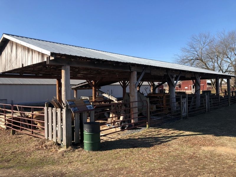
Farmers took advantage of these new smaller sawmills. The sawmill was used on the farm to produce lumber for fencing, barns, houses, and countless other jobs where wood was required. Many farming communities would purchase and run the mill together.
The Kinder Farm Park's style of sawmill, an O Mill, was manufactured between the late 1800's and 1930's. The O Mill is a Frick Company sawmill, built in Waynesboro, PA. The sawyers or sawmill operators, that run this mill, have cut lumber for numerous projects around the Park. Some of these projects include miles of fence boards, animal runs, shelters, and many buildings around the farm complex. They also produced the lumber for the display cases, conference table, wainscoting, and cabinets for the Visitors Center.
Topics. This historical marker is listed in these
this page online
Location. 39° 5.995′ N, 76° 34.939′ W. Marker is in Millersville, Maryland, in Anne Arundel County. It is on Kinder Farm Park Road 0.4 miles west of Gail Sanchez Way, on the left when traveling west. Touch for map. Marker is in this post office area: Millersville MD 21108, United States of America. Touch for directions.

Regionally, this marker is in the Baltimore Metro Region. It is also in the American Mid-Atlantic and on the Eastern Seaboard. Globally, it is in the North Atlantic Region, North America, the Western Hemisphere, the Western World, and the Anglosphere. Historically, it finds itself in what was once one of the original Thirteen Colonies and also the Antebellum South.
Other nearby markers. At least 8 other markers are within 3 miles of this marker, measured as the crow flies: Tobacco Barn (within shouting distance of this marker); Kinder Farm Ice House (about 400 feet away, measured in a direct line); The Kinder Farmhouse (about 400 feet away); Earleigh Heights Store (approx. 0.7 miles away); Frost's Store and Post Office
Another marker is no longer nearby. Kinder Farmhouse Project (was about 400 feet away but has been replaced with another marker now near it).
Credits. This page was last revised on February 8, 2020. It was originally submitted on February 8, 2020, by Devry Becker Jones of Washington, District of Columbia. This page has been viewed 624 times since then and 54 times this year. Photos: 1, 2. submitted on February 8, 2020, by Devry Becker Jones of Washington, District of Columbia.
