Fort George Island near Jacksonville in Duval County, Florida — The American South (South Atlantic)
Slave Trade / La Traite d'Esclaves
A Valuable Commodity / Une marchandise de grande valeur
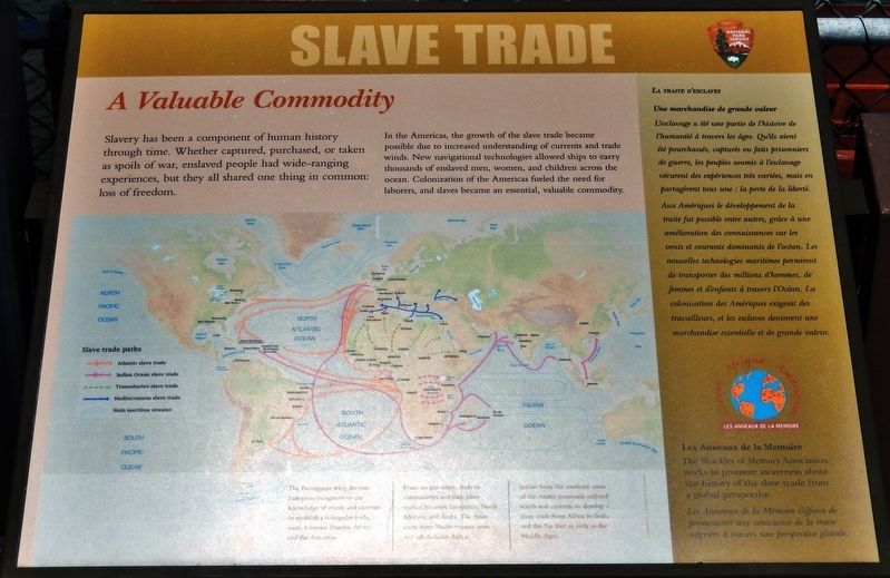
Slavery has been a component of human history through time. Whether captured, purchased, or taken as spoils of war, enslaved people had wide-ranging experiences, but they all shared one thing in common: loss of freedom.
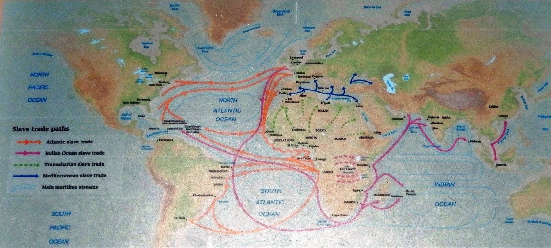
In the Americas, the growth of the slave trade became possible due to increased understanding of currents and trade winds. New navigational technologies allowed ships to carry thousands of enslaved men, women, and children across the ocean. Colonization of the Americas fueled the need for laborers, and slaves became an essential, valuable commodity.
The Shackles of Memory Association works to promote awareness about the history of the slave trade from a global perspective.
L'esclavage a été une partie de l'histoire de l'humanité à travers les âges. Qu'ils aient été pourchassés, capturés ou faits prisonniers de guerre, les peuples soumis à l'esclavage vécurent des expériences très variées, mais en partagèrent tous une : la perte de la liberté.
Aux Amériques le développement de la traite fut possible entre autres, grâce à une amélioration des connaissances sur les vents et courants dominants de l'océan. Les nouvelles technologies maritimes permirent de transporter des millions d'hommes, de femmes et d'enfants à travers l'Océan. La colonisation des Amériques exigeait des travailleurs, et les esclaves devinrent une marchandise essentielle et de grande valeur.
Les Anneaux de la Mémoire s’efforce de promouvoir une conscience de la traite négrière á travers une perspective globale.
Erected by National Park Service, U.S. Department of the Interior.
Topics. This historical marker is listed in these topic lists: African Americans • Colonial Era • Industry & Commerce • Waterways & Vessels.
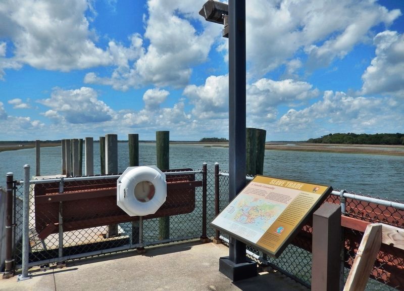
Location. 30° 26.472′ N, 81° 26.345′ W. Marker is near Jacksonville, Florida, in Duval County. It is on Fort George Island. Marker can be reached from Palmetto Avenue, 2.2 miles north of Fort George Road when traveling north. Marker is located at the Kingsley Plantation Historical Site, within the Timucuan Ecological and Historic Preserve. Marker is mounted on the boat dock near the northwest corner of the plantation site, overlooking the Fort George River. Access to Kingsley Plantation is north from Florida State Route A1A (Heckscher Drive), onto Fort George Road, and

Courtesy Les Anneaux de la Mémoire
2. Marker detail: Slave Trade Paths
The Portuguese were the first European navigators to use knowledge of winds and currents to establish a triangular trade route between Europe, Africa and the Americas.
From ancient times, trade in commodities and slave labor existed between Europeans, North Africans and Arabs. The slaves were from Mediterranean areas and sub-Saharan Africa.
Sailors from the southern coast of the Arabian peninsula utilized winds and currents to develop a slave trade from Africa to India and the Far East as early as the Middle Ages.
Other nearby markers. At least 8 other markers are within walking distance of this marker. A different marker also named Slave Trade / La Traite d'Esclaves (here, next to this marker); Fort George Island (about 400 feet away, measured in a direct line); Waterways (about 400 feet away); Choices (about 400 feet away); Plantation House (about 400 feet away); A Very Comfortable Habitation (about 700 feet away); Looking Back (about 700 feet away); a different marker also named Looking Back (about 700 feet away). Touch for a list and map of all markers in Jacksonville.
Regarding Slave Trade / La Traite d'Esclaves. Kingsley Plantation is listed on the National Register of Historic Places, #70000182
Credits. This page was last revised on February 3, 2023. It was originally submitted on February 14, 2020, by Cosmos Mariner of Cape Canaveral, Florida. This page has been viewed 143 times since then and 9 times this year. Photos: 1, 2, 3, 4. submitted on February 15, 2020, by Cosmos Mariner of Cape Canaveral, Florida.


