Saint John in Saint John County, New Brunswick — The Atlantic Provinces (North America)
A Portal to the New World
La porte du Nouveau Monde
— Harbour Passage Trail —
Inscription.
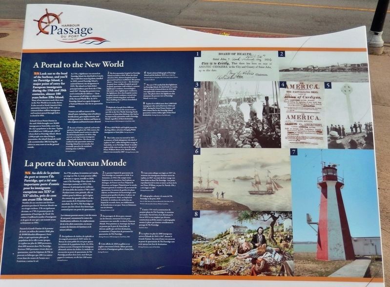
Look out to the head of the harbour, and you'll see Partridge Island, a major point of entry for European immigrants during the 19th and 20th centuries, almost 100 years before Ellis Island.
Many of our ancestors made their start in the New World on its rocky shores. It also served as North America's first quarantine station in 1785, with an estimated three million immigrants and mariners passed through before it closed in 1941.
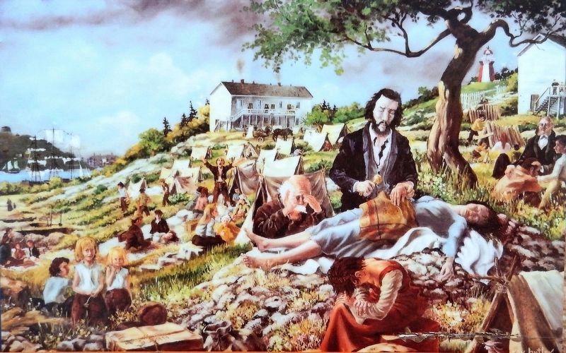
Ireland's Great Potato Famine in the mid-1840s brought over 30,000 immigrants to Saint John, more than the city's population at the time. Typhus fever killed over 2,000 people, 600 of whom died on Partridge Island. About 2,500 people were then living in quarantine; the island's hospitals could only accommodate 200, leaving the others in army tents or on the ground outside.
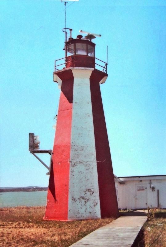
In 1791, a lighthouse was erected on Partridge Island, the third built in Canada. The world's first steam fog alarm, installed in 1859, earned Partridge Island a national historic site designation in 1925. The island was Saint John's principal military post from the 1790s until 1947. During this period, it was used continually for defence — from the cannons of tall ships to submarines of the Second World War. In 1974 Partridge Island was again designated a National Historic Site for its quarantine station.
Visitors can still see traces of the island's past, including ruins of military fortifications, gun emplacements, and underground crew shelters and listen to tales of ghosts and buried treasure abound.
Au-delà de la pointe du port se trouve l'île Partridge, qui a été une importante porte d'entrée pour les immigrants européens aux XIXe et XXe siècles, près de cent ans avant Ellis Island.
Nombre de nos ancêtres ont fait leurs premiers pas dans le Nouveau Monde sur ses rivages rocheux. L'île est également devenue, en 1785, le premier poste de quarantaine d'Amérique du Nord. On estime à 3 millions le nombre d'immigrants et de gens de mer qui y ont transité avant sa fermeture en 1941.
Fuyant la Grande Famine de la pomme de terre, au milieu des années 1840, plus de 30 000 Irlandais débarquent à Saint John, ce qui représente plus que la population de la ville à cette époque. Le typhus tue plus de 2000 personnes, dont 600 meurent dans l'île Partridge. Environ 2500 personnes vivent alors en quarantaine, mais les hôpitaux de l'île ne peuvent en héberger que 200. Les autres vivent dans des
Photographed By Heritage Resources
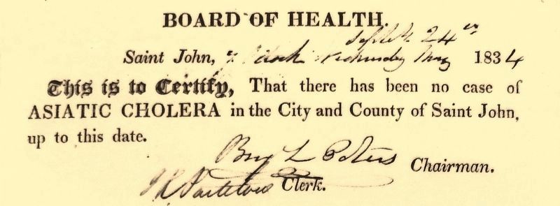
2. Marker detail: Cholera Notice
English:
Because of cholera, typhoid, and measles epidemics throughout the 19th century, the Board of Health issued notices to calm the fearful local population. In 1854 a ship arrived, carrying German immigrants infected with cholera. The disease was confined to the quarantine station at Partridge Island for two months, but eventually spread to the mainland, claiming some 1,200 lives.
Français:
Des épidémies de choléra, de typhoïde et de rougeole ponctuent le XIXe siècle. Le Bureau de santé publie des avis pour apaiser les craintes de la population locale. En 1854, un bateau accoste; il transporte des immigrants allemands atteints du choléra. La maladie est circonscrite au poste de quarantaine de l'île Partridge pendant deux mois, mais finit par gagner le continent, où elle fait 1200 morts.
En 1791, un phare, le troisième au Canada, est érigé sur l'île. Le tout premier sifflet de brume à vapeur, installé en 1859, vaut à Partridge d'être classée lieu historique national en 1925. L'île demeure le principal poste militaire de Saint John des années 1790 à 1947. Pendant toute cette période, elle est utilisée pour la défense, qu'il s'agisse des canons des grands voiliers ou des sous-marins de la Deuxième Guerre mondiale. En 1974, l'île Partridge est encore une fois classée lieu historique national pour son poste de quarantaine.
Les visiteurs peuvent encore y voir des traces de son passé, notamment les ruines des fortifications militaires, les emplacements de tir et les abris souterrains, ou encore écouter des histoires de fantômes et de trésors enfouis.
Topics. This historical marker is listed in these topic lists: Cemeteries & Burial Sites • Disasters • Science & Medicine • Settlements & Settlers.
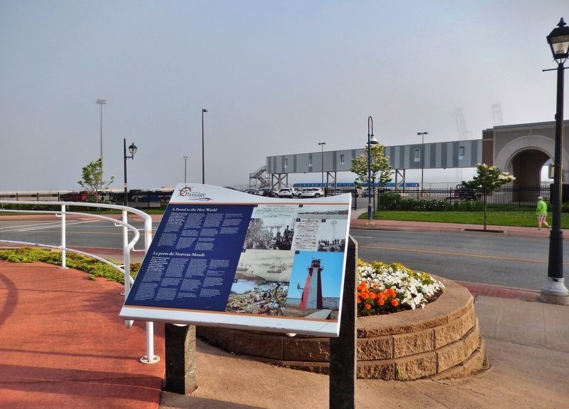
Location. 45° 16.012′ N, 66° 3.626′ W. Marker is in Saint John, New Brunswick, in Saint John County. Marker is on Water Street just west of Prince William Street, on the left when traveling south. Marker is located in a walkway plaza overlooking the Diamond Jubilee Cruise Terminal. Touch for map
Photographed By Heritage Resources, 11-06
3. Marker detail: First quarantine hospital on Partridge Island
English:
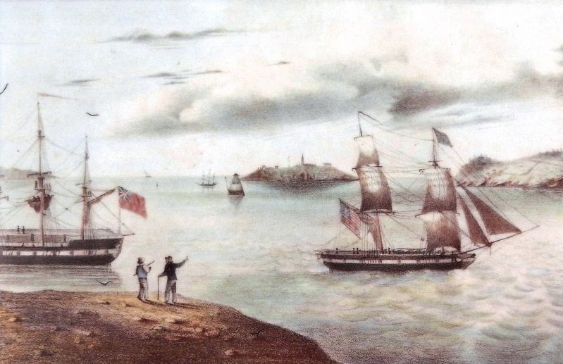
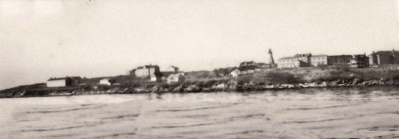
The first quarantine hospital on Partridge Island was built in 1830. When the island closed in 1941, thirteen hospitals and six graveyards had been established. This picture shows — from west to east — the detention hospital, barn, smallpox hospital, general hospital, quarantine staff residence, assistant lightkeeper's residence, bacteriologist's laboratory, three lightkeepers' residences, the lighthouse, first-class hospital, marine hospital, doctor's residence, second-class hospital, disinfecting plant, and wharf. These buildings have all been demolished.
Français:
Le premier hôpital de quarantaine de l'île Partridge est construit en 1830. À sa fermeture, en 1941, l'île compte treize hôpitaux et six cimetières. Sur la photo, on distingue, de l'ouest vers l'est, l'hôpital de détention, un hangar, l'hôpital pour la variole, l'hôpital général, la résidence du personnel de quarantaine, la maison du gardien de phare adjoint, un laboratoire de bactériologie, trois maisons pour gardien de phare, le phare, un hôpital de première classe, un hôpital de la marine, la résidence des médecins, un hôpital de seconde classe, un établissement de désinfection et un quai. Tous ces bâtiments ont été détruits.
Other nearby markers. At least 8 other markers are within walking distance of this marker. Irish Immigrant Memorial (here, next to this marker); The "Three Lamps" (within shouting distance of this marker); An Island Abounding With Life (within shouting distance of this marker); Shedding Light on the Three Sisters Mystery (within shouting distance of this marker); The Marco Polo / Le Marco Polo (within shouting distance of this marker); The Largest in British North America (within shouting distance of this marker); Clearing Customs in Style (approx. 0.3 kilometers away); The Troop Fleet in the Days of Sail (approx. 0.4 kilometers away). Touch for a list and map of all markers in Saint John.
Photographed By Heritage Resources, 9506
4. Marker detail: Immigrants at Sand Point, 1906
English:
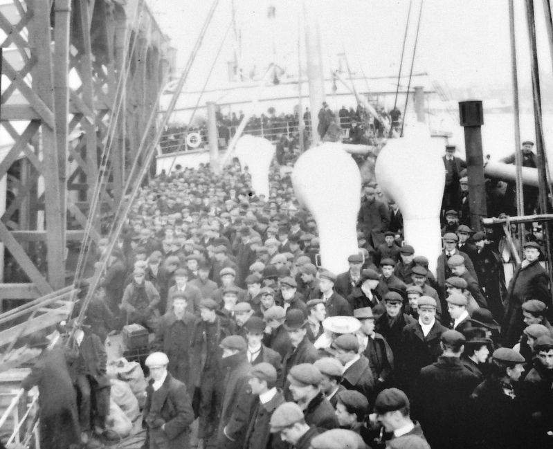
Shiploads of people from different countries came across the ocean to start a new life in the New World. Entering North America via Saint John Harbour, they had to be inspected by quarantine staff at Partridge Island, regardless of their destination.
Français:
Des passagers de divers pays, entassés sur des bateaux, traversent l'océan pour commencer une nouvelle vie dans le Nouveau Monde. Pour pénétrer en Amérique du Nord en passant par le port de Saint John, ils doivent, quelle que soit leur destination, se soumettre à l'inspection du personnel de quarantaine de l'île Partridge.
Photographed By Heritage Resources
5. Marker detail: 1820 Welsh and English Poster
English:
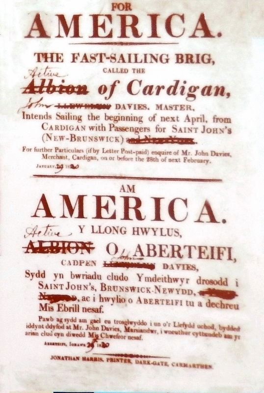
This 1820 Welsh and English poster for the brig Albion advertises bringing Welsh immigrants to Saint John.
Français:
Cette affiche de 1820 en gallois et en anglais concernant le brick Albion prévient de l'arrivée d'immigrants gallois à Saint John.
This 1820 Welsh and English poster for the brig Albion advertises bringing Welsh immigrants to Saint John.
Français:
Cette affiche de 1820 en gallois et en anglais concernant le brick Albion prévient de l'arrivée d'immigrants gallois à Saint John.
Photographed By Heritage Resources, 4960
6. Marker detail: Partridge Island Celtic Cross Memorial
English:
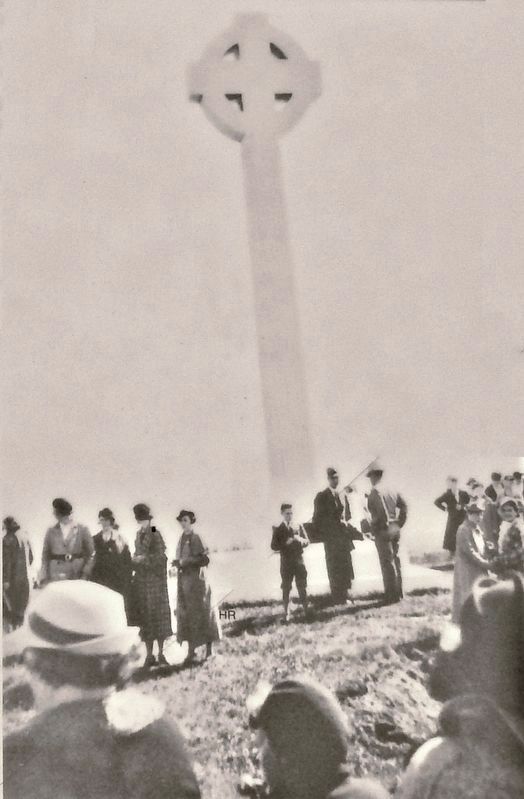
This Celtic cross was erected in 1927, in memory of Irish immigrants who died of typhus in 1847, either during their voyage to Saint John, or on Partridge Island. A smaller replica of the cross can be seen at the end of Prince William Street at St. Patrick's Park, where it was erected in 1967.
Français:
Cette croix celtique est érigée en 1927 à la mémoire des immigrants irlandais morts du typhus, en 1847, au cours de leur voyage vers Saint John ou dans l'île Partridge. Une petite reproduction de la croix se trouve au bout de la rue Prince William, au parc St. Patrick. Elle y a été érigée en 1967.
Photographed By Daniel K. Glenn
8. Marker detail: Partridge Island Lighthouse
English:
The year 1791 marked the first lighthouse on Partridge Island, the third built in Canada. Made of wood, it burned down in 1832, and was replaced by various structures over the years. The photo shows the lighthouse that dominates the present view of Partridge Island.
Français:
L'année 1791 voit la construction du premier phare de l'île Partridge, le troisième au Canada. Fait de bois, il est détruit par le feu en 1832 et est remplacé par diverses constructions au fil des années. La photographie montre le phare qui domine actuellement le paysage de l'île Partridge.
Photographed By Heritage Resources, Ray Butler print
9. Marker detail: The Great Potato Famine
English:
Typhus fever killed more than 2,000 Irish immigrants who arrived between 1845 and 1847, during the Great Potato Famine, and 600 of them died at the Partridge Island quarantine station within sight of their final destination.
Français:
Le typhus tue plus de 2000 immigrants arrivés d'Irlande de 1845 à 1847, durant la Grande Famine. Six cents d'entre eux meurent au poste de quarantaine de l'île Partridge sans avoir aperçu leur lieu de destination.
Credits. This page was last revised on November 3, 2022. It was originally submitted on February 14, 2020, by Cosmos Mariner of Cape Canaveral, Florida. This page has been viewed 125 times since then and 4 times this year. Photos: 1, 2, 3, 4, 5, 6, 7, 8, 9, 10. submitted on February 19, 2020, by Cosmos Mariner of Cape Canaveral, Florida.
