
Perryville in Cecil County, Maryland — The American Northeast (Mid-Atlantic)
Count de Rochambeau’s Troops
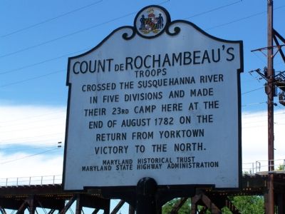
Photographed by William Pfingsten, July 12, 2007
1. Count de Rochambeau's Troops Marker
Erected by Maryland Historical Trust & Maryland State Highway Administration.
Topics and series. This historical marker is listed in these topic lists: War, US Revolutionary • Waterways & Vessels. In addition, it is included in the Maryland Historical Trust, and the The Washington-Rochambeau Route series lists. A significant historical year for this entry is 1782.
Location. 39° 33.37′ N, 76° 4.718′ W. Marker is in Perryville, Maryland, in Cecil County. It is on Main Street ¼ mile west of River Road, on the left when traveling west. I list direction of west even though the road starts curving counterclockwise toward Perry Point entrance. Touch for map. Marker is in this post office area: Perryville MD 21903, United States of America. Touch for directions.

Regionally, this marker is in Greater Wilmington, on the Eastern Shore, and in Greater Philadelphia. It is also in the American Mid-Atlantic, on the Delmarva Peninsula, in the Tidewater, in the Chesapeake
this page online
Other nearby markers. At least 8 other markers are within walking distance of this marker: Rodgers Tavern (about 400 feet away, measured in a direct line); Geo Washington Traveled This Road (about 400 feet away); Historic Rodgers Tavern (about 400 feet away); Old Post Road (about 500 feet away); Revered Son (about 500 feet away); a different marker also named Perryville (about 500 feet away); Perryville Railroad Ferry & Station (about 700 feet away); a different marker also named Perryville (approx. 0.2 miles away). Touch for a list and map of all markers in Perryville.
Another marker is no longer nearby. Perryville (was about 500 feet away but has been replaced with another marker now near it).
Additional commentary.
1.
Word was received in early December 2024 that the bridge piers just downstream of the Amtrak bridge, seen on photo
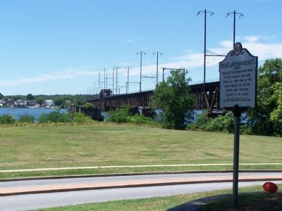
Photographed by William Pfingsten, July 12, 2007
2. Susquehanna River
Site of Lower Susquehanna Ferry crossing. Piers of original bridge over the river are visible next to the railroad bridge.
— Submitted December 12, 2024, by Carl Gordon Moore Jr. of North East, Maryland.
Credits. This page was last revised on May 20, 2025. It was originally submitted on July 12, 2007, by Bill Pfingsten of Bel Air, Maryland. This page has been viewed 2,416 times since then and 49 times this year. Last updated on February 15, 2020, by Carl Gordon Moore Jr. of North East, Maryland. Photos: 1, 2. submitted on July 12, 2007, by Bill Pfingsten of Bel Air, Maryland.
